2020s Maps of David City, Nebraska
Explore 4 historic maps of David City from the 2020s. These maps offer a rare glimpse into what life looked like during the 2020s — showing old roads, neighborhoods, homes, and landmarks that have changed or disappeared over time.
Whether you're researching your family's past, planning a metal detecting trip, or studying how David City's landscape evolved across the 2020s, these high-resolution maps are a powerful tool for exploring the history of this region.
- Focus on a specific era: All maps on this page are from the 2020s, giving you a focused view of this time period.
- See what’s changed: Compare century-old streets, trails, and buildings to today's modern landscape using overlays and satellite layers.
- Research with precision: Use these maps for genealogy, historical research, land use analysis, or educational projects.
- View, download, or print: Maps are fully viewable online in high resolution, and can be downloaded or printed for your own records.
Start exploring David City's history through authentic maps from the 2020s. This is your window into the past.
David City, NE maps
(4)- 2021 Map of David City East, 2021 Print
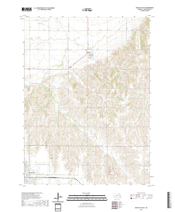 2021 David City East2021 Print · USGSButler County farmland near the county seat comes into focus in this recent survey of the Nebraska plains. Local historians can trace the street grids of David City and Octavia or follow the path of Bone Cr and Brezina Reservoir.
 - 2021 Map of Garrison, 2021 Print
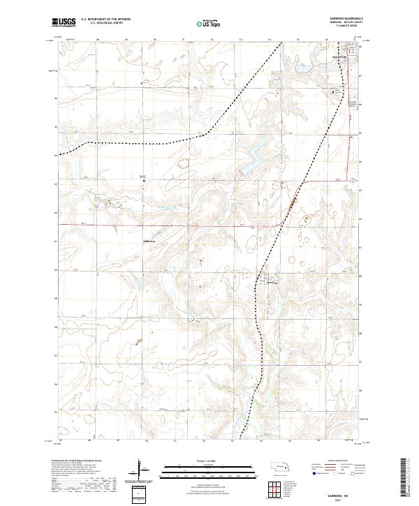 2021 Garrison2021 Print · USGSButler County's rural landscape is captured here in the early twenty-first century, showing the enduring agricultural grid and river valleys. Researchers can trace family sites near Garrison, Millerton, and local landmarks like Pleasant Hill Cem.
 - 2021 Map of David City West, 2021 Print
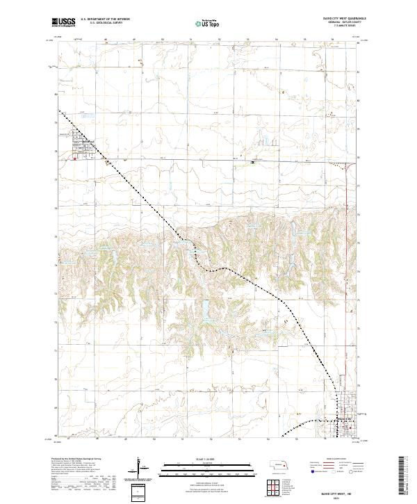 2021 David City West2021 Print · USGSButler County's agricultural heartland transitions from the Platte River valley into rolling uplands in this 2021 study. Researchers can trace the development of Bellwood and David City while locating landmarks like the Butler County Courthouse and the Catholic Cem.
 - 2021 Map of Brainard, 2021 Print
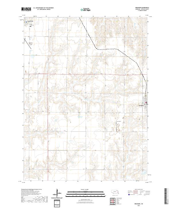 2021 Brainard2021 Print · USGSButler County farmland near Brainard is shown in detail during the early 2020s, revealing a landscape defined by prairie creeks and rural aviation. Genealogists can locate Saint Marys Cem while researchers trace the paths of Kezan Cr and Plum Cr.
End of results
Showing maps 1-4 of 4
Top cities near David City
- Columbus historical maps
- Schuyler historical maps
- Bellwood historical maps
- Rising City historical maps
- Brainard historical maps
- Ulysses historical maps
See more
Frequently asked questions
- What are the different types of historical maps available for David City?
- What is the oldest map of David City?
- Where can I purchase historical maps of David City for my home or office?
- Where can I download high-res historical maps of David City?
- Are there historical topographic maps available for David City?
- Is there historical aerial imagery available for David City?
- Where are historical maps of David City sourced from?