Old Maps of Doughboy, Nebraska for Academic Research
Study the evolution of Doughboy with 11 high-resolution historic maps. Whether you're teaching, researching, or modeling changes in land use, these maps provide essential visual documentation of urban, environmental, and geographic change.
- Analyze long-term change: Track patterns in development, transportation, and natural features.
- Ideal for environmental or urban studies: Support academic projects with primary historical map data.
- Use in the classroom or lab: Educators and researchers rely on these maps to bring historical context to life.
These maps are a powerful tool for teaching, research, and visualizing how Doughboy has changed over the decades.
Doughboy, NE maps
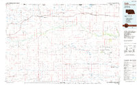
(11)- 1950 Map of Doughboy, 1972 Print
 1950 Doughboy1972 Print · USGSCherry County ranchlands and the Sandhills lakes are captured here during the mid-twentieth century. Genealogists can locate remote rural outposts like Doughboy and several early schoolhouses including Heath Sch and School No 165.
 - 1952 Map of Doughboy
 1952 Doughboy1952 Print · USGSCherry County ranching country is documented here in the early fifties, centered on the Snake River and its surrounding valleys. Researchers can trace rural school districts like School No 165 and the small settlement of Doughboy.
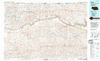
 - 1957 Map of Valentine, 1960 Print
 1957 Valentine1960 Print · USGSNorthern Nebraska's ranching country and the vast Sand Hills are detailed here in the late fifties. Genealogists and historians can locate numerous family-named landmarks like the Dahlgren Ranch and trace the path of the Chicago and North Western railroad through Valentine.3 unique versions available
 - 1959 Map of Valentine
 1959 Valentine1959 Print · USGSThe northern Nebraska Sand Hills are captured here in the late fifties, showcasing a vast ranching landscape shaped by the Niobrara and Loup rivers. Genealogists and historians can trace rail-town development along the Chicago and North Western and locate remote outposts like Brownlee or Kennedy.
 - 1985 Map of Farm Flat
 1985 Farm Flat1985 Print · USGSCherry County ranching country is documented here in the mid-1980s, showcasing the high flats and valleys between the river and the creeks. Researchers can trace land use at Three Bar Ranch, locate the rural School No 83, or find the old settlement at Doughboy.
 - 1985 Map of Cody
 1985 Cody1985 Print · USGSThe Nebraska Sandhills and the South Dakota borderlands are captured here in the mid-1980s, centered on the Chicago and North Western rail corridor. Genealogists and local historians can trace small-town development in Cody and Merriman or locate rural landmarks within the Samuel R McKelvie National Forest.
 - 1994 Map of Cody
 1994 Cody1994 Print · USGSThe Nebraska Sandhills and South Dakota borderlands are captured here in the mid-nineties, showing the vast ranching country around the Niobrara River. Local historians can trace early settlements like Eli and Lavaca alongside the borders of the Samuel R Mc Kelvie National Forest.
 - 2011 Map of Farm Flat, 2011 Print
 2011 Farm Flat2011 Print · USGSCovers Doughboy, including Cherry County, United States, and other nearby areas
 - 2014 Map of Farm Flat, 2014 Print
 2014 Farm Flat2014 Print · USGSCovers Doughboy, including Cherry County, United States, and other nearby areas
 - 2017 Map of Farm Flat, 2017 Print
 2017 Farm Flat2017 Print · USGSCovers Doughboy, including Cherry County, United States, and other nearby areas
 - 2021 Map of Farm Flat, 2021 Print
 2021 Farm Flat2021 Print · USGSThis survey of Cherry County captures the Sandhills' unique geography of named flats and river valleys in the early 2020s. Researchers can trace the course of the Snake River and locate historic points like Doughboy, Badger Lake, and School Section Flat.
End of results
Showing maps 1-11 of 11
Frequently asked questions
- What are the different types of historical maps available for Doughboy?
- What is the oldest map of Doughboy?
- Where can I purchase historical maps of Doughboy for my home or office?
- Where can I download high-res historical maps of Doughboy?
- Are there historical topographic maps available for Doughboy?
- Is there historical aerial imagery available for Doughboy?
- Where are historical maps of Doughboy sourced from?