Old Maps of St. Johns Precinct, Nebraska for Genealogy
Trace your family roots with 32 historic maps of St. Johns Precinct. These high-res maps reveal old neighborhoods, homesites, landmarks, and streets — helping you uncover where your ancestors lived and how the area evolved over time.
- Explore historic neighborhoods: Identify where your relatives may have lived in the 1800s or 1900s.
- Compare maps over time: Trace the changes in streets, buildings, and landmarks for multi-generational research.
- Perfect for genealogy & ancestry research: Used by family historians and researchers to map out lineage and migration.
These maps are an incredible resource for exploring your personal connection to St. Johns Precinct's past.
St. Johns Precinct, NE maps
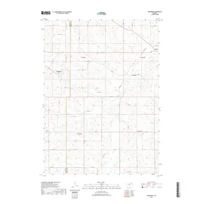
(32)- 1898 Map of Elk Point, 1960 Print
 1898 Elk Point1960 Print · USGSThe tri-state borderlands of South Dakota, Nebraska, and Iowa are captured here in the late nineteenth century as a landscape of ferries and river-fed commerce. Researchers can trace the early foundations of Elk Point and Vermillion or locate vanished crossings like Ionia Ferry and the Ponca Ferry.2 unique versions available
 - 1901 Map of Elk Point
 1901 Elk Point1901 Print · USGSThe tri-state borderlands of South Dakota, Nebraska, and Iowa are captured here at the turn of the century during the peak of the steam rail era. Researchers can trace the original paths of the Chicago Milwaukee and St. Paul Ry. and locate early settlements like Spirit Mound, Newcastle, and Burbank.
 - 1907 Map of Elk Point
 1907 Elk Point1907 Print · USGSThe tri-state borderlands of South Dakota, Nebraska, and Iowa are shown here at the start of the century, centered on the Missouri and Big Sioux river valleys. Researchers can trace the river's old path through oxbows like Mc Cook Lake and locate early river crossings including Vermilion Ferry and Ponca Ferry.6 unique versions available
 - 1955 Map of Sioux City, 1959 Print
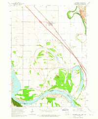
 1955 Sioux City1959 Print · USGSThe Missouri River valley in the mid-fifties is captured here during a time of major engineering and social transition. Genealogists and historians can trace the foundations of Gavins Point Dam, tribal boundaries on the Santee Sioux Indian Reservation, and local landmarks like the Norfolk State Hospital.4 unique versions available
 - 1958 Map of Sioux City
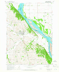
 1958 Sioux City1958 Print · USGSThe Missouri River valley in the late fifties was a bustling intersection of tribal lands, rail corridors, and river towns. Genealogists can trace family roots through specific rural sites like Daisy Valley School, St Johns Church and School, and Yankton State Hospital.
 - 1959 Map of Sioux City
 1959 Sioux City1959 Print · USGSThe tri-state region surrounding the Missouri River is captured here in the late fifties, showing the convergence of Nebraska, South Dakota, and Iowa. Researchers can trace rural lineages through numerous country schoolhouses like Cemetery School and the many numbered Washington School districts.
 - 1963 Map of Jefferson, 1964 Print
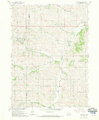
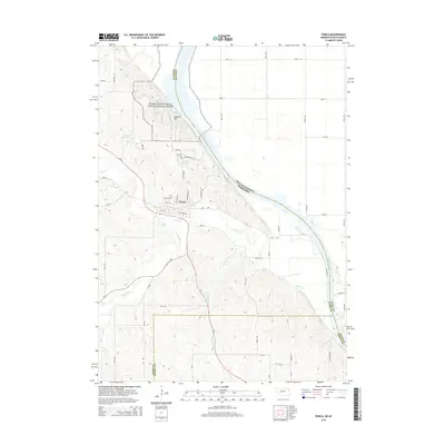
 1963 Jefferson1964 Print · USGSThe borderlands of South Dakota, Iowa, and Nebraska are captured in the early sixties as the interstate system arrived. Genealogists can trace family footprints at Civil Bend Cem, Montagne Sch, and the old rail line of the Milwaukee Road.4 unique versions available
 - 1964 Map of Ponca, 1966 Print
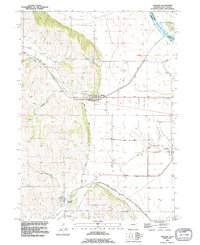
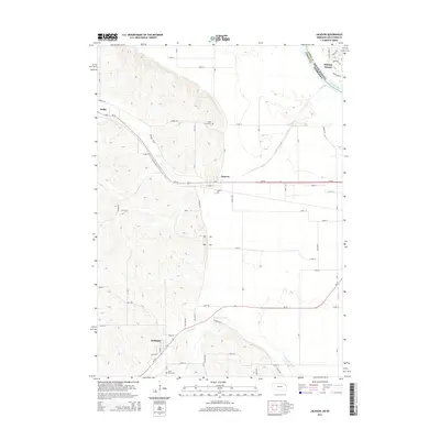
 1964 Ponca1966 Print · USGSThe Missouri River bluffs of Northeast Nebraska are captured here in the mid-1960s, showing the intersection of river life and upland farming. Researchers can find country schools like Allard Sch and landmarks including Lookout Hill and Ponca Cem.2 unique versions available
 - 1967 Map of Waterbury, 1969 Print
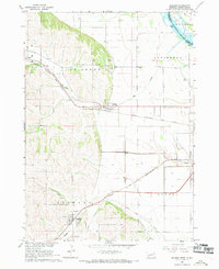
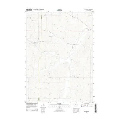
 1967 Waterbury1969 Print · USGSDixon and Dakota Counties are shown in the late sixties as the local rail and agricultural networks remained central to rural life. Family historians can trace the exact locations of rural schools and cemeteries, including Way Sch, St Johns Ch, and Woods Cem.
 - 1967 Map of Jackson, 1969 Print
 1967 Jackson1969 Print · USGSThe tri-state border region of Nebraska, South Dakota, and Iowa is captured in the late sixties, where the Big Sioux meets the Missouri River. Trace rail history and family sites through Jackson and Hubbard, including St Johns Cem.2 unique versions available
 - 1986 Map of Sioux City North
 1986 Sioux City North1986 Print · USGSThe tri-state borderlands of Iowa, South Dakota, and Nebraska are captured here in the mid-eighties as the region's agricultural and academic centers thrived. Researchers can trace historic rail lines like the Illinois Central Gulf and locate landmarks from Briar Cliff College to the heights of Spirit Mound.2 unique versions available
 - 1986 Map of Sioux City South
 1986 Sioux City South1986 Print · USGSThe tri-state borderlands of Iowa, Nebraska, and South Dakota come into focus in the mid-1980s as a landscape of tribal lands and rail corridors. Researchers can trace the extensive boundaries of the Winnebago Indian Reservation and find local landmarks like Morningside College and Martin Field.2 unique versions available
 - 1993 Map of Jackson, 1995 Print
 1993 Jackson1995 Print · USGSDakota County, Nebraska, is captured here in the early nineties as the communities of Jackson and Hubbard thrived alongside the river bluffs. Researchers can trace family sites at St Johns Cem and St Marys Cem or locate old transit lines along the Old Grade and Knox Boulevard.
 - 1994 Map of Ponca
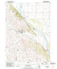 1994 Ponca1994 Print · USGSPonca and the Missouri River bluffs are captured in detail during the early 1990s as the town expanded near the state park. Genealogists and local historians can trace family plots in Ponca Cem and Elmwood Cem or locate old landmarks like the Gaging Sta.
 - 1994 Map of Jefferson, 1995 Print
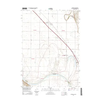
 1994 Jefferson1995 Print · USGSThe tri-state borderlands along the Missouri River come alive in this mid-nineties survey of Union County. Genealogists and local historians can trace the foundations of Jefferson and North Sioux City, alongside landmarks like St Peters Cem and the Mc Cook Sch.
 - 2011 Map of Ponca, 2011 Print
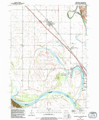
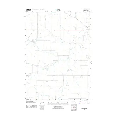
 2011 Ponca2011 Print · USGSCovers St. Johns Precinct, including Ponca, Civil Bend Township, and other nearby areas
 - 2011 Map of Waterbury, 2011 Print
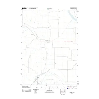
 2011 Waterbury2011 Print · USGSCovers St. Johns Precinct, including Waterbury, Emerson Precinct, and other nearby areas
 - 2011 Map of Jackson, 2011 Print
 2011 Jackson2011 Print · USGSCovers St. Johns Precinct, including Dakota Dunes, Hubbard, and other nearby areas
 - 2011 Map of Jefferson, 2011 Print
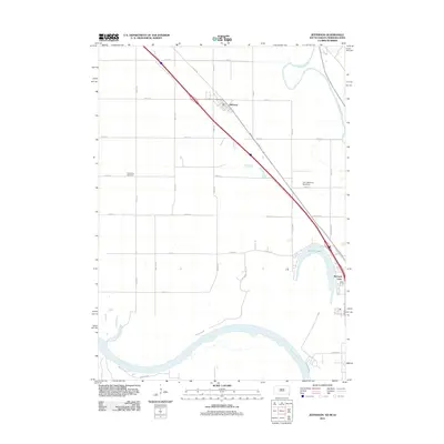 2011 Jefferson2011 Print · USGSCovers St. Johns Precinct, including Dakota Dunes, North Sioux City, and other nearby areas
 - 2012 Map of Jefferson, 2012 Print
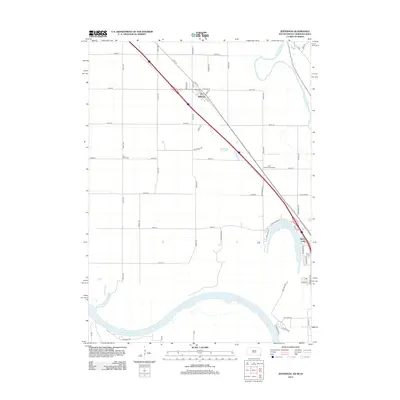 2012 Jefferson2012 Print · USGSCovers St. Johns Precinct, including Dakota Dunes, North Sioux City, and other nearby areas
 - 2014 Map of Jackson, 2014 Print
 2014 Jackson2014 Print · USGSCovers St. Johns Precinct, including Dakota Dunes, Hubbard, and other nearby areas
 - 2014 Map of Waterbury, 2014 Print
 2014 Waterbury2014 Print · USGSCovers St. Johns Precinct, including Waterbury, Emerson Precinct, and other nearby areas
 - 2014 Map of Ponca, 2014 Print
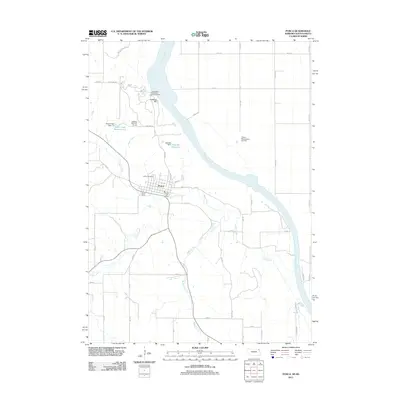
 2014 Ponca2014 Print · USGSCovers St. Johns Precinct, including Ponca, Civil Bend Township, and other nearby areas
 - 2015 Map of Jefferson, 2015 Print
 2015 Jefferson2015 Print · USGSCovers St. Johns Precinct, including Dakota Dunes, North Sioux City, and other nearby areas
 - 2017 Map of Waterbury, 2017 Print
 2017 Waterbury2017 Print · USGSCovers St. Johns Precinct, including Waterbury, Emerson Precinct, and other nearby areas
Showing maps 1-25 of 32
Top cities near St. Johns Precinct
- Sioux City historical maps
- South Sioux City historical maps
- Dakota Dunes historical maps
- North Sioux City historical maps
- Elk Point historical maps
- Dakota City historical maps
See more
Top neighborhoods of St. Johns Precinct
Frequently asked questions
- What are the different types of historical maps available for St. Johns Precinct?
- What is the oldest map of St. Johns Precinct?
- Where can I purchase historical maps of St. Johns Precinct for my home or office?
- Where can I download high-res historical maps of St. Johns Precinct?
- Are there historical topographic maps available for St. Johns Precinct?
- Is there historical aerial imagery available for St. Johns Precinct?
- Where are historical maps of St. Johns Precinct sourced from?