1960s Maps of Dawes County, Nebraska
Explore 7 historic maps of Dawes County from the 1960s. These maps offer a rare glimpse into what life looked like during the 1960s — showing old roads, neighborhoods, homes, and landmarks that have changed or disappeared over time.
Whether you're researching your family's past, planning a metal detecting trip, or studying how Dawes County's landscape evolved across the 1960s, these high-resolution maps are a powerful tool for exploring the history of this region.
- Focus on a specific era: All maps on this page are from the 1960s, giving you a focused view of this time period.
- See what’s changed: Compare century-old streets, trails, and buildings to today's modern landscape using overlays and satellite layers.
- Research with precision: Use these maps for genealogy, historical research, land use analysis, or educational projects.
- View, download, or print: Maps are fully viewable online in high resolution, and can be downloaded or printed for your own records.
Start exploring Dawes County's history through authentic maps from the 1960s. This is your window into the past.
Dawes County, NE maps
(7)- 1966 Map of Chadron 3 SE, 1967 Print
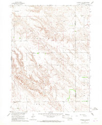 1966 Chadron 3 SE1967 Print · USGSDawes and Sheridan counties meet in this Nebraska panhandle landscape during the mid-sixties. Local history researchers can locate the Antelope Valley Cem and rural school sites such as New Home Sch and Chimney Butte Sch.2 unique versions available
 - 1966 Map of Chadron 3 NE, 1967 Print
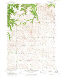 1966 Chadron 3 NE1967 Print · USGSThe Nebraska Panhandle's rural landscape comes into focus during the mid-sixties, showing the intersection of Dawes and Sheridan counties. Researchers can trace the legacy of local education through sites like Pleasant Home Sch and Antelope Sch near the Chicago and North Western rail line.2 unique versions available
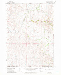
 - 1966 Map of Chadron 3 SW, 1967 Print
 1966 Chadron 3 SW1967 Print · USGSDawes County in the mid-1960s reflects a landscape of deep canyons and seasonal drainage. Researchers can trace the rugged topography of Antelope Sand Canyon and find local landmarks such as Pepper Creek and the southern area of Craig.2 unique versions available
 - 1967 Map of Slim Butte SW, 1969 Print
 1967 Slim Butte SW1969 Print · USGSThe High Plains border of South Dakota and Nebraska comes into focus in the late sixties, where the prominent Slim Butte rises above the prairie. Researchers can trace the Pine Ridge Indian Reservation Boundary and locate the remote Wild Landing Field.2 unique versions available
 - 1967 Map of Slim Butte, 1970 Print
 1967 Slim Butte1970 Print · USGSThe Pine Ridge Indian Reservation borderlands are captured here in the late sixties as the White River winds through the South Dakota-Nebraska line. Researchers can locate remote community landmarks like Holy Guardian Angel Ch and St Matthew Ch Cem near Slim Butte.
 - 1969 Map of Chadron NE, 1972 Print
 1969 Chadron NE1972 Print · USGSDawes County, Nebraska, and the South Dakota borderlands are captured here in the late sixties, showing a landscape of deep creek breaks and river valleys. Researchers can locate remote rural landmarks like the Beaver Valley Cem, Friends Ch, and the high point at Limekiln.
 - 1969 Map of Bordeaux, 1972 Print
 1969 Bordeaux1972 Print · USGSThe northwestern Nebraska plains meet the Pine Ridge in the late sixties, where the Chicago and North Western railroad defines the local economy. Researchers can locate the settlement of Bordeaux, a small Cem, and landmarks like Sheridan Gates.
End of results
Showing maps 1-7 of 7
Top cities of Dawes County
Frequently asked questions
- What are the different types of historical maps available for Dawes County?
- What is the oldest map of Dawes County?
- Where can I purchase historical maps of Dawes County for my home or office?
- Where can I download high-res historical maps of Dawes County?
- Are there historical topographic maps available for Dawes County?
- Is there historical aerial imagery available for Dawes County?
- Where are historical maps of Dawes County sourced from?