Old Maps of Dawes County, Nebraska for Academic Research
Study the evolution of Dawes County with 218 high-resolution historic maps. Whether you're teaching, researching, or modeling changes in land use, these maps provide essential visual documentation of urban, environmental, and geographic change.
- Analyze long-term change: Track patterns in development, transportation, and natural features.
- Ideal for environmental or urban studies: Support academic projects with primary historical map data.
- Use in the classroom or lab: Educators and researchers rely on these maps to bring historical context to life.
These maps are a powerful tool for teaching, research, and visualizing how Dawes County has changed over the decades.
Dawes County, NE maps
(218)- 1896 Map of Oelrichs
 1896 Oelrichs1896 Print · USGSThe southern Black Hills and Cheyenne River valley come alive in this late nineteenth-century survey of the South Dakota and Nebraska borderlands. Genealogists and historians can trace early rail-side towns and industrial sites like Hot Springs, Smithwick, and the Evans Quarry.
 - 1900 Map of Oelrichs
 1900 Oelrichs1900 Print · USGSFall River County at the close of the nineteenth century reveals a landscape defined by the arrival of the railroad and the growth of early quarrying operations. Genealogists and historians can trace the Missouri Valley and Elkhorn RR through stops like Buffalo Gap and Oelrichs.4 unique versions available
 - 1902 Map of Edgemont
 1902 Edgemont1902 Print · USGSThe Black Hills frontier meets the Nebraska plains at the turn of the century, centered on the rail hub of Edgemont. Trace early settlements and rail stops like Minnekahta, Ardmore, and the Quarry as they appeared in this early 1902 survey.4 unique versions available
 - 1946 Map of Box Butte Reservoir West, 1978 Print
 1946 Box Butte Reservoir West1978 Print · USGSThe Nebraska Panhandle's ranching country comes into focus in this mid-century survey, documenting the early years of the Box Butte Reservoir. Genealogists and local historians can locate remote landmarks such as Sch No 62, Sch No 50, and the breaks of Sand Canyon.
 - 1947 Map of Box Butte NE, 1976 Print
 1947 Box Butte NE1976 Print · USGSNorthwestern Nebraska at the end of the 1940s reveals a ranching landscape shaped by the Niobrara River and early irrigation projects. Researchers can locate remote homestead Windmills and the site of School No 80 near the Irrigation Canal.2 unique versions available
 - 1947 Map of Box Butte NW, 1977 Print
 1947 Box Butte NW1977 Print · USGSThe Niobrara River valley in the late 1940s reveals a high plains landscape shaped by early irrigation and ranching. Genealogists and historians can trace local landmarks like Kattn Cem, the Dunlap Sch, and scientific sites including the Fossil Beds.
 - 1948 Map of Box Butte Reservoir West
 1948 Box Butte Reservoir West1948 Print · USGSThe Nebraska high plains meet the headwaters of the Niobrara River in the late 1940s, just as the reservoir began to transform the local landscape. Researchers can locate remote rural schoolhouses like Sch No 52 and trace the early route of the Chicago Burlington and Quincy railroad.2 unique versions available
 - 1948 Map of Box Butte Reservoir East
 1948 Box Butte Reservoir East1948 Print · USGSThe Nebraska panhandle comes into focus just after the war as the Box Butte Dam begins to reshape the Niobrara River valley. Researchers can trace rural school districts like Sch No 17 and explore the rugged breaks of Sand Canyon.
 - 1949 Map of Box Butte NE
 1949 Box Butte NE1949 Print · USGSNorthwest Nebraska's high plains meet the winding Niobrara River during the late 1940s, a time when water meant survival for remote ranching families. Researchers can trace rural school districts like School No 80 and identify dozens of historic Windmill sites across Pepper Creek.2 unique versions available
 - 1949 Map of Box Butte NW
 1949 Box Butte NW1949 Print · USGSIn the high plains of western Nebraska after the war, this area of Dawes and Box Butte counties shows a landscape defined by ranching and river water. Researchers can trace rural life through landmarks like Running Water Sch, the Katen Cem, and the unique Fossil Beds.2 unique versions available
 - 1951 Map of Marsland
 1951 Marsland1951 Print · USGSThe High Plains of Box Butte County are captured here in the early fifties, centered on the railroad town of Marsland. Genealogists and local historians can trace a vanished rural school system through sites like School No 26 and locate family landmarks such as St Marys Ch.3 unique versions available
 - 1955 Map of Hot Springs, 1958 Print
 1955 Hot Springs1958 Print · USGSThe Black Hills and South Dakota badlands are captured here in the mid-fifties, during a peak of military and industrial activity. Researchers can locate the Black Hills Ordnance Depot, early Uranium Mines, and historic rail stops like Pringle or Oglala.5 unique versions available
 - 1955 Map of Alliance, 1966 Print
 1955 Alliance1966 Print · USGSThe Nebraska panhandle comes into sharp focus during the mid-fifties, showing a landscape defined by the Niobrara River and the expanding Sand Hills. Researchers can trace the grounds of Fort Robinson, locate Saint Marys Church, or follow the Chicago Burlington and Quincy rail line through Hemingford.3 unique versions available
 - 1957 Map of Alliance
 1957 Alliance1957 Print · USGSNorthwest Nebraska in the mid-fifties is captured here as a landscape of rail hubs, sprawling cattle ranches, and the eastern edge of the dunes. Genealogists and historians can trace rail lines through Alliance and Chadron or locate landmarks like Saint Marys Church and the Agate Spring Fossil Beds.
 - 1958 Map of Alliance
 1958 Alliance1958 Print · USGSNorthwestern Nebraska in the late fifties shows a landscape shaped by the legacy of the high plains frontier and modern agricultural expansion. Genealogists and historians can trace rail-line settlements and landmarks like Fort Robinson and the Agate Spring Fossil Beds.
 - 1966 Map of Chadron 3 SE, 1967 Print
 1966 Chadron 3 SE1967 Print · USGSDawes and Sheridan counties meet in this Nebraska panhandle landscape during the mid-sixties. Local history researchers can locate the Antelope Valley Cem and rural school sites such as New Home Sch and Chimney Butte Sch.2 unique versions available
 - 1966 Map of Chadron 3 NE, 1967 Print
 1966 Chadron 3 NE1967 Print · USGSThe Nebraska Panhandle's rural landscape comes into focus during the mid-sixties, showing the intersection of Dawes and Sheridan counties. Researchers can trace the legacy of local education through sites like Pleasant Home Sch and Antelope Sch near the Chicago and North Western rail line.2 unique versions available
 - 1966 Map of Chadron 3 SW, 1967 Print
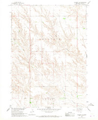 1966 Chadron 3 SW1967 Print · USGSDawes County in the mid-1960s reflects a landscape of deep canyons and seasonal drainage. Researchers can trace the rugged topography of Antelope Sand Canyon and find local landmarks such as Pepper Creek and the southern area of Craig.2 unique versions available
 - 1967 Map of Slim Butte SW, 1969 Print
 1967 Slim Butte SW1969 Print · USGSThe High Plains border of South Dakota and Nebraska comes into focus in the late sixties, where the prominent Slim Butte rises above the prairie. Researchers can trace the Pine Ridge Indian Reservation Boundary and locate the remote Wild Landing Field.2 unique versions available
 - 1967 Map of Slim Butte, 1970 Print
 1967 Slim Butte1970 Print · USGSThe Pine Ridge Indian Reservation borderlands are captured here in the late sixties as the White River winds through the South Dakota-Nebraska line. Researchers can locate remote community landmarks like Holy Guardian Angel Ch and St Matthew Ch Cem near Slim Butte.
 - 1969 Map of Chadron NE, 1972 Print
 1969 Chadron NE1972 Print · USGSDawes County, Nebraska, and the South Dakota borderlands are captured here in the late sixties, showing a landscape of deep creek breaks and river valleys. Researchers can locate remote rural landmarks like the Beaver Valley Cem, Friends Ch, and the high point at Limekiln.
 - 1969 Map of Bordeaux, 1972 Print
 1969 Bordeaux1972 Print · USGSThe northwestern Nebraska plains meet the Pine Ridge in the late sixties, where the Chicago and North Western railroad defines the local economy. Researchers can locate the settlement of Bordeaux, a small Cem, and landmarks like Sheridan Gates.
 - 1970 Map of Bohemian Creek, 1972 Print
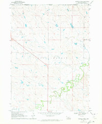 1970 Bohemian Creek1972 Print · USGSThe Nebraska panhandle frontier meets the South Dakota border in this early 1970s survey. Trace the winding White River and the rural reaches of Bohemian Creek past local Gravel Pits and the open spaces of West Chadron.
 - 1970 Map of Chadron 3 NW, 1972 Print
 1970 Chadron 3 NW1972 Print · USGSNorthwestern Nebraska at the start of the 1970s shows a landscape defined by the Pine Ridge forest and high plains ranching. Researchers can locate the Prairie Home Sch and trace the winding course of Bordeaux Creek through the Nebraska National Forest.2 unique versions available
 - 1970 Map of Chadron East, 1972 Print
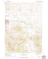 1970 Chadron East1972 Print · USGSChadron and the surrounding Nebraska Panhandle are captured in the early 1970s, showing the town's expansion and its rail connections. Genealogists and historians can trace the grounds of Chadron State College, Highland Cem, and Assumption Academy.
Showing maps 1-25 of 218
Top cities of Dawes County
Frequently asked questions
- What are the different types of historical maps available for Dawes County?
- What is the oldest map of Dawes County?
- Where can I purchase historical maps of Dawes County for my home or office?
- Where can I download high-res historical maps of Dawes County?
- Are there historical topographic maps available for Dawes County?
- Is there historical aerial imagery available for Dawes County?
- Where are historical maps of Dawes County sourced from?