
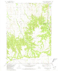
1970 Map of Chadron 3 NW
USGS Topo · Published 1972About this map
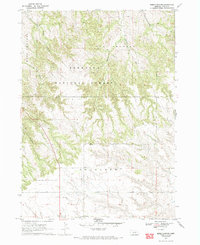
The Nebraska National Forest dominates the upper half of this 1970 survey, where the rugged terrain of the Pine Ridge is deeply incised by Kings Canyon and Strong Canyon. The landscape transitions from the high, wooded divides of West Chadron and East Chadron into the flatter, agricultural plateau identified simply as Table to the south. This transition from forest to open tableland is marked by the headwaters of Bordeaux Creek and Chadron Creek, which flow north through the breaks.
Find a feature on this map
13 named features on this map. Tap any name to fly to it.
Don’t see what you’re looking for? This feature index may not catch every label — zoom into the map to look around manually.
Map Details
Editions of this 1970 Chadron 3 NW Map
2 editions found
Other maps of this area

1955 · Alliance
USGS Topo · 1:250,000

1957 · Alliance
USGS Topo · 1:250,000

1958 · Alliance
USGS Topo · 1:250,000

1966 · Chadron 3 SE
USGS Topo · 1:24,000

1966 · Chadron 3 NE
USGS Topo · 1:24,000
1966 · Chadron 3 SW
USGS Topo · 1:24,000

1969 · Bordeaux
USGS Topo · 1:24,000
1970 · Chadron East
USGS Topo · 1:24,000
1980 · Coffee Mill Butte SE
USGS Topo · 1:24,000
1980 · Coffee Mill Butte
USGS Topo · 1:24,000