
1949 Map of Box Butte NW
USGS Topo · Published 1949About this map
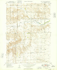
The Niobrara River winds through this high plains landscape at the border of Dawes and Box Butte counties, marking a transition between the elevated tablelands and the river valley. The presence of Fossil Beds near the western edge of the quadrangle highlights the significant paleontological history of this region. Settlers in this semi-arid environment relied on an emerging water infrastructure, evidenced by the Irrigation Canal and numerous windmills scattered across the range. Educational life in these rural townships centered on small local institutions like Dunlap Sch and Running Water Sch, while the remote Katen Cem serves as a vital marker for genealogists researching early families in the Craig and Running Water precincts. The network of drainage features, including Sand Canyon Creek and Cottonwood Creek, underscores the essential relationship between water access and habitation in post-war western Nebraska.
Find a feature on this map
13 named features on this map. Tap any name to fly to it.
Don’t see what you’re looking for? This feature index may not catch every label — zoom into the map to look around manually.
Map Details
Editions of this 1949 Box Butte NW Map
2 editions found
Other maps of this area

1947 · Box Butte NE
USGS Topo · 1:24,000

1947 · Box Butte
USGS Topo · 1:24,000

1947 · Box Butte NW
USGS Topo · 1:24,000

1948 · Hemingford
USGS Topo · 1:24,000

1948 · Box Butte Reservoir East
USGS Topo · 1:24,000

1949 · Box Butte NE
USGS Topo · 1:24,000

1949 · Box Butte SW
USGS Topo · 1:24,000

1949 · Box Butte
USGS Topo · 1:24,000

1955 · Alliance
USGS Topo · 1:250,000

1957 · Alliance
USGS Topo · 1:250,000