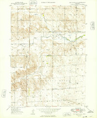
1949 Map of Box Butte NW
USGS Topo · Published 1949About this map
The Niobrara River winds across this late 1940s landscape, marking a transition in the High Plains where water management shaped the local economy. An Irrigation Canal diverts water from the river to support agriculture in the northern section, while numerous windmills scattered across the sections indicate a heavy reliance on groundwater for ranching. Along the border of Dawes and Box Butte counties, the map reveals a rural infrastructure of community gathering points, including the Dunlap Sch, Running Water Sch, and School No 100. Geologically and paleontologically significant, the area features identified Fossil Beds north of the county line, while the Katen Cem provides a specific point of interest for genealogists tracing early families in this stretch of the Nebraska panhandle. The terrain is defined by drainages such as Cottonwood Creek and Sand Canyon Creek, which cut through the high tablelands.
Find a feature on this map
12 named features on this map. Tap any name to fly to it.
Don’t see what you’re looking for? This feature index may not catch every label — zoom into the map to look around manually.
Map Details
Editions of this 1949 Box Butte NW Map
2 editions found
Other maps of this area

1947 · Box Butte NE
USGS Topo · 1:24,000

1947 · Box Butte
USGS Topo · 1:24,000

1947 · Box Butte NW
USGS Topo · 1:24,000

1948 · Hemingford
USGS Topo · 1:24,000

1948 · Box Butte Reservoir East
USGS Topo · 1:24,000

1949 · Box Butte NE
USGS Topo · 1:24,000

1949 · Box Butte SW
USGS Topo · 1:24,000

1949 · Box Butte
USGS Topo · 1:24,000

1949 · Box Butte NW
USGS Topo · 1:24,000

1955 · Alliance
USGS Topo · 1:250,000