
1946 Map of Box Butte Reservoir West
USGS Topo · Published 1978About this map
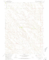
The Niobrara River carves through the High Plains of the Nebraska Panhandle, defining the rugged geography between the township boundaries of Leonard and Lawrence. This mid-century survey captures the landscape at a point of significant hydraulic development, dominated by the western portion of the Box Butte Reservoir. The terrain is characterized by deep erosional features like Sand Canyon and Sand Draw, alongside the upland flats near Quincy. For those researching the rural social fabric of the era, the map identifies local educational landmarks including Sch No 62 and Sch No 50, which served the scattered ranching and farming families across the Dawes Co Box Butte Co line.
Find a feature on this map
10 named features on this map. Tap any name to fly to it.
Don’t see what you’re looking for? This feature index may not catch every label — zoom into the map to look around manually.
Map Details
Editions of this 1946 Box Butte Reservoir West Map
This is the sole edition of this map. No revisions or reprints were ever made.
Other maps of this area

1946 · Nonpareil
USGS Topo · 1:24,000

1948 · Box Butte Reservoir West
USGS Topo · 1:24,000

1948 · Hemingford
USGS Topo · 1:24,000

1948 · Nonpareil
USGS Topo · 1:24,000

1948 · Box Butte Reservoir East
USGS Topo · 1:24,000

1951 · Marsland
USGS Topo · 1:62,500

1955 · Alliance
USGS Topo · 1:250,000

1957 · Alliance
USGS Topo · 1:250,000

1958 · Alliance
USGS Topo · 1:250,000
1980 · Coffee Mill Butte SE
USGS Topo · 1:24,000