1970s Maps of Dawson County, Nebraska
Explore 13 historic maps of Dawson County from the 1970s. These maps offer a rare glimpse into what life looked like during the 1970s — showing old roads, neighborhoods, homes, and landmarks that have changed or disappeared over time.
Whether you're researching your family's past, planning a metal detecting trip, or studying how Dawson County's landscape evolved across the 1970s, these high-resolution maps are a powerful tool for exploring the history of this region.
- Focus on a specific era: All maps on this page are from the 1970s, giving you a focused view of this time period.
- See what’s changed: Compare century-old streets, trails, and buildings to today's modern landscape using overlays and satellite layers.
- Research with precision: Use these maps for genealogy, historical research, land use analysis, or educational projects.
- View, download, or print: Maps are fully viewable online in high resolution, and can be downloaded or printed for your own records.
Start exploring Dawson County's history through authentic maps from the 1970s. This is your window into the past.
Dawson County, NE maps
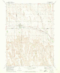
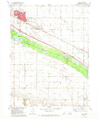
(13)- 1970 Map of Gothenburg, 1973 Print
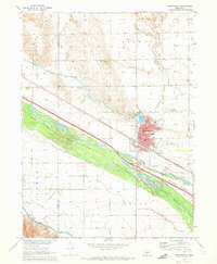 1970 Gothenburg1973 Print · USGSGothenburg is documented here during the early 1970s as a vital Platte Valley hub of irrigation and rail transport. Researchers can trace local genealogy and land use through sites like Gothenburg Cemetery, Peckham Cem, and the Union Pacific rail corridor.2 unique versions available
 - 1970 Map of Eustis, 1973 Print
 1970 Eustis1973 Print · USGSThe high plains of Nebraska near the Dawson and Frontier county line are captured here as they appeared in the early seventies. Genealogists and local historians can trace the tracks of the Burlington Northern, locate the Holmes Sch, and find the Silica Mine south of Eustis.
 - 1970 Map of Gothenburg SW, 1973 Print
 1970 Gothenburg SW1973 Print · USGSDawson and Lincoln County land use is captured here in the early seventies, showing a landscape reshaped by irrigation and canyon-land farming. Researchers can locate the Potters Sch and trace the paths of the Thirtymile Canal and Tri County Supply Canal.
 - 1970 Map of Willow Island, 1973 Print
 1970 Willow Island1973 Print · USGSCentral Nebraska's Platte River valley is captured in the early seventies, showing a landscape defined by irrigation and rail. Trace the footprints of rural life at Willow Island, Center Star Sch, and the Willow Island Cem.
 - 1970 Map of Gothenburg SE, 1973 Print
 1970 Gothenburg SE1973 Print · USGSThe Platte River valley in the early seventies shows a landscape defined by intensive irrigation and the Union Pacific railroad. Trace rural landmarks like Decker Sch, Pleasant View Cem, and the recreational camps around Central Midway Lake.
 - 1970 Map of Farnam, 1973 Print
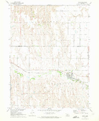
 1970 Farnam1973 Print · USGSFarnam sat at the intersection of Lincoln, Dawson, and Frontier counties in the 1970s, where the prairie gives way to deep creek breaks. Researchers can trace the Burlington Northern rail corridor and find local landmarks like the Farnam Cem and Plum Creek.
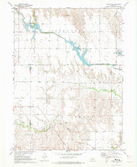
 - 1971 Map of Johnson Lake, 1973 Print
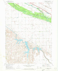
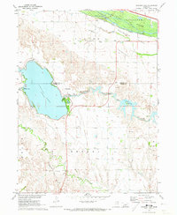 1971 Johnson Lake1973 Print · USGSThe Platte River valley in the early 1970s shows a landscape where pioneer history meets modern engineering. Researchers can trace the Emigrant Trail, locate School No 4, and explore the development around Johnson Lake.2 unique versions available
 - 1971 Map of Cozad NW, 1973 Print
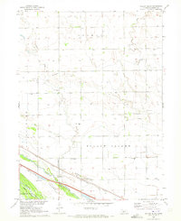
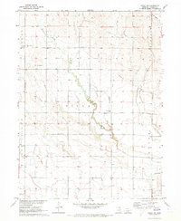 1971 Cozad NW1973 Print · USGSDawson County agriculture and irrigation are captured here in the early 1970s, showcasing the intricate canal systems of the Nebraska plains. Genealogists can locate family landmarks such as School No 13, Walnut Grove Cem, and Cottonwood Cem.
 - 1971 Map of Cozad, 1973 Print
 1971 Cozad1973 Print · USGSCozad and the Platte River valley are captured in the early 1970s, showing a landscape defined by irrigation and historic trails. Researchers can locate numerous numbered rural schools and trace the Emigrant Trail alongside the Cozad Canal.
 - 1971 Map of Elwood NW, 1973 Print
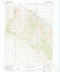
 1971 Elwood NW1973 Print · USGSGosper County and Dawson County landscapes are defined by water management and rail travel in the early seventies. Genealogists and historians can trace the Burlington Northern line through Brace or explore the shores of Gallagher Lake and Plum Creek.2 unique versions available
 - 1972 Map of Odencranze Table South, 1975 Print
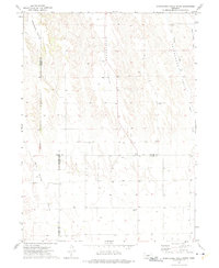 1972 Odencranze Table South1975 Print · USGSCuster County's high tablelands and deep valleys are documented in the early seventies as three Nebraska counties meet at this rural junction. Researchers can locate remote landmarks like Swedish Grove Cem, Linburg Cem, and School No 284 among the draws of Buffalo Creek.
 - 1972 Map of Roten Valley South, 1975 Print
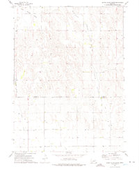 1972 Roten Valley South1975 Print · USGSCuster and Dawson counties in the early 1970s reveal a landscape of high tablelands and strategic water management. Genealogists and researchers can trace the agricultural footprint of the era through features like the Rock Island Table, Stump Ditch, and Buffalo Creek.
 - 1979 Map of Gothenburg
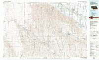 1979 Gothenburg1979 Print · USGSThe Nebraska Loess Hills and the Platte River valley are captured here in the late seventies, showing a landscape defined by irrigation and rail. Researchers can trace the Union Pacific line through Gothenburg, locate family sites near Eustis, or explore the canyon country around Stockville.
End of results
Showing maps 1-13 of 13
Top cities of Dawson County
- Lexington historical maps
- Cozad historical maps
- Gothenburg historical maps
- Overton historical maps
- Sumner historical maps
- Farnam historical maps
See more
Frequently asked questions
- What are the different types of historical maps available for Dawson County?
- What is the oldest map of Dawson County?
- Where can I purchase historical maps of Dawson County for my home or office?
- Where can I download high-res historical maps of Dawson County?
- Are there historical topographic maps available for Dawson County?
- Is there historical aerial imagery available for Dawson County?
- Where are historical maps of Dawson County sourced from?