Old Maps of Dawson County, Nebraska for Academic Research
Study the evolution of Dawson County with 160 high-resolution historic maps. Whether you're teaching, researching, or modeling changes in land use, these maps provide essential visual documentation of urban, environmental, and geographic change.
- Analyze long-term change: Track patterns in development, transportation, and natural features.
- Ideal for environmental or urban studies: Support academic projects with primary historical map data.
- Use in the classroom or lab: Educators and researchers rely on these maps to bring historical context to life.
These maps are a powerful tool for teaching, research, and visualizing how Dawson County has changed over the decades.
Dawson County, NE maps
(160)- 1896 Map of Lexington
 1896 Lexington1896 Print · USGSDawson and Gosper Counties in the mid-1890s are defined by the convergence of the Platte River and competing railroad lines. Genealogists can trace family settlements along the Union Pacific R. R. and the Burlington and Missouri River R. R., locating early sites like Elwood and Coyote.
 - 1896 Map of Kearney
 1896 Kearney1896 Print · USGSBuffalo County and the Platte River valley are captured in the late 1890s as the railroad network cemented the region's growth. Genealogists can locate family lands across townships like Williamsburg or trace the early paths of the Union Pacific R. R. and Kearney Canal.7 unique versions available
 - 1899 Map of Lexington
 1899 Lexington1899 Print · USGSDawson and Gosper counties are captured during a period of rapid prairie development following the arrival of the transcontinental rails. Genealogists can trace the early grids of rail towns like Lexington and Bertrand or the spans of the Lexington Bridge.7 unique versions available
 - 1902 Map of Gothenburg
 1902 Gothenburg1902 Print · USGSThe Platte River valley in the early twentieth century was a landscape defined by new railroads and irrigation. Genealogists and historians can trace the early rail stops at Gothenburg and Cozad or locate remote frontier outposts like Stockville and Moorefield.3 unique versions available
 - 1951 Map of Mason City SW, 1953 Print
 1951 Mason City SW1953 Print · USGSCentral Nebraska's ranching and farming landscape is frozen in time during the early 1950s as three counties meet along the river. Genealogists can locate family-named landmarks and rural hubs like Cumro, the Box Elder Cem, and Milton Store.3 unique versions available
 - 1951 Map of Oconto SW, 1953 Print
 1951 Oconto SW1953 Print · USGSCuster and Dawson County farmsteads are captured here in the early fifties, showing a rural Nebraska landscape before school consolidation. Genealogists can locate family sites near Pleasant Valley Ch or trace students at Sunny Hill Sch and Lemmery Sch.3 unique versions available
 - 1951 Map of Oconto SE, 1953 Print
 1951 Oconto SE1953 Print · USGSAgricultural life in central Nebraska during the early fifties centered around the drainages of Buffalo Creek and the Wood River. Genealogists can locate family-named landmarks and rural school sites such as Lone Eagle Sch, Pleasant Hill Sch, and the local Lutheran Ch.3 unique versions available
 - 1951 Map of Eddyville, 1953 Print
 1951 Eddyville1953 Print · USGSDawson and Custer Counties appear here in the early fifties, showing a rural Nebraska landscape of railroad towns and upland ranching. Genealogists and local historians can locate early landmarks like Park Valley Cem and several country schools including Hidden Hollow Sch.2 unique versions available
 - 1951 Map of Eddyville SW, 1953 Print
 1951 Eddyville SW1953 Print · USGSCuster and Dawson Counties are captured here in the early fifties, dominated by the valley of the Wood River. Researchers can trace the Union Pacific rail line and locate rural landmarks like Happy Hollow Sch and Eddyville.3 unique versions available
 - 1954 Map of McCook, 1966 Print
 1954 McCook1966 Print · USGSSouthwest Nebraska in the mid-fifties reveals a landscape shaped by major water projects and the Chicago Burlington and Quincy RR. Trace ancestral roots and defunct rail stops in McCook, Wauneta, and along the shores of Swanson Lake.2 unique versions available
 - 1954 Map of North Platte, 1968 Print
 1954 North Platte1968 Print · USGSThe Nebraska Sand Hills and the Platte River valley are captured here during a period of mid-century growth and agricultural expansion. Trace the vast irrigation network of the Sutherland Canal, locate old rural schoolhouses like Rose Hill School, and find family holdings such as Conrey Ranch.3 unique versions available
 - 1955 Map of Broken Bow
 1955 Broken Bow1955 Print · USGSCentral Nebraska in the mid-fifties is defined by the sweeping Sand Hills and the vital river valleys that supported its ranching and rail towns. Researchers can trace the rail corridors of the Union Pacific RR and locate settlements like Dannebrog, Broken Bow, and Brewster.5 unique versions available
 - 1955 Map of Grand Island, 1967 Print
 1955 Grand Island1967 Print · USGSCentral Nebraska is seen here during a period of industrial and agricultural growth, centered on the vital Platte River corridor. Researchers can trace the mid-century footprints of the U S Naval Ammunition Depot and the Cornhusker Ordnance Plant.3 unique versions available
 - 1956 Map of Broken Bow
 1956 Broken Bow1956 Print · USGSCentral Nebraska during the mid-fifties reveals a region defined by its river-valley railroads and the rolling Sand Hills. Genealogists and local historians can trace the paths of the Chicago Burlington and Quincy through towns like Broken Bow, Merna, and Anselmo.
 - 1956 Map of North Platte
 1956 North Platte1956 Print · USGSThe Nebraska Sand Hills meet the high plains river valleys in the mid-1950s, a period of intensive water management and rail commerce. Genealogists and historians can trace early prairie settlements like Stapleton and Tryon, or follow the industrial corridor of the Union Pacific through North Platte.
 - 1957 Map of North Platte
 1957 North Platte1957 Print · USGSThe Nebraska Sand Hills and the Platte River valley are captured here in the mid-fifties as the ranching and irrigation economy matured. Genealogists and historians can locate family-named schoolhouses like Maire School or trace the railroad hubs at North Platte and the Fort McPherson National Cemetery.
 - 1957 Map of McCook
 1957 McCook1957 Print · USGSSouthwestern Nebraska in the mid-fifties is captured here during a period of significant water development and rail-based commerce. Researchers can trace the path of the Chicago Burlington and Quincy through Indianola and Bartley, or locate rural settlements like Chase Village and Ough near the Sand Hills.
 - 1957 Map of Grand Island
 1957 Grand Island1957 Print · USGSCentral Nebraska and Northern Kansas are shown here during a period of massive hydraulic and military expansion in the mid-fifties. Researchers can trace the development of the Harlan County Reservoir and the massive wartime legacy of the Cornhusker Ordnance Plant.
 - 1958 Map of McCook
 1958 McCook1958 Print · USGSSouthwest Nebraska during the late fifties reveals a landscape of massive new reservoirs and established rail hubs like McCook. Genealogists can trace family footprints through rural centers like St Johns Church and the many grain elevators along the Union Pacific RR.2 unique versions available
 - 1958 Map of Grand Island
 1958 Grand Island1958 Print · USGSSouth-central Nebraska thrived as a rail and industrial hub during the late fifties, shaped by the braided Platte River. Genealogists and historians can trace rail lines like the Union Pacific RR through towns such as Kearney or locate the sprawling Cornhusker Ordnance Plant.
 - 1961 Map of Elm Creek West, 1963 Print
 1961 Elm Creek West1963 Print · USGSCentral Nebraska's river valley and rail corridor are captured here in the early sixties, as the irrigation-fed landscape prepared for modern highway expansion. Genealogists can locate rural landmarks like Williamsburg Ch, East Twelfth Sch, and the small siding at Trued.
 - 1961 Map of Miller SW, 1963 Print
 1961 Miller SW1963 Print · USGSDawson and Buffalo counties are captured here in the early sixties, showing a rural Nebraska landscape shaped by the Missouri River Basin project. Genealogists can trace family footprints near Fairview Cem or the old grounds of School No 83 and School No 63.2 unique versions available
 - 1962 Map of Lexington West, 1964 Print
 1962 Lexington West1964 Print · USGSDawson County and the Platte River valley are shown in the early sixties as a hub of irrigation and rail transport. Genealogists and historians can trace the local landscape through rural landmarks like School No 38, the Emigrant Trail, and Grace Cem.2 unique versions available
 - 1962 Map of Lexington SE, 1964 Print
 1962 Lexington SE1964 Print · USGSDawson County agriculture and rural life are detailed here in the early sixties, showing the complex irrigation networks of the Nebraska plains. Genealogists and historians can trace the foundations of the community through landmarks like Fairhaven Ch, School No 21, and the Dawson County Canal.2 unique versions available
 - 1962 Map of Buffalo, 1964 Print
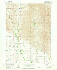 1962 Buffalo1964 Print · USGSThe Dawson County plains in the early 1960s were a landscape of managed waterways and small-scale farming communities. Researchers can trace the irrigation network of the Gothenburg Canal and locate rural landmarks like Rose Hill Cem and School No 44.
Showing maps 1-25 of 160
Top cities of Dawson County
- Lexington historical maps
- Cozad historical maps
- Gothenburg historical maps
- Overton historical maps
- Sumner historical maps
- Farnam historical maps
See more
Frequently asked questions
- What are the different types of historical maps available for Dawson County?
- What is the oldest map of Dawson County?
- Where can I purchase historical maps of Dawson County for my home or office?
- Where can I download high-res historical maps of Dawson County?
- Are there historical topographic maps available for Dawson County?
- Is there historical aerial imagery available for Dawson County?
- Where are historical maps of Dawson County sourced from?