Old Maps of Hall County, Nebraska for Genealogy
Trace your family roots with 95 historic maps of Hall County. These high-res maps reveal old neighborhoods, homesites, landmarks, and streets — helping you uncover where your ancestors lived and how the area evolved over time.
- Explore historic neighborhoods: Identify where your relatives may have lived in the 1800s or 1900s.
- Compare maps over time: Trace the changes in streets, buildings, and landmarks for multi-generational research.
- Perfect for genealogy & ancestry research: Used by family historians and researchers to map out lineage and migration.
These maps are an incredible resource for exploring your personal connection to Hall County's past.
Hall County, NE maps
(95)- 1892 Map of Grand Island
 1892 Grand Island1892 Print · USGSGrand Island and the surrounding Hall County prairies are captured in the late nineteenth century as a vital rail junction. Genealogists and historians can trace early track layouts of the Union Pacific R. R. and locate old settlements like Alda and Doniphan.
 - 1894 Map of Kenesaw
 1894 Kenesaw1894 Print · USGSRailroad development and the complex channels of the Platte River dominate the Nebraska landscape in the 1890s. Genealogists and historians can trace the early town plats of Kenesaw and Juniata or locate the historic Wood River Bridge.
 - 1895 Map of Grand Island
 1895 Grand Island1895 Print · USGSGrand Island emerged as a vital rail crossroads in central Nebraska during the late nineteenth century. Genealogists and historians can trace the early development of the city grid and surrounding settlements like Alda and Doniphan, or locate crossings such as the Island Bridge.
 - 1895 Map of Wood River
 1895 Wood River1895 Print · USGSThe central Nebraska plains were undergoing a railroad-driven expansion in the 1890s as homesteads filled the townships. Researchers can trace early property lines and rail stops along the Union Pacific (Main Line) at Wood River and the braided channels of the North Channel Platte River.
 - 1896 Map of Wood River
 1896 Wood River1896 Print · USGSCentral Nebraska at the close of the nineteenth century is defined by its massive river islands and burgeoning rail towns. Local historians can trace early prairie commerce through the rail lines connecting Wood River, Shelton, and the distinctive Sugar Bowl terrain.4 unique versions available
 - 1898 Map of Grand Island
 1898 Grand Island1898 Print · USGSCentral Nebraska is captured in the late 1890s as a bustling rail and agricultural crossroads centered on the Platte River. Genealogists and historians can trace early settlements like Doniphan and Harvard or the grounds of the Insane Asylum outside Hastings.4 unique versions available
 - 1899 Map of Loup
 1899 Loup1899 Print · USGSCentral Nebraska at the end of the century was a land defined by its rivers and expanding rail lines. Genealogists can trace the early pioneer hubs of Dannebrog, Ashton, and Scotia along the Union Pacific RR.2 unique versions available
 - 1899 Map of St. Paul
 1899 St. Paul1899 Print · USGSCentral Nebraska's river valleys and rail hubs are preserved here during the expansion of the late 1890s. Researchers can trace the development of St. Paul and Central City alongside curious landmarks like Mumpumpey Hill and the Burlington and Missouri River R. R.4 unique versions available
 - 1953 Map of Dannebrog
 1953 Dannebrog1953 Print · USGSDannebrog and Cairo sit at the intersection of vital Nebraska rail lines and river valleys during the early fifties. Local historians can trace the precise locations of rural landmarks like Oak Ridge Cem, the Gaging Station, and numerous numbered district schools.2 unique versions available
 - 1953 Map of Boelus, 1955 Print
 1953 Boelus1955 Print · USGSHoward County and the surrounding river valleys are captured here in the early fifties during the Missouri River Basin development program. Researchers can find old rural landmarks including Boelus, the Swedish Cem, and numerous schoolhouses like Boesen Sch.2 unique versions available
 - 1955 Map of Broken Bow
 1955 Broken Bow1955 Print · USGSCentral Nebraska in the mid-fifties is defined by the sweeping Sand Hills and the vital river valleys that supported its ranching and rail towns. Researchers can trace the rail corridors of the Union Pacific RR and locate settlements like Dannebrog, Broken Bow, and Brewster.5 unique versions available
 - 1955 Map of Grand Island, 1967 Print
 1955 Grand Island1967 Print · USGSCentral Nebraska is seen here during a period of industrial and agricultural growth, centered on the vital Platte River corridor. Researchers can trace the mid-century footprints of the U S Naval Ammunition Depot and the Cornhusker Ordnance Plant.3 unique versions available
 - 1956 Map of Broken Bow
 1956 Broken Bow1956 Print · USGSCentral Nebraska during the mid-fifties reveals a region defined by its river-valley railroads and the rolling Sand Hills. Genealogists and local historians can trace the paths of the Chicago Burlington and Quincy through towns like Broken Bow, Merna, and Anselmo.
 - 1957 Map of Grand Island
 1957 Grand Island1957 Print · USGSCentral Nebraska and Northern Kansas are shown here during a period of massive hydraulic and military expansion in the mid-fifties. Researchers can trace the development of the Harlan County Reservoir and the massive wartime legacy of the Cornhusker Ordnance Plant.
 - 1958 Map of Grand Island
 1958 Grand Island1958 Print · USGSSouth-central Nebraska thrived as a rail and industrial hub during the late fifties, shaped by the braided Platte River. Genealogists and historians can trace rail lines like the Union Pacific RR through towns such as Kearney or locate the sprawling Cornhusker Ordnance Plant.
 - 1961 Map of St. Paul SW, 1963 Print
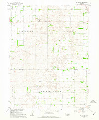 1961 St. Paul SW1963 Print · USGSHoward and Hall Counties are shown in the early sixties as a network of established townships and rural districts. Genealogists can locate specific homestead sites near School No 16, School No 51, or the Union Pacific line crossing the St Libory border.
 - 1961 Map of St. Libory, 1963 Print
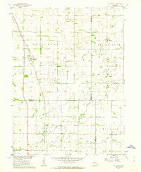 1961 St. Libory1963 Print · USGSThe rural landscape of Howard and Hall counties in the early sixties is defined by a dense network of country schools and the tracks of the Union Pacific. Genealogists can locate family-named landmarks like the Norwegian Cem, Worms, and School No 41.
 - 1962 Map of Denman, 1963 Print
 1962 Denman1963 Print · USGSThe braided Platte River channels define this Nebraska landscape in the early sixties as agricultural irrigation and modern highways transformed the valley. Genealogists and rail historians can trace the paths of the Union Pacific and Chicago Burlington and Quincy through Denman and Kenesaw.3 unique versions available
 - 1962 Map of Prosser, 1963 Print
 1962 Prosser1963 Print · USGSThe braided channels of the Platte River and the Union Pacific rail line defined life in rural Adams and Hall Counties during the early sixties. Researchers can trace family history through sites like Hayland, School No 87, and Concordia Cem.2 unique versions available
 - 1962 Map of Abbott, 1964 Print
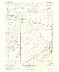 1962 Abbott1964 Print · USGSHall County’s landscape in the early sixties is defined by the massive Corn Husker Ordnance Plant and the steady expansion of Grand Island. Genealogists can locate family landmarks like Engleman Sch or the Soldiers and Sailors Cem near the rail lines.4 unique versions available
 - 1962 Map of Shelton NE, 1964 Print
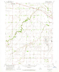 1962 Shelton NE1964 Print · USGSHall County’s agricultural and military landscape is captured here in the early sixties, centered on the townships of Harrison and Mayfield. Genealogists can locate rural schoolhouses like Plainview Sch and trace the extensive Corn Husker Ordnance Plant grounds.3 unique versions available
 - 1962 Map of Cameron, 1964 Print
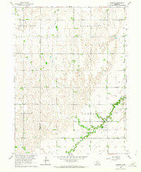 1962 Cameron1964 Print · USGSCentral Nebraska's rural landscape comes into focus during the early sixties, showing the agricultural settlement along the buffalo and hall county line. Genealogists can locate family landmarks like Mount Pleasant Cem, School No 48, and the Cameron Ch.
 - 1962 Map of Shelton, 1964 Print
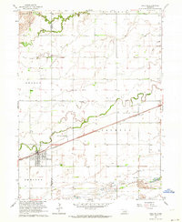 1962 Shelton1964 Print · USGSThe town of Shelton and its surrounding Nebraska river bottoms are captured here in the early 1960s. Researchers can trace rural school districts like School No 33 and School No 5 or follow the Union Pacific tracks past Platte Valley Academy.2 unique versions available
 - 1962 Map of Doniphan, 1964 Print
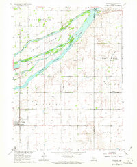 1962 Doniphan1964 Print · USGSDoniphan and the Platte River valley are captured here in the early sixties, showing a landscape defined by braided river channels and rural townships. Genealogists can locate family-named precincts and community landmarks like Cedarview Cem, School No 19, and the riverside Camp Augustine.3 unique versions available
 - 1962 Map of Grand Island, 1964 Print
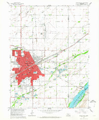 1962 Grand Island1964 Print · USGSGrand Island thrived as a major Nebraska rail hub in the early sixties, where the Union Pacific met the Burlington line. Genealogists and historians can locate dozens of neighborhood landmarks, from the East Grand Island Cem to Central High Sch and the Soldiers and Sailors Home.4 unique versions available
Showing maps 1-25 of 95
Top cities of Hall County
- Grand Island historical maps
- Wood River historical maps
- Doniphan historical maps
- Cairo historical maps
- Alda historical maps
Frequently asked questions
- What are the different types of historical maps available for Hall County?
- What is the oldest map of Hall County?
- Where can I purchase historical maps of Hall County for my home or office?
- Where can I download high-res historical maps of Hall County?
- Are there historical topographic maps available for Hall County?
- Is there historical aerial imagery available for Hall County?
- Where are historical maps of Hall County sourced from?