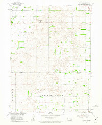
1961 Map of St. Paul SW
USGS Topo · Published 1963About this map
The agricultural landscape of central Nebraska is captured here across the boundary of Howard and Hall Counties. In the early 1960s, this area was organized into distinct townships including Cleveland, St Libory, Mayfield, and Prairie Creek. The map documents a rural education network before district consolidation, marking locations for School No 16, School No 51, and School No 55. This pattern of numerical school assignments reflects the systematic organization of the Platte River Valley hinterland. Transport and topography are defined by the Union Pacific line in the northeast corner and distinctive elevations like Mumpumpey Hill, which serves as a site for a Radio Tower. Hydrological features such as Lake Slough and the winding terrain around Pool Hill illustrate the local drainage patterns typical of this portion of the Missouri River Basin development area.
Find a feature on this map
13 named features on this map. Tap any name to fly to it.
Don’t see what you’re looking for? This feature index may not catch every label — zoom into the map to look around manually.
Map Details
Editions of this 1961 St. Paul SW Map
This is the sole edition of this map. No revisions or reprints were ever made.
Other maps of this area

1892 · Grand Island
USGS Topo · 1:62,500

1895 · Grand Island
USGS Topo · 1:62,500

1895 · Wood River
USGS Topo · 1:62,500

1896 · Wood River
USGS Topo · 1:125,000

1898 · Grand Island
USGS Topo · 1:125,000

1899 · Loup
USGS Topo · 1:125,000

1899 · St. Paul
USGS Topo · 1:125,000

1953 · Dannebrog
USGS Topo · 1:24,000

1953 · Nysted
USGS Topo · 1:24,000

1955 · Broken Bow
USGS Topo · 1:250,000