
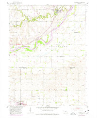
1953 Map of Dannebrog
USGS Topo · Published 1953About this map
The Dannebrog settlement is situated along the bends of Oak Creek and the Loup River, serving as a focal point in this mid-century topographic survey of the Nebraska plains. The landscape is defined by its transition from the valley floor to the upland plateaus of Dannebrog, Cleveland, and Mayfield townships. Two major rail corridors anchor the regional economy: the Union Pacific tracks passing through Dannebrog and the Chicago Burlington and Quincy line near Cairo at the southern edge.
Find a feature on this map
22 named features on this map. Tap any name to fly to it.
Don’t see what you’re looking for? This feature index may not catch every label — zoom into the map to look around manually.
Map Details
Editions of this 1953 Dannebrog Map
2 editions found
Other maps of this area

1892 · Grand Island
USGS Topo · 1:62,500

1895 · Grand Island
USGS Topo · 1:62,500

1895 · Wood River
USGS Topo · 1:62,500

1896 · Wood River
USGS Topo · 1:125,000

1898 · Grand Island
USGS Topo · 1:125,000

1899 · Loup
USGS Topo · 1:125,000

1899 · St. Paul
USGS Topo · 1:125,000

1953 · Boelus
USGS Topo · 1:24,000

1953 · Farwell
USGS Topo · 1:24,000

1953 · Nysted
USGS Topo · 1:24,000