2020s Maps of Holt County, Nebraska
Explore 59 historic maps of Holt County from the 2020s. These maps offer a rare glimpse into what life looked like during the 2020s — showing old roads, neighborhoods, homes, and landmarks that have changed or disappeared over time.
Whether you're researching your family's past, planning a metal detecting trip, or studying how Holt County's landscape evolved across the 2020s, these high-resolution maps are a powerful tool for exploring the history of this region.
- Focus on a specific era: All maps on this page are from the 2020s, giving you a focused view of this time period.
- See what’s changed: Compare century-old streets, trails, and buildings to today's modern landscape using overlays and satellite layers.
- Research with precision: Use these maps for genealogy, historical research, land use analysis, or educational projects.
- View, download, or print: Maps are fully viewable online in high resolution, and can be downloaded or printed for your own records.
Start exploring Holt County's history through authentic maps from the 2020s. This is your window into the past.
Holt County, NE maps
(59)- 2021 Map of Lambs Lake, 2021 Print
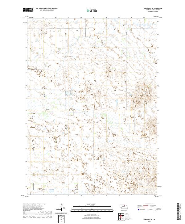
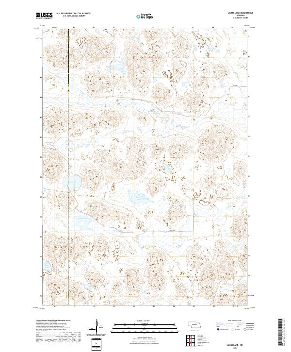 2021 Lambs Lake2021 Print · USGSThe border of Rock and Holt counties in the Nebraska Sandhills is documented here in the early twenty-first century. Researchers can trace the isolated wetlands and rangelands of this sparsely populated region, including Lambs Lake, Overton Lake, and Holt Cr.
 - 2021 Map of Naper, 2021 Print
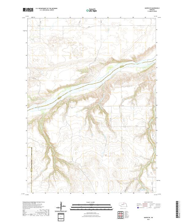
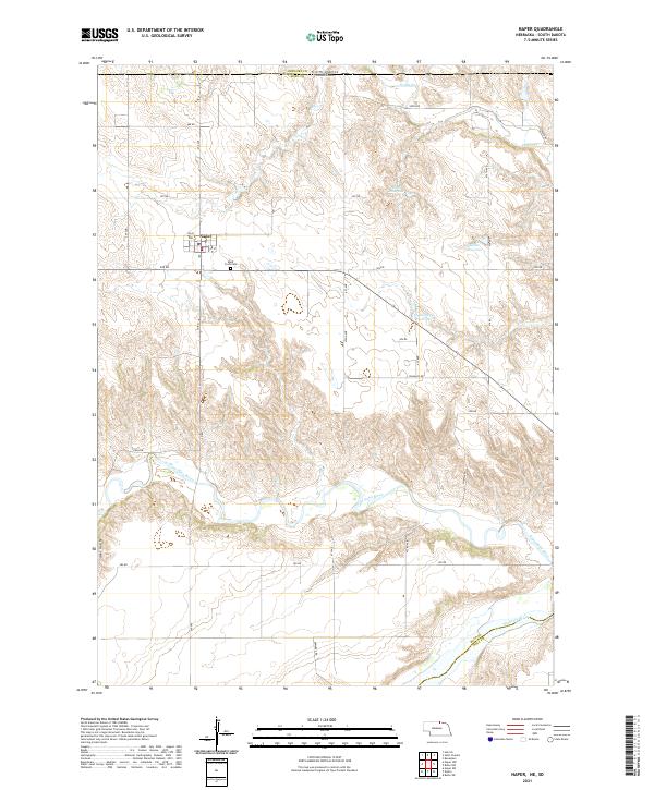 2021 Naper2021 Print · USGSThe Boyd County panhandle along the South Dakota border is shown here in the modern era, framed by the winding valleys of the northern plains. Researchers can locate the Naper townsite, the Knoll Crest Cem, and water features like Ponca Cr and the Niobrara River.
 - 2021 Map of Stuart SE, 2021 Print
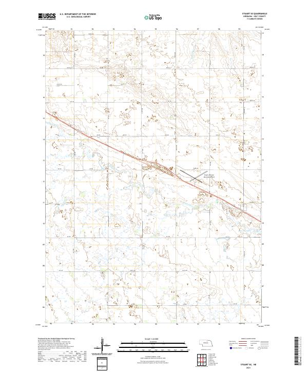 2021 Stuart SE2021 Print · USGSHolt County in the early twenty-first century maintains its agricultural roots along the winding Elkhorn River corridor. Researchers can trace the path of the historic railroad via the Cowboy Trl or locate landmarks like the Stuart-Atkinson Municipal Airport.
 - 2021 Map of Stuart NE, 2021 Print
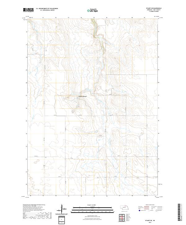 2021 Stuart NE2021 Print · USGSHolt County ranching country is captured here during the early twenty-first century, showing the intersection of water and wire in Nebraska. Researchers can trace land use patterns around Wilson Ranch and the riparian corridors of Big Sandy Cr and Beaver Cr.
 - 2021 Map of Dora Lake, 2021 Print
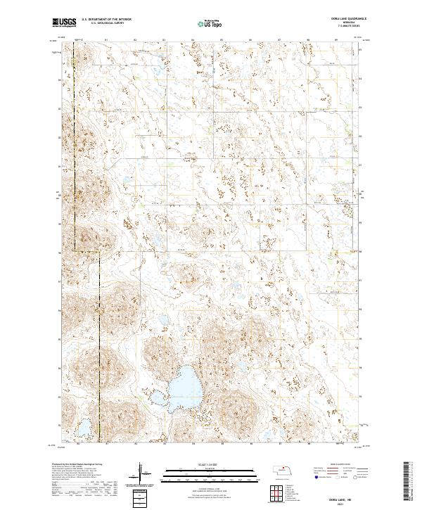 2021 Dora Lake2021 Print · USGSHolt County's interior landscape is documented here in the early twenty-first century, showing the intersection of the Nebraska Sandhills and rural land division. Researchers can trace the section-line roads and seasonal drainage of Dry Cr near the prominent Dora Lake.
 - 2021 Map of Dustin, 2021 Print
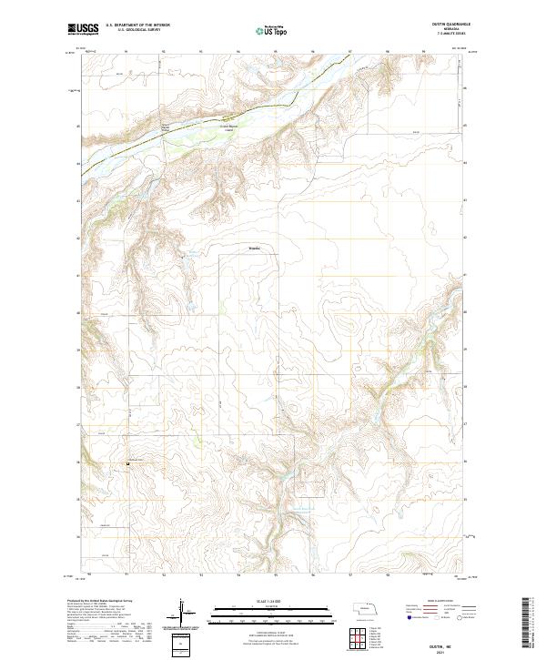 2021 Dustin2021 Print · USGSHolt County near the Niobrara River is shown here as it appeared in the early twenty-first century, preserving the rural character of northern Nebraska. Researchers can trace land tracts near Dustin, locate the Cleveland Cem, and identify old river crossings at Grand Rapids Bridge.
 - 2021 Map of Stuart NW, 2021 Print
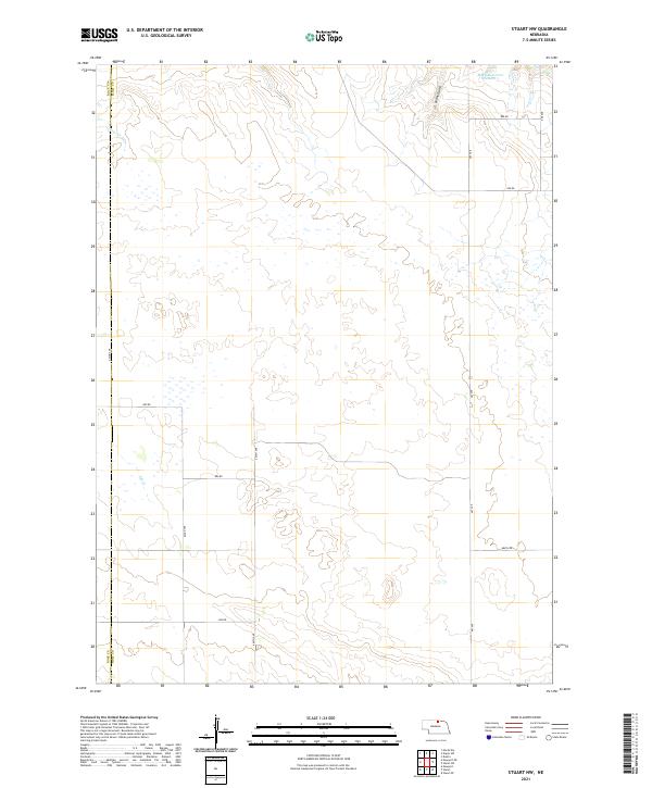 2021 Stuart NW2021 Print · USGSThe Nebraska Sandhills at the Holt and Rock County line appear here in recent years as a landscape of remote ranching and rural infrastructure. Researchers can trace the drainage of Otter Cr and Ash Cr or locate water resources like MMK Reservoir Number 1.
 - 2021 Map of Swan Lake, 2021 Print
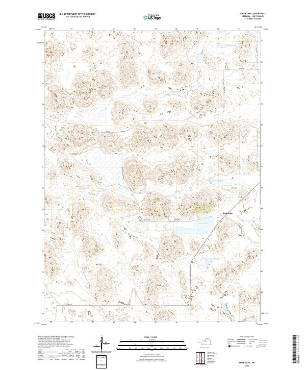 2021 Swan Lake2021 Print · USGSHolt County's interior is captured here in the early 2020s, showing a landscape defined by the S Fork Elkhorn River and numerous local basins. Researchers can trace the rural road network along Frontier Rd or explore the drainage patterns of Swan Lake and Rush Lake.
 - 2021 Map of Lambs Lake NE, 2021 Print
 2021 Lambs Lake NE2021 Print · USGSHolt County's prairie landscape is documented in the early 2020s, revealing a sparse agricultural network of section-line roads and seasonal water. Researchers can trace land divisions along 874 Rd and 870 Rd, or follow the path of Dry Cr through the local townships.
 - 2021 Map of Naper SW, 2021 Print
 2021 Naper SW2021 Print · USGSThe borderlands of Holt and Boyd counties are seen here in the early 2020s, dominated by the winding course of the Niobrara River. Researchers can trace the varied drainages of Cedar Gulch and Otter Cr or locate JMK Reservoir Number 1.
 - 2021 Map of Cottonwood Lake, 2021 Print
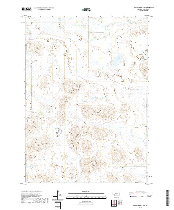 2021 Cottonwood Lake2021 Print · USGSHolt County's sandhills and wetlands are documented in the early twenty-first century, showing a remote ranching landscape north of the Elkhorn River. Genealogists and researchers can locate the settlement of Inez and trace local routes like Benton Rd and 860th Rd past Whipple Lake.
 - 2021 Map of Abbott Ranch, 2021 Print
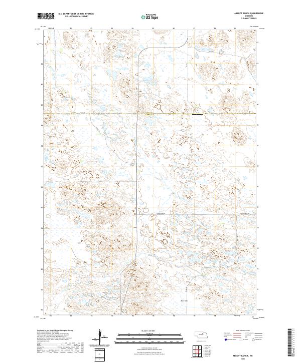 2021 Abbott Ranch2021 Print · USGSThe Nebraska Sandhills come into focus in this 2021 study of the Garfield and Holt County borderlands. Trace the winding paths of Big Cedar Creek and Little Cedar Creek or locate local landmarks like Beat Flats along the remote Cedar River Road.
 - 2021 Map of Mariaville, 2021 Print
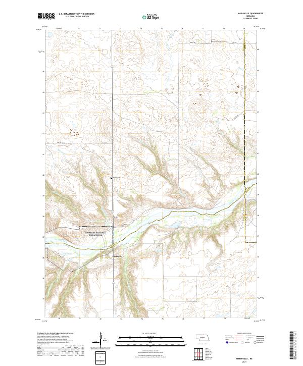 2021 Mariaville2021 Print · USGSKeya Paha County is captured here at the start of the 2020s, dominated by the protected waters of the Niobrara. Local history researchers can trace the rural landscape through landmarks like Simpson Cem, King Hill, and the tiny settlement of Mariaville.
 - 2021 Map of Stuart, 2021 Print
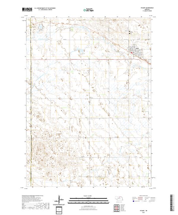 2021 Stuart2021 Print · USGSStuart and the surrounding Nebraska prairie are documented here in the early twenty-first century. Genealogists and local historians can trace family plots at Saint Boniface Cem or follow the path of the Cowboy Trl across the Elkhorn River.
 - 2021 Map of Carson Lake, 2021 Print
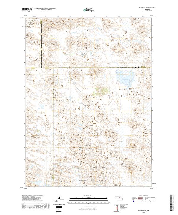 2021 Carson Lake2021 Print · USGSThe Nebraska Sandhills at the meeting of four counties are captured here in the early twenty-first century. Researchers can trace the hydrologic signatures of Carson Lake, follow the path of Big Cedar Cr, and locate family land near Garska Meadow.
 - 2021 Map of Bruner Lake, 2021 Print
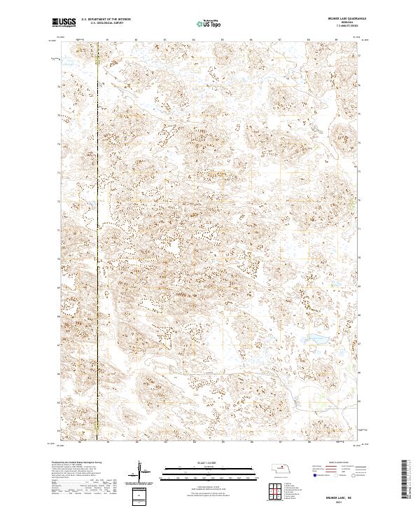 2021 Bruner Lake2021 Print · USGSHolt County's ranching country and the eastern edge of Rock County are captured here in the early twenty-first century. Genealogists and land researchers can trace property boundaries across T26N R17W or locate family landmarks near Bruner Lake and Long Lake.
 - 2021 Map of Dorsey NW, 2021 Print
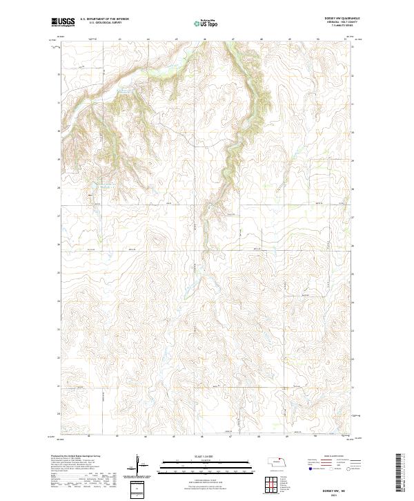 2021 Dorsey NW2021 Print · USGSHolt County's rural landscape is defined here by its complex drainage systems and mid-century water management features. Researchers can trace the paths of Redbird Cr and Steel Cr, or locate local landmarks like Witt Reservoir Number 1.
 - 2021 Map of Ewing, 2021 Print
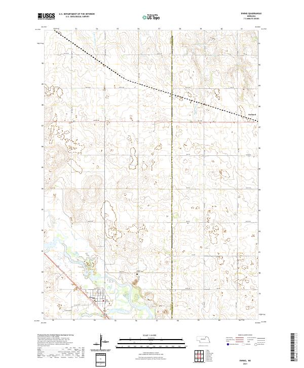 2021 Ewing2021 Print · USGSThe community of Ewing is captured here in the early twenty-first century at the confluence of the Elkhorn River forks. Researchers can trace the path of the Cowboy Trail and locate local landmarks like Saint Peters Cem and the outskirts of Orchard.
 - 2021 Map of Emmet SW, 2021 Print
 2021 Emmet SW2021 Print · USGSThe Nebraska Sandhills of Holt County come into focus in this recent survey of its ranching landscape. Researchers can trace the drainage of Holt Cr and locate water features like Lizard Lake, Gold Lake, and West Lake among the section-line roads.
 - 2021 Map of Atkinson NE, 2021 Print
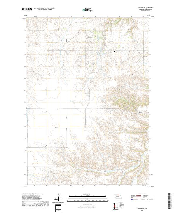 2021 Atkinson NE2021 Print · USGSHolt County's rural landscape is captured here in the early twenty-first century, showing the intricate creek systems and section-line roads of north-central Nebraska. Researchers can locate Phoenix Cem, trace the various forks of Eagle Cr, and find the remote Rock Falls.
 - 2021 Map of Deloit SW, 2021 Print
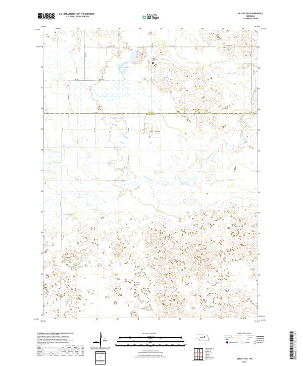 2021 Deloit SW2021 Print · USGSWheeler and Holt counties appear here in the early twenty-first century, showcasing the wetland-rich terrain of the Nebraska Sandhills. Researchers can trace rural infrastructure and local history via Saint Anthonys Cem and the waters of Clearwater Cr.
 - 2021 Map of Dorsey, 2021 Print
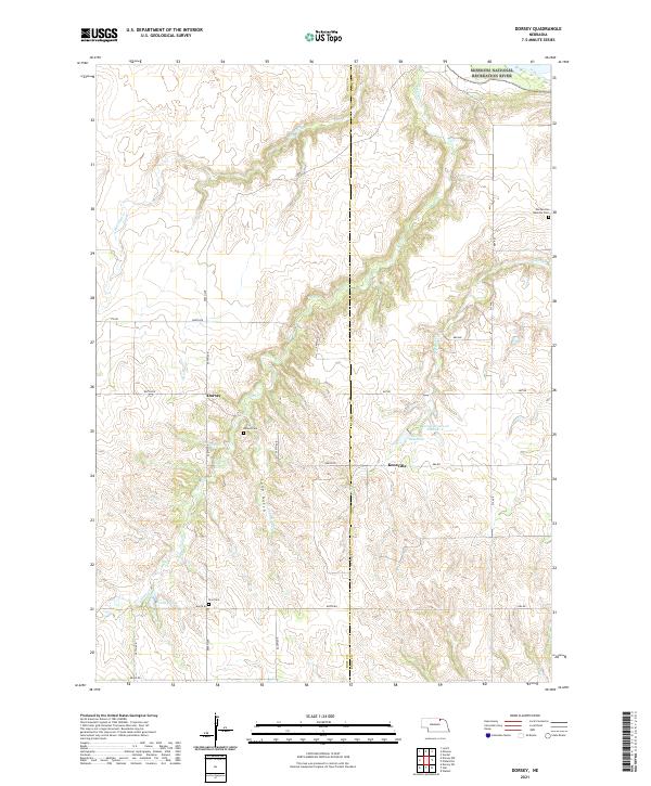 2021 Dorsey2021 Print · USGSThe Holt and Knox county line comes alive in the early twenty-first century as the landscape transitions toward the Niobrara valley. Genealogists and local historians can locate rural landmarks like Pischelville National Cem, Dorsey, and Star Cem.
 - 2021 Map of Butte SW, 2021 Print
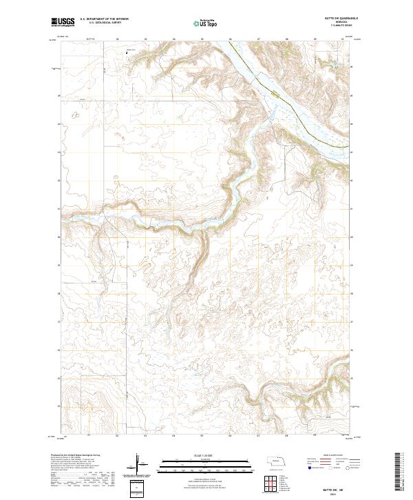 2021 Butte SW2021 Print · USGSHolt County's river-cut ranchlands are captured here during the early twenty-first century, showing the rural landscape south of the Niobrara. Local historians can locate the Adams Cem and trace the paths of The River Rd and Big Sandy Creek.
 - 2021 Map of Butte NW, 2021 Print
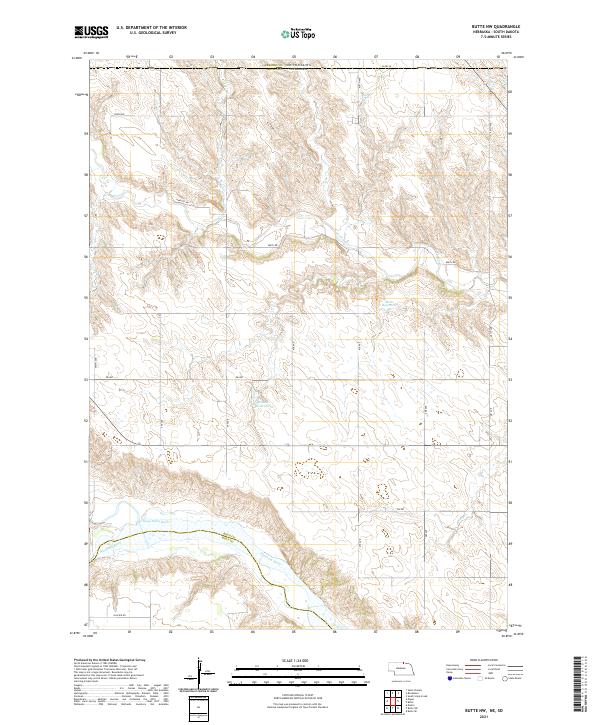 2021 Butte NW2021 Print · USGSBoyd County, Nebraska, near the South Dakota border, is shown here in the early twenty-first century as a land shaped by the Niobrara River. Researchers can trace local water rights and land divisions near Mohr Reservoir and the Keya Paha River.
 - 2021 Map of Goose Lake, 2021 Print
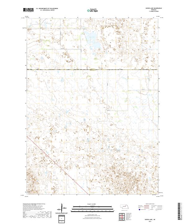 2021 Goose Lake2021 Print · USGSWheeler and Holt counties remain defined by their quiet Sandhills geography in this recent survey of the Nebraska interior. Local researchers and landowners can trace the shoreline of Goose Lake and the drainage patterns of Buffalo Flats and Cache Cr.
Showing maps 1-25 of 59
Top cities of Holt County
- O'Neill historical maps
- Atkinson historical maps
- Stuart historical maps
- Ewing historical maps
- Chambers historical maps
- Page historical maps
See more
Frequently asked questions
- What are the different types of historical maps available for Holt County?
- What is the oldest map of Holt County?
- Where can I purchase historical maps of Holt County for my home or office?
- Where can I download high-res historical maps of Holt County?
- Are there historical topographic maps available for Holt County?
- Is there historical aerial imagery available for Holt County?
- Where are historical maps of Holt County sourced from?