2020s Maps of Keya Paha County, Nebraska
Explore 20 historic maps of Keya Paha County from the 2020s. These maps offer a rare glimpse into what life looked like during the 2020s — showing old roads, neighborhoods, homes, and landmarks that have changed or disappeared over time.
Whether you're researching your family's past, planning a metal detecting trip, or studying how Keya Paha County's landscape evolved across the 2020s, these high-resolution maps are a powerful tool for exploring the history of this region.
- Focus on a specific era: All maps on this page are from the 2020s, giving you a focused view of this time period.
- See what’s changed: Compare century-old streets, trails, and buildings to today's modern landscape using overlays and satellite layers.
- Research with precision: Use these maps for genealogy, historical research, land use analysis, or educational projects.
- View, download, or print: Maps are fully viewable online in high resolution, and can be downloaded or printed for your own records.
Start exploring Keya Paha County's history through authentic maps from the 2020s. This is your window into the past.
Keya Paha County, NE maps
(20)- 2021 Map of Springview SE, 2021 Print
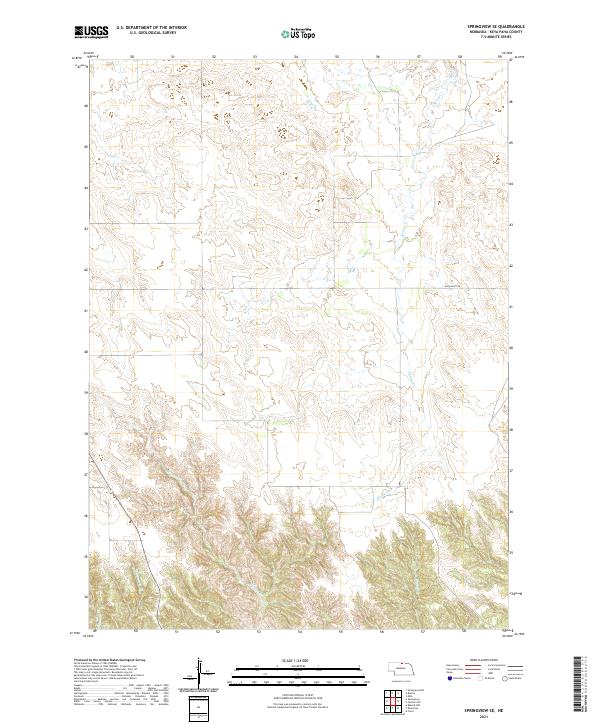 2021 Springview SE2021 Print · USGSKeya Paha County at the start of the twenty-first century remains defined by its natural watercourses and cattle-country seclusion. Researchers can trace the drainages of Spring Creek and Wyman Creek or locate local landmarks like Hay Valley Rd.
 - 2021 Map of Bassett NW, 2021 Print
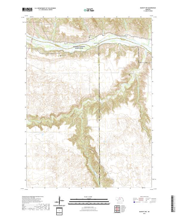 2021 Bassett NW2021 Print · USGSNorthern Nebraska's river breaks and canyons are documented in this recent survey, showcasing the remote landscape where Brown and Rock counties meet. Researchers can locate isolated burial sites like Putnam Cem and Leonard Cem near the Niobrara River.
 - 2021 Map of Huddle Table, 2021 Print
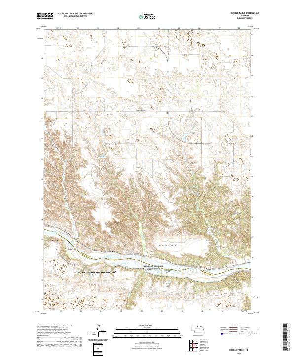 2021 Huddle Table2021 Print · USGSThe Niobrara River corridor in Keya Paha County is shown here in modern detail, preserving the rugged ranchland and canyon systems of northern Nebraska. Trace the winding paths of Chimney Creek and Buzzard Canyon or locate landmarks like Huddle Table and Cedar Island.
 - 2021 Map of Riverview, 2021 Print
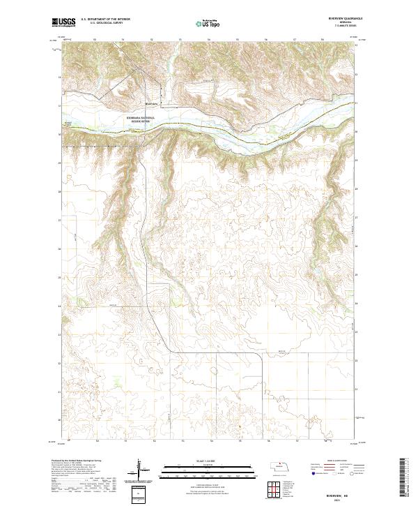 2021 Riverview2021 Print · USGSThe Niobrara river valley in northern Nebraska remained a sanctuary of wild water and remote ranchlands into the early twenty-first century. Researchers can trace the boundaries of the Fort Niobrara National Wildlife Refuge and locate the settlement of Riverview near Kindall Island.
 - 2021 Map of Mills, 2021 Print
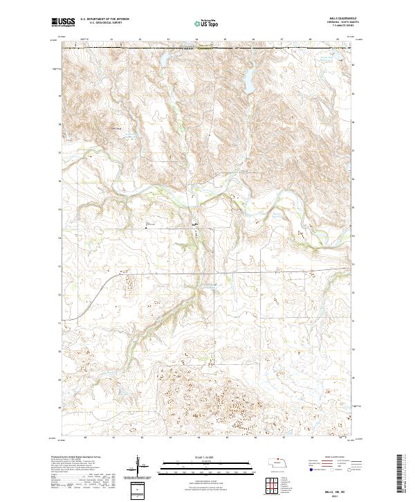 2021 Mills2021 Print · USGSKeya Paha County, Nebraska, sits along the South Dakota border in this recent survey of the prairie landscape. Researchers can locate Mills and the Olive Branch Cemetery while tracing the winding path of the Keya Paha River and its many tributary creeks.
 - 2021 Map of Meadville, 2021 Print
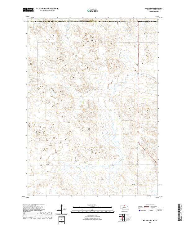
 2021 Meadville2021 Print · USGSThe Niobrara River valley in Keya Paha County is shown here in the early 2020s, as it cuts through the Nebraska plains. Local historians can trace the rural infrastructure around Meadville, including the Meadville Bridge and the drainages of Jewett Cr and Plum Cr.
 - 2021 Map of Springview, 2021 Print
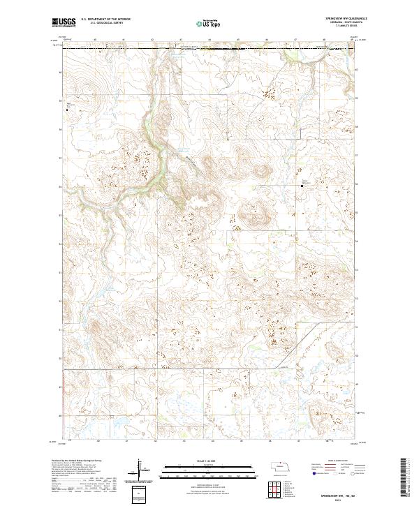
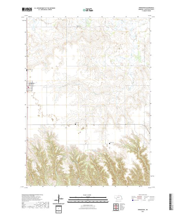 2021 Springview2021 Print · USGSSpringview and the surrounding Keya Paha County uplands are documented here in the early twenty-first century. Genealogists and local historians can trace the town grid and find area burial sites like Mount Hope Cem, Rogers Cem, and the Keya Paha County Courthouse.
 - 2021 Map of Jamison SW, 2021 Print
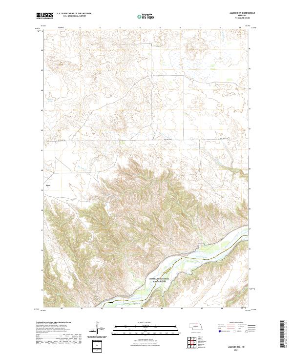 2021 Jamison SW2021 Print · USGSThe Niobrara River valley in 2021 remains a protected corridor of prairie and bluffs at the Keya Paha and Rock county line. Local historians can trace the rural landscape near Dyer and the path of Big Anne Cr as it flows toward the scenic river.
 - 2021 Map of Norden, 2021 Print
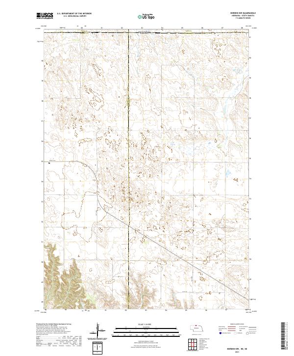
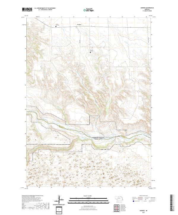 2021 Norden2021 Print · USGSThe high plains of Keya Paha County meet the deep valley of the Niobrara River in this modern topographic study. Researchers can locate family sites at Pleasant Dale Cem or trace the river's path through Kuhres Rapid and under the Norden Bridge.
 - 2021 Map of Carns, 2021 Print
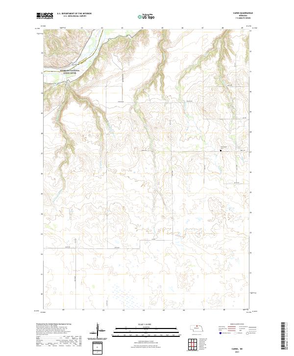 2021 Carns2021 Print · USGSNorth-central Nebraska river country is documented here in the early twenty-first century, centered on the vital crossing at Carns Bridge. Genealogists and local historians can trace family locations near Willowdale Cem and follow the paths of Rock Cr and the Middle Br.
 - 2021 Map of Muleshoe Creek, 2021 Print
 2021 Muleshoe Creek2021 Print · USGSThe Niobrara River corridor in Cherry County remains a remote landscape of protected waterways and cattle country. Trace the river's path through Egelhoffs Narrows, locate the County Line Bridge, and follow the Niobrara River Trl.
 - 2021 Map of Mariaville, 2021 Print
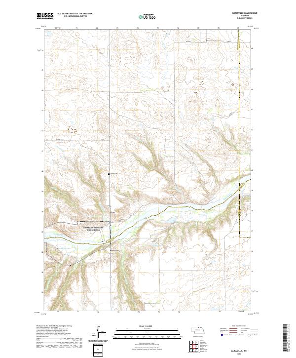 2021 Mariaville2021 Print · USGSKeya Paha County is captured here at the start of the 2020s, dominated by the protected waters of the Niobrara. Local history researchers can trace the rural landscape through landmarks like Simpson Cem, King Hill, and the tiny settlement of Mariaville.
 - 2021 Map of Norden NW, 2021 Print
 2021 Norden NW2021 Print · USGSThe Nebraska-South Dakota borderlands in the early 2020s remain a landscape of vast cattle range and quiet section roads. Genealogists and local historians can locate the Sparks Cem and trace the paths of Shadley Cr and Coleman Cr through the hills.
 - 2021 Map of Hayford Lake, 2021 Print
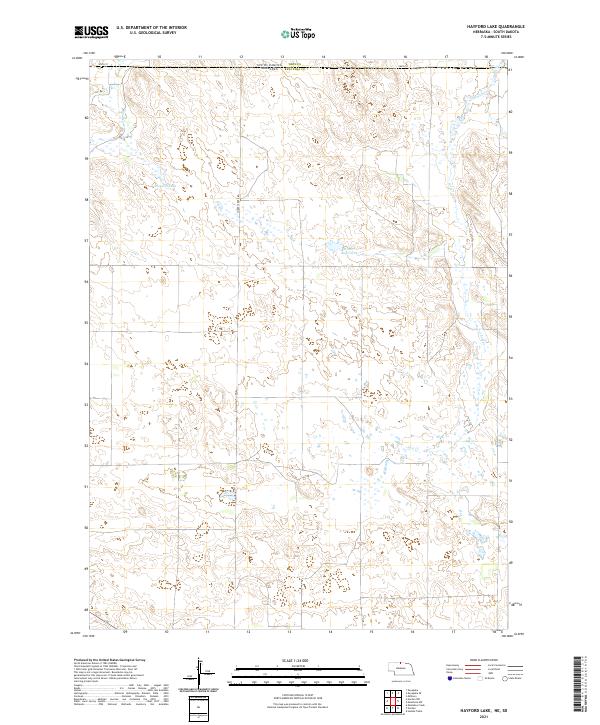 2021 Hayford Lake2021 Print · USGSThe Nebraska and South Dakota borderlands remain a landscape of isolated ranching and high plains hydrology in the early twenty-first century. Researchers can trace the drainage patterns of Shadley Cr and Lost Cr or locate family interests near Hayford Lake.
 - 2021 Map of Burton, 2021 Print
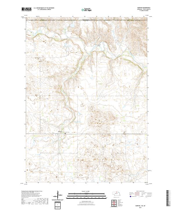 2021 Burton2021 Print · USGSThe high plains of Keya Paha County meet the South Dakota border in this recent survey of the Nebraska panhandle region. Researchers can locate the Burton Cem near the town of Burton, and trace the path of the Keya Paha River past Leavens Bridge.
 - 2021 Map of Meadville NE, 2021 Print
 2021 Meadville NE2021 Print · USGSKeya Paha County at the South Dakota border appears in this modern survey of Nebraska’s northern plains. Genealogists and land researchers can trace property boundaries and the vital water sources of Holt Cr and Timber Cr.
 - 2021 Map of Meadville NW, 2021 Print
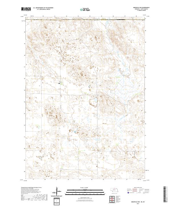 2021 Meadville NW2021 Print · USGSThe Nebraska-South Dakota borderlands come into focus in this recent survey of the rural landscape where Keya Paha and Tripp counties meet. Genealogists and local researchers can pinpoint the Lost Creek Cemetery and trace the path of Cottonwood Creek.
 - 2021 Map of Dutch Creek, 2021 Print
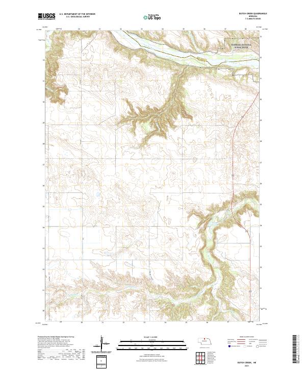 2021 Dutch Creek2021 Print · USGSThe Niobrara River valley in Brown County is captured here in the early 2020s, showing the intersection of water and plateau. Genealogists and researchers can trace the drainages of Plum Cr and Jewett Cr as they cut through the northern Nebraska terrain.
 - 2021 Map of Springview NW, 2021 Print
 2021 Springview NW2021 Print · USGSKeya Paha County and the South Dakota borderlands are shown here in the early twenty-first century as a landscape of remote ranching and essential water management. Genealogists and local historians can locate West Enterprise Cem and Jordan Valley Cem, or trace the winding course of the Keya Paha Riv and Deckers Gulch.
 - 2021 Map of Jamison, 2021 Print
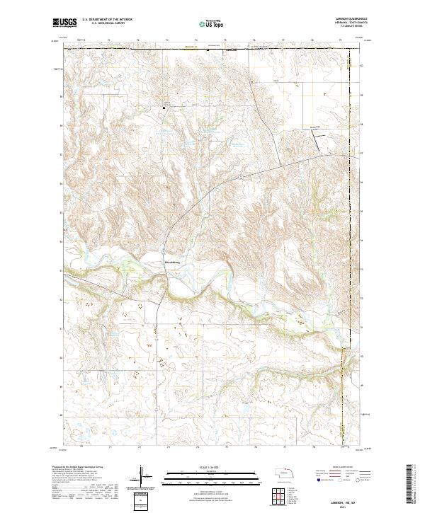 2021 Jamison2021 Print · USGSThe northern edge of Nebraska meets the South Dakota border in this recent survey of the rural Keya Paha landscape. Researchers can locate family landmarks like Burkinshaw Field and Immanuel Cem, or trace the winding course of the Keya Paha River.
End of results
Showing maps 1-20 of 20
Top cities of Keya Paha County
Frequently asked questions
- What are the different types of historical maps available for Keya Paha County?
- What is the oldest map of Keya Paha County?
- Where can I purchase historical maps of Keya Paha County for my home or office?
- Where can I download high-res historical maps of Keya Paha County?
- Are there historical topographic maps available for Keya Paha County?
- Is there historical aerial imagery available for Keya Paha County?
- Where are historical maps of Keya Paha County sourced from?