Old Maps of Keya Paha County, Nebraska for Metal Detecting
Plan your next treasure hunt with 114 historic maps of Keya Paha County. Find old homesites, ghost towns, trails, and gathering spots that may be lost to time — perfect for identifying promising metal detecting locations.
- Locate forgotten sites: Uncover places like long-lost settlements, abandoned rail lines, or gathering spots.
- Plan better hunts: Use map overlays combined with LiDAR or satellite views to narrow in on historically rich areas.
- Made for detectorists: Thousands of hobbyists use these maps to discover relics, coins, and hidden history.
Use these historic maps to boost your research and find new opportunities beneath the surface of Keya Paha County.
Keya Paha County, NE maps
(114)- 1949 Map of Dutch Creek, 1976 Print
 1949 Dutch Creek1976 Print · USGSBrown County's rugged Niobrara riverfront comes to life in this mid-century survey of the Garfield and Pine Glen precincts. Genealogists and historians can locate family landmarks like Lessig Cem and numerous rural schoolhouses including Jones Sch and Highland Sch.
 - 1949 Map of Jamison SW, 1976 Print
 1949 Jamison SW1976 Print · USGSThe Niobrara River breaks in north-central Nebraska are captured here in the late 1940s as rural life centered on the local schoolhouse. Genealogists and local historians can trace ranching roots through landmarks like Bothwell Sch, Holton Sch, and Big Anne Spring.
 - 1949 Map of Riverview, 1977 Print
 1949 Riverview1977 Print · USGSThe Niobrara River valley in the late 1940s was a remote ranching landscape of deep draws and isolated schools. Genealogists and historians can locate old rural education sites like Lamb Sch and School No 61 or the tiny settlement of Riverview.
 - 1949 Map of Carns, 1979 Print
 1949 Carns1979 Print · USGSThe Niobrara River valley in the late 1940s remained a landscape of dispersed ranching and localized school districts. Researchers can trace the rural community through its many one-room schoolhouses like Turkey Foot Sch, the settlement at Carns, and the quiet grounds of Willowdale Cem.
 - 1950 Map of Bassett NW
 1950 Bassett NW1950 Print · USGSThe Niobrara River valley in the early post-war years shows a landscape of remote ranches and deep canyons at the junction of three Nebraska counties. Genealogists can locate several family burial sites like Leonard Cem and rural landmarks such as Cuba Ch and the Camp Meeting Ground.2 unique versions available
 - 1950 Map of Norden
 1950 Norden1950 Print · USGSThe Niobrara River valley in the early fifties shows a rugged landscape of family-run cattle operations and scattered rural school districts. Genealogists can locate family holdings like Worth Ranch or McMara Ranch and burial sites at Sparks Cem.2 unique versions available
 - 1950 Map of Carns
 1950 Carns1950 Print · USGSRock County ranching country is captured here at mid-century, where the Niobrara River meets the drainages of the Sandhills. Researchers can trace the locations of several one-room schoolhouses like Mariaville Sch and Turkey Foot Sch, alongside the village of Carns.2 unique versions available
 - 1950 Map of Riverview
 1950 Riverview1950 Print · USGSThe Niobrara River valley in northern Nebraska appears here at mid-century, split between the Rock and Keya Paha county lines. Researchers can trace rural life through the locations of the Riverview settlement and several outlying schoolhouses like Lamb Sch and School No 62.2 unique versions available
 - 1950 Map of Meadville
 1950 Meadville1950 Print · USGSThe Niobrara River valley in Keya Paha County is shown here at mid-century, documenting a landscape of isolated farmsteads and rural townships. Genealogists can locate several historic schoolhouses including School No 87 and School No 42 near Meadville.2 unique versions available
 - 1950 Map of Huddle Table
 1950 Huddle Table1950 Print · USGSMid-century ranching life in northern Nebraska is preserved here as it appeared in 1950 along the river breaks. Genealogists and historians can locate several family landholdings like the Kirkpatrick Ranch and Chase Ranch, alongside rural landmarks such as Union Ch and School No 8.2 unique versions available
 - 1950 Map of Mariaville
 1950 Mariaville1950 Print · USGSThe Niobrara River breaks through the Nebraska sandhills at mid-century, revealing a landscape of remote ranching and rural education. Genealogists and researchers can locate the Mariaville settlement, Simpson Cem, and schools like School No 69.2 unique versions available
 - 1950 Map of Dutch Creek
 1950 Dutch Creek1950 Print · USGSNorthwestern Brown County was a landscape of remote farmsteads and scattered rural schoolhouses in the mid-century. Genealogists can locate family landmarks like Lessig Cem and Highland Ch or trace the drainage paths of Devils Gulch and Bone Creek.2 unique versions available
 - 1951 Map of Jamison SW
 1951 Jamison SW1951 Print · USGSThe Niobrara River breaks and prairie of north-central Nebraska are captured here in the late 1940s. Genealogists can locate rural landmarks like Bothwell Sch, Holton Sch, and the riverside settlement of Dyer.2 unique versions available
 - 1952 Map of Norden
 1952 Norden1952 Print · USGSKeya Paha and Brown counties meet along the winding Niobrara River in the early fifties, capturing a period of transition for Nebraska's ranching country. Genealogists can trace family footprints at Norden, Sparks Cem, and numerous schoolhouses from Rockford Sch to School No 74.
 - 1955 Map of O'Neill, 1974 Print
 1955 O'Neill1974 Print · USGSNorth-central Nebraska in the 1950s reveals a vast cattle-ranching landscape transitioning from the Missouri River breaks to the iconic Sand Hills. Researchers can trace the path of the Chicago and North Western rail line and locate rural landmarks like the Dustin Post Office and St Johns Lake Ch.2 unique versions available
 - 1957 Map of Valentine, 1960 Print
 1957 Valentine1960 Print · USGSNorthern Nebraska's ranching country and the vast Sand Hills are detailed here in the late fifties. Genealogists and historians can locate numerous family-named landmarks like the Dahlgren Ranch and trace the path of the Chicago and North Western railroad through Valentine.3 unique versions available
 - 1959 Map of Valentine
 1959 Valentine1959 Print · USGSThe northern Nebraska Sand Hills are captured here in the late fifties, showcasing a vast ranching landscape shaped by the Niobrara and Loup rivers. Genealogists and historians can trace rail-town development along the Chicago and North Western and locate remote outposts like Brownlee or Kennedy.
 - 1959 Map of O'Neill
 1959 O'Neill1959 Print · USGSNorth-central Nebraska in the late fifties is defined by the vast Sand Hills and the vital Chicago and North Western rail line. Genealogists and researchers can trace family roots through settlements like Atkinson, Bassett, and Stuart or follow the waters of the Niobrara River.2 unique versions available
 - 1964 Map of Mills, 1965 Print
 1964 Mills1965 Print · USGSThe Keya Paha River valley at the South Dakota and Nebraska border is captured here in the mid-sixties. Local researchers can trace the settlement at Mills, locate the Olive Branch Cem, and follow the Rosebud Indian Reservation Boundary.
 - 1964 Map of Meadville NW, 1965 Print
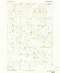 1964 Meadville NW1965 Print · USGSThe Nebraska and South Dakota borderlands are shown here in the mid-1960s, featuring ranching life and rural school districts. Researchers can locate the Heerten Cem and trace old cattle lands at Schroeder Ranch or find the Lost Creek Sch.
 - 1964 Map of Springview, 1965 Print
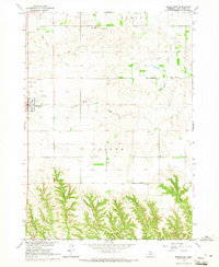 1964 Springview1965 Print · USGSMid-century Keya Paha County is centered here on the plateau town of Springview as it appeared before modern development. Researchers can trace rural lineages through four distinct burial grounds like Sugarloaf Hill Cem and find the location of the Green Valley Sch.
 - 1964 Map of Burton, 1965 Print
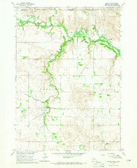 1964 Burton1965 Print · USGSThe Nebraska-South Dakota borderlands come into focus in the mid-1960s, showing the intersection of the Rosebud Reservation and rural Keya Paha County. Genealogists and researchers can trace the community around Burton, identifying local family landmarks like the Burton Cem and Roadside Sch.
 - 1964 Map of Springview SE, 1965 Print
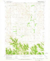 1964 Springview SE1965 Print · USGSKeya Paha County in the mid-1960s shows a landscape of section lines and small private aviation. Genealogists and land researchers can trace field boundaries near Stoltenberg Landing Strip or follow the waters of Spring Creek and Wyman Creek.
 - 1964 Map of Springview NW, 1965 Print
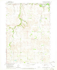 1964 Springview NW1965 Print · USGSThe Keya Paha River valley at the Nebraska and South Dakota border comes into focus in this mid-1960s survey. Researchers can trace rural landmarks and family sites like Kenaston Cem, Jordan Sch, and the Rosebud Indian Reservation Boundary.
 - 1964 Map of Jamison, 1965 Print
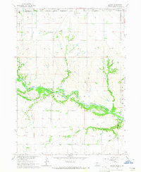 1964 Jamison1965 Print · USGSThe Nebraska-South Dakota borderlands come into focus in the mid-1960s, showing the intersection of the Rosebud Indian Reservation with the winding Keya Paha River. You can trace the rural communities of Jamison and Brocksburg alongside Spotted Tail Sch and Emmanuel Cem.
Showing maps 1-25 of 114
Top cities of Keya Paha County
Frequently asked questions
- What are the different types of historical maps available for Keya Paha County?
- What is the oldest map of Keya Paha County?
- Where can I purchase historical maps of Keya Paha County for my home or office?
- Where can I download high-res historical maps of Keya Paha County?
- Are there historical topographic maps available for Keya Paha County?
- Is there historical aerial imagery available for Keya Paha County?
- Where are historical maps of Keya Paha County sourced from?