Old Maps of Warnerville, Nebraska for Hiking & Exploration
Hike through history with 9 historic maps of Warnerville. Explore old trails, ghost towns, and forgotten backroads — perfect for outdoor adventurers and local explorers.
- Rediscover forgotten places: Map out old mining camps, roads, and footpaths that no longer exist on modern maps.
- Layer with modern tools: Combine with LiDAR or satellite views to plan hikes through historical terrain.
- Made for exploration: Popular among hikers, overlanders, and local history lovers.
Use these maps to find adventure and explore the hidden past of Warnerville.
Warnerville, NE maps
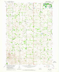
(9)- 1955 Map of Fremont, 1966 Print
 1955 Fremont1966 Print · USGSEastern Nebraska and the Missouri River border are captured during the mid-fifties, just as the interstate system began to emerge. Researchers can trace the development of Omaha, locate the sprawling Offutt Air Force Base, or study the river-bound ecology of the De Soto National Wildlife Refuge.3 unique versions available
 - 1957 Map of Fremont
 1957 Fremont1957 Print · USGSEastern Nebraska and western Iowa thrive along the Platte and Missouri rivers during the mid-fifties. Genealogists can locate small rural schools like Fairview School and tracing the paths of the Union Pacific through towns like Albion and Humphrey.
 - 1958 Map of Fremont
 1958 Fremont1958 Print · USGSEastern Nebraska in the late fifties is captured here as a thriving corridor of river-valley commerce and rail transport. Researchers can trace the development of Omaha and Fremont or locate local landmarks like Midland College and Offutt Air Force Base.
 - 1963 Map of Enola, 1964 Print
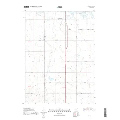
 1963 Enola1964 Print · USGSMadison County's agricultural heartland is documented here in the early sixties, showing a landscape shaped by rail and river. Researchers can find old country school sites like Tannehill Sch and trace family roots at Besk Cem or the settlement of Enola.2 unique versions available
 - 1985 Map of Stanton
 1985 Stanton1985 Print · USGSNortheast Nebraska in the mid-eighties shows a landscape of river-valley agriculture and evolving rail networks. Genealogists can trace family footprints through Stanton and Madison, or locate historical markers like the Old Indian Treaty Boundary and Saint Bernard.2 unique versions available
 - 2011 Map of Enola, 2011 Print
 2011 Enola2011 Print · USGSCovers Warnerville, including Enola, Madison County, and other nearby areas
 - 2014 Map of Enola, 2014 Print
 2014 Enola2014 Print · USGSCovers Warnerville, including Enola, Madison County, and other nearby areas
 - 2017 Map of Enola, 2017 Print
 2017 Enola2017 Print · USGSCovers Warnerville, including Enola, Madison County, and other nearby areas
 - 2021 Map of Enola, 2021 Print
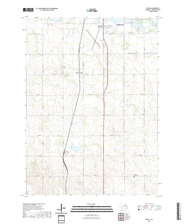 2021 Enola2021 Print · USGSMadison County farmland south of Norfolk comes into focus in this recent survey of the Nebraska plains. Local researchers can trace family landmarks and rural infrastructure from the Pleasant Valley Cemetery to the airfields at Simpson Airport and Warnerville.
End of results
Showing maps 1-9 of 9
Top cities near Warnerville
- Norfolk historical maps
- Madison historical maps
- Woodland Park historical maps
- Stanton historical maps
- Battle Creek historical maps
- Hadar historical maps
See more
Frequently asked questions
- What are the different types of historical maps available for Warnerville?
- What is the oldest map of Warnerville?
- Where can I purchase historical maps of Warnerville for my home or office?
- Where can I download high-res historical maps of Warnerville?
- Are there historical topographic maps available for Warnerville?
- Is there historical aerial imagery available for Warnerville?
- Where are historical maps of Warnerville sourced from?