Old Maps of Rock County, Nebraska for Genealogy
Trace your family roots with 174 historic maps of Rock County. These high-res maps reveal old neighborhoods, homesites, landmarks, and streets — helping you uncover where your ancestors lived and how the area evolved over time.
- Explore historic neighborhoods: Identify where your relatives may have lived in the 1800s or 1900s.
- Compare maps over time: Trace the changes in streets, buildings, and landmarks for multi-generational research.
- Perfect for genealogy & ancestry research: Used by family historians and researchers to map out lineage and migration.
These maps are an incredible resource for exploring your personal connection to Rock County's past.
Rock County, NE maps
(174)- 1949 Map of Jamison SW, 1976 Print
 1949 Jamison SW1976 Print · USGSThe Niobrara River breaks in north-central Nebraska are captured here in the late 1940s as rural life centered on the local schoolhouse. Genealogists and local historians can trace ranching roots through landmarks like Bothwell Sch, Holton Sch, and Big Anne Spring.
 - 1949 Map of Riverview, 1977 Print
 1949 Riverview1977 Print · USGSThe Niobrara River valley in the late 1940s was a remote ranching landscape of deep draws and isolated schools. Genealogists and historians can locate old rural education sites like Lamb Sch and School No 61 or the tiny settlement of Riverview.
 - 1949 Map of Carns, 1979 Print
 1949 Carns1979 Print · USGSThe Niobrara River valley in the late 1940s remained a landscape of dispersed ranching and localized school districts. Researchers can trace the rural community through its many one-room schoolhouses like Turkey Foot Sch, the settlement at Carns, and the quiet grounds of Willowdale Cem.
 - 1950 Map of Bassett NW
 1950 Bassett NW1950 Print · USGSThe Niobrara River valley in the early post-war years shows a landscape of remote ranches and deep canyons at the junction of three Nebraska counties. Genealogists can locate several family burial sites like Leonard Cem and rural landmarks such as Cuba Ch and the Camp Meeting Ground.2 unique versions available
 - 1950 Map of Carns
 1950 Carns1950 Print · USGSRock County ranching country is captured here at mid-century, where the Niobrara River meets the drainages of the Sandhills. Researchers can trace the locations of several one-room schoolhouses like Mariaville Sch and Turkey Foot Sch, alongside the village of Carns.2 unique versions available
 - 1950 Map of Riverview
 1950 Riverview1950 Print · USGSThe Niobrara River valley in northern Nebraska appears here at mid-century, split between the Rock and Keya Paha county lines. Researchers can trace rural life through the locations of the Riverview settlement and several outlying schoolhouses like Lamb Sch and School No 62.2 unique versions available
 - 1950 Map of Mariaville
 1950 Mariaville1950 Print · USGSThe Niobrara River breaks through the Nebraska sandhills at mid-century, revealing a landscape of remote ranching and rural education. Genealogists and researchers can locate the Mariaville settlement, Simpson Cem, and schools like School No 69.2 unique versions available
 - 1951 Map of Jamison SW
 1951 Jamison SW1951 Print · USGSThe Niobrara River breaks and prairie of north-central Nebraska are captured here in the late 1940s. Genealogists can locate rural landmarks like Bothwell Sch, Holton Sch, and the riverside settlement of Dyer.2 unique versions available
 - 1951 Map of Naper SW
 1951 Naper SW1951 Print · USGSHolt County ranching and rural life are preserved here in the early fifties, centering on the canyon-cut lands along the Niobrara River. Genealogists and local historians can trace legacy landholdings like Tienken Ranch and several rural schoolhouses, including School No 51 and the Frost Valley Sch.2 unique versions available
 - 1954 Map of Stuart, 1955 Print
 1954 Stuart1955 Print · USGSThe town of Stuart thrives along the CHICAGO AND NORTH WESTERN railroad in the mid-fifties. Genealogists can locate several rural landmarks including School No 70 and School No 183 along the banks of Keegan Creek.2 unique versions available
 - 1954 Map of Stuart NW, 1956 Print
 1954 Stuart NW1956 Print · USGSHolt and Rock counties are captured here in the mid-1950s, showing a remote ranching landscape defined by the drainage of Beaver Creek. Genealogists and local historians can trace family operations like Muesch Ranch and locate rural landmarks such as School No 249.
 - 1954 Map of Newport NE, 1956 Print
 1954 Newport NE1956 Print · USGSNorth-central Nebraska ranching country in the mid-1950s is defined here by its scattered rural schoolhouses and spring-fed breaks. Genealogists and local historians can locate several local landmarks, including the Kirkwood Cemetery, Plainview Sch, and Otter Creek.
 - 1954 Map of Long Pine, 1956 Print
 1954 Long Pine1956 Print · USGSLong Pine and the surrounding Nebraska tablelands are captured here in the mid-fifties as the railroad and creek shaped local industry. Researchers can trace the Chicago and North Western line, find School No 7, and locate Camp Witness.
 - 1954 Map of Bassett, 1956 Print
 1954 Bassett1956 Print · USGSThe Rock County seat at mid-century is captured here as a thriving rail and ranching center. Genealogists and local historians can locate outlying landmarks like Frauen Ranch, Valley Grove Ch, and rural schools including School No 17.
 - 1954 Map of Newport, 1956 Print
 1954 Newport1956 Print · USGSNewport and its surrounding Rock County townships are captured in the mid-1950s just as the rail-and-river economy defined the region. Researchers can trace the Chicago and North Western line or locate rural landmarks like School No 21 and the Flowing Well.2 unique versions available
 - 1954 Map of Newport SW, 1956 Print
 1954 Newport SW1956 Print · USGSThe North Fork and South Fork of the Elkhorn River meander through Rock County in the mid-1950s, following the route of the Chicago and North Western. Locate rural landmarks including Adams Lake and several country schoolhouses like Glendale Sch.2 unique versions available
 - 1955 Map of O'Neill, 1974 Print
 1955 O'Neill1974 Print · USGSNorth-central Nebraska in the 1950s reveals a vast cattle-ranching landscape transitioning from the Missouri River breaks to the iconic Sand Hills. Researchers can trace the path of the Chicago and North Western rail line and locate rural landmarks like the Dustin Post Office and St Johns Lake Ch.2 unique versions available
 - 1959 Map of O'Neill
 1959 O'Neill1959 Print · USGSNorth-central Nebraska in the late fifties is defined by the vast Sand Hills and the vital Chicago and North Western rail line. Genealogists and researchers can trace family roots through settlements like Atkinson, Bassett, and Stuart or follow the waters of the Niobrara River.2 unique versions available
 - 1969 Map of O'Neill
 1969 O'Neill1969 Print · USGSCentral Nebraska in the mid-fifties is defined here by the expansive Sand Hills and the winding Niobrara River. Trace the Chicago and North Western rail line through cattle towns like O'Neill and Ainsworth.
 - 1981 Map of Bruner Lake
 1981 Bruner Lake1981 Print · USGSThe remote ranching country along the Rock and Holt County line is captured here in the early 1980s. Researchers can locate established homesteads like Indian Hollow Ranch and Taylor Ranch alongside water features such as Bruner Lake.
 - 1981 Map of Boiling Spring
 1981 Boiling Spring1981 Print · USGSFour Nebraska counties meet along the Calamus River in the early 1980s, revealing a landscape of remote cattle operations. Genealogists and historians can trace the footprints of family holdings like Easy Hour Ranch, Spencer Ranch, and the waters of Boiling Spring.
 - 1981 Map of Stonehouse Ranch NW, 1982 Print
 1981 Stonehouse Ranch NW1982 Print · USGSRanching life in the Nebraska Sandhills is captured here during the early eighties. Genealogists and local historians can trace family landholdings like Swinney Ranch and Coble Ranch, or locate the Rose Hill Cem.
 - 1981 Map of Stonehouse Ranch NE, 1982 Print
 1981 Stonehouse Ranch NE1982 Print · USGSRock County ranching country is captured here in the early eighties, showcasing the remote Sandhills landscape before modern consolidation. Family researchers and historians can locate legacy operations like Gurney Ranch and Bouy Ranch or the broad Gracie Flats.
 - 1981 Map of Shovel Dot Ranch, 1982 Print
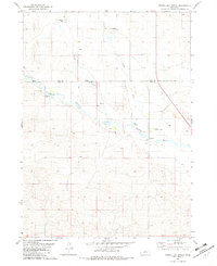 1981 Shovel Dot Ranch1982 Print · USGSThe cattle country of Rock and Loup Counties comes into focus in the early eighties as ranching operations sit alongside the meandering Calamus River. Local history and land use are visible through named outposts like Shovel Dot Ranch, the Weber Ranch, and the Fox Bridge crossing.
 - 1981 Map of Carson Lake, 1982 Print
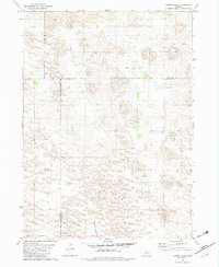 1981 Carson Lake1982 Print · USGSGarfield County ranching lands are captured in the early 1980s, documenting a remote landscape defined by wide meadows and creek beds. Genealogists and local historians can trace legacy holdings like Taylor Ranch and Noyes Ranch near the shores of Carson Lake.
Showing maps 1-25 of 174
Top cities of Rock County
Frequently asked questions
- What are the different types of historical maps available for Rock County?
- What is the oldest map of Rock County?
- Where can I purchase historical maps of Rock County for my home or office?
- Where can I download high-res historical maps of Rock County?
- Are there historical topographic maps available for Rock County?
- Is there historical aerial imagery available for Rock County?
- Where are historical maps of Rock County sourced from?