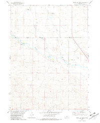
1981 Map of Shovel Dot Ranch
USGS Topo · Published 1982About this map
Shovel Dot Ranch and several other significant cattle operations define this section of the Nebraska Sandhills along the border of Rock and Loup Counties. The Calamus River meanders across the central portion of the landscape, joined by tributaries like Skull Creek and Bloody Creek. This 1980s-era topographic study illustrates the sparse, ranch-driven settlement pattern of the region, where isolated outposts like the Dilsaver Ranch, Weber Ranch, and South Shovel Dot Ranch serve as primary landmarks across the rolling terrain. Human impact on the land is concentrated along the river valley, evident in the Fox Bridge crossing and small-scale industrial sites such as the Gravel Pit and Claypit. Numerous Springs and the presence of Fox Bayou highlight the vital water sources that sustain these remote ranching homesteads.
Find a feature on this map
14 named features on this map. Tap any name to fly to it.
Don’t see what you’re looking for? This feature index may not catch every label — zoom into the map to look around manually.
Map Details
Editions of this 1981 Shovel Dot Ranch Map
This is the sole edition of this map. No revisions or reprints were ever made.
Other maps of this area

1952 · Taylor NW
USGS Topo · 1:24,000

1952 · Almeria NE
USGS Topo · 1:24,000

1952 · Almeria NW
USGS Topo · 1:24,000

1955 · Broken Bow
USGS Topo · 1:250,000

1955 · O'Neill
USGS Topo · 1:250,000

1956 · Broken Bow
USGS Topo · 1:250,000

1959 · O'Neill
USGS Topo · 1:250,000

1969 · O'Neill
USGS Topo · 1:250,000

1981 · Boiling Spring
USGS Topo · 1:24,000

1981 · Stonehouse Ranch NW
USGS Topo · 1:24,000