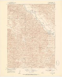
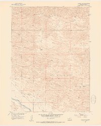
1952 Map of Taylor NW
USGS Topo · Published 1954About this map
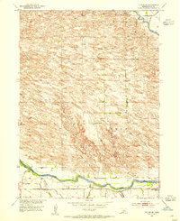
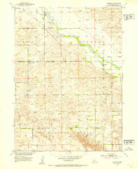
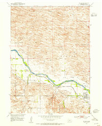
The Calamus River meanders across this mid-century landscape of Loup County, defining the drainage patterns and early settlement sites in this portion of Nebraska. Ranching activity is evident through the presence of the Upriver Ranch in the north and the Holmes Ranch to the south, while the Sebesta Sch highlights the distribution of rural education at the time. This 1952 field survey showcases a transitional topography between the hills of Bloody and Little York, where the river's path creates distinctive features like Horseshoe Bend Lake and the marshy Mud Bayou. These water sources and family-run operations represent the primary economic drivers of the era, documented just as the region was being mapped for the Department of the Interior program for the development of the Missouri River Basin.
Find a feature on this map
12 named features on this map. Tap any name to fly to it.
Don’t see what you’re looking for? This feature index may not catch every label — zoom into the map to look around manually.
Map Details
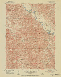
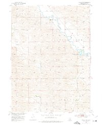
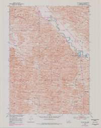
Editions of this 1952 Taylor NW Map
4 editions found
Other maps of this area
1952 · Almeria NE
USGS Topo · 1:24,000
1952 · Taylor SE
USGS Topo · 1:24,000
1952 · Almeria
USGS Topo · 1:24,000
1952 · Taylor
USGS Topo · 1:24,000

1952 · Taylor NE
USGS Topo · 1:24,000

1955 · Broken Bow
USGS Topo · 1:250,000

1955 · O'Neill
USGS Topo · 1:250,000

1956 · Broken Bow
USGS Topo · 1:250,000

1959 · O'Neill
USGS Topo · 1:250,000

1969 · O'Neill
USGS Topo · 1:250,000