
1952 Map of Taylor NE
USGS Topo · Published 1954About this map
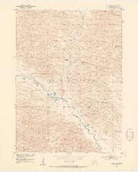
The Calamus River winds through this Nebraska Sandhills landscape, creating a distinct riparian corridor amidst the rolling topography of Little York. In the early 1950s, this area was defined by a series of prominent cattle operations, including the Chapman Ranch, Schonhar Ranch, and the Scherzberg Ranch. These properties, along with the River Ranch and its adjacent Landing Field, illustrate the expansive ranching economy and necessary aviation infrastructure of the mid-century Nebraska interior. The presence of the Valley View Sch and various family-named landmarks like Scherzberg Bayou and Bald Lake provides a clear view of the localized community structure. Mapping of Gracie Creek and numerous windmill sites further details the water management essential for livestock in this environment.
Find a feature on this map
16 named features on this map. Tap any name to fly to it.
Don’t see what you’re looking for? This feature index may not catch every label — zoom into the map to look around manually.
Map Details
Editions of this 1952 Taylor NE Map
2 editions found
Other maps of this area

1952 · Burwell
USGS Topo · 1:24,000

1952 · Taylor NW
USGS Topo · 1:24,000

1952 · Taylor SE
USGS Topo · 1:24,000

1952 · Taylor
USGS Topo · 1:24,000

1952 · Burwell NW
USGS Topo · 1:24,000

1955 · Broken Bow
USGS Topo · 1:250,000

1955 · O'Neill
USGS Topo · 1:250,000

1956 · Broken Bow
USGS Topo · 1:250,000

1959 · O'Neill
USGS Topo · 1:250,000

1969 · O'Neill
USGS Topo · 1:250,000