1990s Maps of Scotts Bluff County, Nebraska
Explore 4 historic maps of Scotts Bluff County from the 1990s. These maps offer a rare glimpse into what life looked like during the 1990s — showing old roads, neighborhoods, homes, and landmarks that have changed or disappeared over time.
Whether you're researching your family's past, planning a metal detecting trip, or studying how Scotts Bluff County's landscape evolved across the 1990s, these high-resolution maps are a powerful tool for exploring the history of this region.
- Focus on a specific era: All maps on this page are from the 1990s, giving you a focused view of this time period.
- See what’s changed: Compare century-old streets, trails, and buildings to today's modern landscape using overlays and satellite layers.
- Research with precision: Use these maps for genealogy, historical research, land use analysis, or educational projects.
- View, download, or print: Maps are fully viewable online in high resolution, and can be downloaded or printed for your own records.
Start exploring Scotts Bluff County's history through authentic maps from the 1990s. This is your window into the past.
Scotts Bluff County, NE maps
(4)- 1990 Map of Robb Draw, 1995 Print
 1990 Robb Draw1995 Print · USGSThe high plains along the Wyoming and Nebraska border are captured here during the 1990s as a landscape shaped by vital irrigation. You can trace the engineering of the Fort Laramie Canal and locate local landmarks like Janise, Togy Mound, and Eagle Nest.
 - 1990 Map of Lyman, 1995 Print
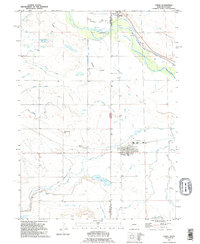 1990 Lyman1995 Print · USGSThe Nebraska-Wyoming borderlands come alive in this late twentieth-century survey of the North Platte River valley. Genealogists and historians can trace the Emigrant Trail past Henry or explore the irrigation networks serving Lyman and Sears.
 - 1990 Map of Mc Compsey Pass, 1995 Print
 1990 Mc Compsey Pass1995 Print · USGSThe Wyoming and Nebraska high plains are captured here in the 1990s, showcasing a landscape of ridge-top passes and essential cattle-country water sources. Trace family ranching roots through Spahr Ranch or locate named landmarks like McCompsey Pass and Devils Armchair.
 - 1990 Map of Torrington SE, 1995 Print
 1990 Torrington SE1995 Print · USGSThe Wyoming and Nebraska borderlands come alive in the 1990s as the North Platte River meets a legacy of westward migration. Trace the historic Emigrant Trail near Hunton Meadows and explore the vast irrigation network of the Interstate Canal.
End of results
Showing maps 1-4 of 4
Top cities of Scotts Bluff County
- Scottsbluff historical maps
- Gering historical maps
- Mitchell historical maps
- Terrytown historical maps
- Morrill historical maps
- Minatare historical maps
See more
Frequently asked questions
- What are the different types of historical maps available for Scotts Bluff County?
- What is the oldest map of Scotts Bluff County?
- Where can I purchase historical maps of Scotts Bluff County for my home or office?
- Where can I download high-res historical maps of Scotts Bluff County?
- Are there historical topographic maps available for Scotts Bluff County?
- Is there historical aerial imagery available for Scotts Bluff County?
- Where are historical maps of Scotts Bluff County sourced from?