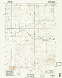
1990 Map of Robb Draw
USGS Topo · Published 1995About this map
Table Mountain and the high plains of the Wyoming-Nebraska border define this high-desert landscape in the early 1990s. The map illustrates a complex irrigation infrastructure essential to the region's agricultural viability, featuring the Fort Laramie Canal and the Crockett Main Canal as they navigate the natural contours of Crockett Meadows. A dense network of laterals and drains, such as the South Horse Creek Lateral and Kiowa Creek Drain Branch B, reveals the extensive human effort to manage water in the arid West.
Find a feature on this map
28 named features on this map. Tap any name to fly to it.
Don’t see what you’re looking for? This feature index may not catch every label — zoom into the map to look around manually.
Map Details
Editions of this 1990 Robb Draw Map
This is the sole edition of this map. No revisions or reprints were ever made.
Other maps of this area

1898 · Scotts Bluff
USGS Topo · 1:125,000

1899 · Goshen Hole
USGS Topo · 1:125,000

1954 · Scottsbluff
USGS Topo · 1:250,000

1954 · Cheyenne
USGS Topo · 1:250,000

1958 · Cheyenne
USGS Topo · 1:250,000

1958 · Scottsbluff
USGS Topo · 1:250,000

1960 · Huntley
USGS Topo · 1:24,000

1960 · Mc Compsey Pass
USGS Topo · 1:24,000

1960 · Lyman
USGS Topo · 1:24,000

1960 · Stegall
USGS Topo · 1:24,000