1960s Maps of Sheridan County, Nebraska
Explore 28 historic maps of Sheridan County from the 1960s. These maps offer a rare glimpse into what life looked like during the 1960s — showing old roads, neighborhoods, homes, and landmarks that have changed or disappeared over time.
Whether you're researching your family's past, planning a metal detecting trip, or studying how Sheridan County's landscape evolved across the 1960s, these high-resolution maps are a powerful tool for exploring the history of this region.
- Focus on a specific era: All maps on this page are from the 1960s, giving you a focused view of this time period.
- See what’s changed: Compare century-old streets, trails, and buildings to today's modern landscape using overlays and satellite layers.
- Research with precision: Use these maps for genealogy, historical research, land use analysis, or educational projects.
- View, download, or print: Maps are fully viewable online in high resolution, and can be downloaded or printed for your own records.
Start exploring Sheridan County's history through authentic maps from the 1960s. This is your window into the past.
Sheridan County, NE maps
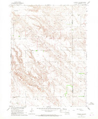
(28)- 1960 Map of Hay Springs SW, 1961 Print
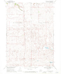
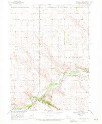
 1960 Hay Springs SW1961 Print · USGSSheridan County agricultural lands are documented here during the height of the mid-century irrigation boom. Genealogists and local historians can locate rural landmarks such as St Peters Ch, Sandridge Sch, and the Mirage Flats Project Headquarters.
 - 1960 Map of Hay Springs SE, 1961 Print
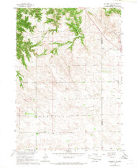
 1960 Hay Springs SE1961 Print · USGSNorthwestern Nebraska ranching country comes alive in the early sixties, showing a landscape defined by the Niobrara River. Researchers can locate landmarks like Banner Sch and Sacred Heart Ch in the Hay Springs area.
 - 1966 Map of Chadron 3 SE, 1967 Print
 1966 Chadron 3 SE1967 Print · USGSDawes and Sheridan counties meet in this Nebraska panhandle landscape during the mid-sixties. Local history researchers can locate the Antelope Valley Cem and rural school sites such as New Home Sch and Chimney Butte Sch.2 unique versions available
 - 1966 Map of Rushville, 1967 Print
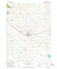
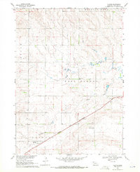
 1966 Rushville1967 Print · USGSRushville and the surrounding Sheridan County plains are captured here in the mid-1960s. Researchers can trace rural life through landmarks like Sandy Knoll Sch, the Chicago and North Western rail line, and Fairview Cemetery.
 - 1966 Map of Rushville SW, 1967 Print
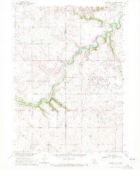
 1966 Rushville SW1967 Print · USGSSheridan County ranching country is centered on the river valley in the mid-1960s. Genealogists can trace local roots through rural landmarks like Hillview School, Beguin Cemetery, and the Mill School along the Niobrara River.
 - 1966 Map of Hay Springs NE, 1967 Print
 1966 Hay Springs NE1967 Print · USGSSheridan County in the mid-1960s shows a landscape of rail-dependent agriculture and isolated rural schoolhouses. Researchers can trace the path of the Chicago and North Western and locate landmarks like Walgren Lake or the Cem.
 - 1966 Map of Hay Springs, 1967 Print
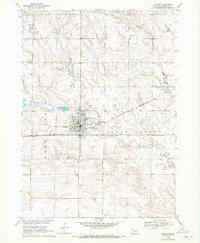
 1966 Hay Springs1967 Print · USGSHay Springs and the surrounding Sheridan County plains are captured here in the mid-1960s during a period of steady ranching and rail activity. Researchers can locate country schools like Goldenrod Sch, the waters of Walgren Lake, and family sites at St Marys Cem.
 - 1966 Map of Chadron 3 NE, 1967 Print
 1966 Chadron 3 NE1967 Print · USGSThe Nebraska Panhandle's rural landscape comes into focus during the mid-sixties, showing the intersection of Dawes and Sheridan counties. Researchers can trace the legacy of local education through sites like Pleasant Home Sch and Antelope Sch near the Chicago and North Western rail line.2 unique versions available
 - 1969 Map of Rushville 4 SW, 1971 Print
 1969 Rushville 4 SW1971 Print · USGSSheridan County ranching country is captured here in the late sixties, showcasing the remote school districts and vast section lines of the Nebraska Panhandle. Genealogists can locate the Hinchley Sch or trace the early course of the Snake River near Bovee Valley.2 unique versions available
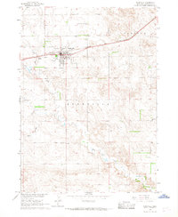
 - 1969 Map of Gordon, 1971 Print
 1969 Gordon1971 Print · USGSGordon served as a vital Nebraska rail and ranching hub in the late sixties, centered on the Chicago and North Western line. Genealogists and researchers can trace the Gordon Cem, Mt Pleasant Sch, and local landmarks like the Drive-in Theater.
 - 1969 Map of Gordon SE, 1971 Print
 1969 Gordon SE1971 Print · USGSRanching and rail life converge in Cherry County during the late sixties as the Chicago and North Western crosses the plains. Genealogists can locate rural schoolhouses like Sunny Knoll Sch and Northwest Cherry Sch among the breaks of Antelope Creek.
 - 1969 Map of Clinton, 1971 Print
 1969 Clinton1971 Print · USGSSheridan County agricultural and railroad life are captured here in the late sixties. Genealogists and local historians can locate specific rural homesteads, schools like Meadow Vale Sch, and the depot at Clinton along the Chicago and North Western.
 - 1969 Map of Whiteclay, 1971 Print
 1969 Whiteclay1971 Print · USGSThe Nebraska-South Dakota borderlands are captured here in the late sixties, where the Whiteclay (Dewing) settlement meets the Pine Ridge area. Genealogists and historians can trace the Old Indian Treaty Boundary or locate sites like Extension Chapel and Abold Cem.
 - 1969 Map of Clinton NW, 1971 Print
 1969 Clinton NW1971 Print · USGSThe Nebraska-South Dakota borderlands come into focus in the late 1960s, showing the intersection of tribal lands and ranching history. Researchers can locate the Old Indian Treaty Boundary and trace local sites like Mt Maria, Mission Ranch, and a small Cem.
 - 1969 Map of Clinton NE, 1971 Print
 1969 Clinton NE1971 Print · USGSThe Nebraska-South Dakota borderlands come into focus in the late sixties as ranching and rural life defined the Sheridan County landscape. Genealogists and researchers can trace local landmarks like Bethel Cem, Albany Pine Lodge Sch, and the winding Wounded Knee Creek.
 - 1969 Map of Clinton SW, 1971 Print
 1969 Clinton SW1971 Print · USGSSheridan County ranching country is captured here in the late sixties as the township system organized the Nebraska panhandle. Researchers can locate family landmarks like Amity Cem and rural schoolhouses including Milan Sch and Hillview Sch.
 - 1969 Map of Rushville SE, 1971 Print
 1969 Rushville SE1971 Print · USGSSheridan County's high plains and river breaks appear here in the late sixties, showing a landscape of remote ranches and cattle country. Researchers can locate the Riverview Sch, the Furman Bridge over the river, and even a solitary Grave on the prairie.
 - 1969 Map of Beaver Wall, 1971 Print
 1969 Beaver Wall1971 Print · USGSSheridan County, Nebraska, sits at a historical crossroads in the late sixties where state lines and tribal lands meet. Genealogists and historians can trace rural school locations like Craven Creek Sch and the significant Old Indian Treaty Boundary.
 - 1969 Map of Rushville 4 NE, 1972 Print
 1969 Rushville 4 NE1972 Print · USGSThe Niobrara River valley in the Nebraska Sandhills is captured here in the late sixties, showing a remote landscape of canyons and cattle country. Genealogists can locate the Lavaca Cem, Longview Sch, and historical river crossings like Hardin Bridge.2 unique versions available
 - 1969 Map of Rushville 4 NW, 1972 Print
 1969 Rushville 4 NW1972 Print · USGSSheridan County in the late sixties shows a remote ranching landscape where life centered on the winding Niobrara River and its crossings. Genealogists and historians can trace rural infrastructure through landmarks like Mount Hope Cem, the Eddie Hill Bridge, and several country schoolhouses.2 unique versions available
 - 1969 Map of Chadron NE, 1972 Print
 1969 Chadron NE1972 Print · USGSDawes County, Nebraska, and the South Dakota borderlands are captured here in the late sixties, showing a landscape of deep creek breaks and river valleys. Researchers can locate remote rural landmarks like the Beaver Valley Cem, Friends Ch, and the high point at Limekiln.
 - 1969 Map of Rushville NE, 1972 Print
 1969 Rushville NE1972 Print · USGSSheridan County ranch lands in the late sixties reveal a landscape of section-line roads and prairie schools. Researchers can trace rural landmarks like Lone Butte and the winding course of the Niobrara River near Long View Sch.
 - 1969 Map of Hog Island, 1972 Print
 1969 Hog Island1972 Print · USGSThe Nebraska Sandhills at the South Dakota border are captured here in the late sixties, showing the vast network of lakes and marshes south of the Pine Ridge Indian Reservation Boundary. Researchers can trace the unique hydrology of Hog Island, Shell Lake, and the winding Meadow Horseshoe Ditch.
 - 1969 Map of Bordeaux, 1972 Print
 1969 Bordeaux1972 Print · USGSThe northwestern Nebraska plains meet the Pine Ridge in the late sixties, where the Chicago and North Western railroad defines the local economy. Researchers can locate the settlement of Bordeaux, a small Cem, and landmarks like Sheridan Gates.
 - 1969 Map of Whiteclay SW, 1972 Print
 1969 Whiteclay SW1972 Print · USGSSheridan County's rugged Panhandle landscape is captured here in the late sixties as the region supported both conservation and rural life. Genealogists and historians can locate the Episcopal Cem, trace the winding Beaver Creek, and explore the bounds of the Metcalf State Wildlife Management Area.
Showing maps 1-25 of 28
Top cities of Sheridan County
Frequently asked questions
- What are the different types of historical maps available for Sheridan County?
- What is the oldest map of Sheridan County?
- Where can I purchase historical maps of Sheridan County for my home or office?
- Where can I download high-res historical maps of Sheridan County?
- Are there historical topographic maps available for Sheridan County?
- Is there historical aerial imagery available for Sheridan County?
- Where are historical maps of Sheridan County sourced from?