
1969 Map of Rushville 4 SW
USGS Topo · Published 1971About this map
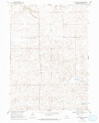
The high plains of Sheridan County are defined here by the undulating landscapes of Niobrara, East Gordon, and Kinkaid, where a sparse settlement pattern reflects the ranching character of the Nebraska Panhandle. The southern portion of the sheet features the Bovee Valley, a distinct topographical depression that historically provided more sheltered terrain than the surrounding windswept rises. Near this valley sits the Hinchley Sch, serving as a vital community anchor for the remote rural families of the late 1960s.
Find a feature on this map
48 named features on this map. Tap any name to fly to it.
Don’t see what you’re looking for? This feature index may not catch every label — zoom into the map to look around manually.
Map Details
Editions of this 1969 Rushville 4 SW Map
2 editions found
Other maps of this area

1948 · Twin Lakes
USGS Topo · 1:62,500

1948 · Spade Ranch
USGS Topo · 1:62,500

1950 · Twin Lakes
USGS Topo · 1:62,500

1950 · Spade Ranch
USGS Topo · 1:62,500

1955 · Alliance
USGS Topo · 1:250,000

1957 · Alliance
USGS Topo · 1:250,000

1958 · Alliance
USGS Topo · 1:250,000

1969 · Rushville SE
USGS Topo · 1:24,000
1969 · Rushville 4 NE
USGS Topo · 1:24,000
1969 · Rushville 4 NW
USGS Topo · 1:24,000