1900s (20th Century) Maps of Douglas County, Nevada
Explore 62 historic maps of Douglas County from the 1900s (20th Century). These maps offer a rare glimpse into what life looked like during the 1900s — showing old roads, neighborhoods, homes, and landmarks that have changed or disappeared over time.
Whether you're researching your family's past, planning a metal detecting trip, or studying how Douglas County's landscape evolved across the 1900s, these high-resolution maps are a powerful tool for exploring the history of this region.
- Focus on a specific era: All maps on this page are from the 1900s, giving you a focused view of this time period.
- See what’s changed: Compare century-old streets, trails, and buildings to today's modern landscape using overlays and satellite layers.
- Research with precision: Use these maps for genealogy, historical research, land use analysis, or educational projects.
- View, download, or print: Maps are fully viewable online in high resolution, and can be downloaded or printed for your own records.
Start exploring Douglas County's history through authentic maps from the 1900s. This is your window into the past.
Douglas County, NV maps
(62)- 1932 Map of Truckee
 1932 Truckee1932 Print · USGSThe high Sierra and Lake Tahoe's western shore are captured here in the early thirties as the region balanced industrial mining and timber with a growing seasonal economy. Trace early lakeside developments from Tahoe Tavern to Meeks Bay PO, or locate historical sites like the Walker Mine and Donner Monument.
 - 1940 Map of Truckee
 1940 Truckee1940 Print · USGSThe High Sierra and Lake Tahoe shoreline appear here in the pre-war era, showing a landscape defined by timber, tourism, and transit. Genealogists and historians can trace the early resort development at Tahoe Vista, the lumber works at Hobart Mills, and the vital Southern Pacific rail line.4 unique versions available
 - 1947 Map of Sacramento, 1948 Print
 1947 Sacramento1948 Print · USGSThe Sacramento Valley meets the high Sierra during a period of post-war expansion. Trace the historic river delta islands like Grand Island or locate early airfield footprints at McClellan Air Force Base and Mather Air Force Base.2 unique versions available
 - 1948 Map of Walker Lake
 1948 Walker Lake1948 Print · USGSThe high desert of Nevada and the eastern Sierra Nevada are captured just after the war as mining and ranching shaped the local economy. Genealogists can trace family connections to centers like Hawthorne and Mina or locate the historic Rockland Mines and Aurora.2 unique versions available
 - 1948 Map of Sacramento, 1951 Print
 1948 Sacramento1951 Print · USGSPost-war Northern California comes alive in this regional survey, capturing the era of expansion between the Central Valley and the High Sierra. Researchers can trace the rail networks of the Central California Traction and Sacramento Northern RR or locate landmarks like the State Capitol and University of California Davis.
 - 1955 Map of Meeks Bay, 1956 Print
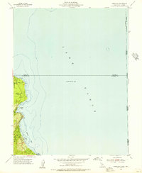 1955 Meeks Bay1956 Print · USGSThe western shores of Lake Tahoe are captured here in the mid-fifties, showing the early footprints of lakeside communities and parklands. Trace the development of Tahoma, Meeks Bay, and Paradise Flat along the edge of the Eldorado National Forest.3 unique versions available
 - 1955 Map of Bijou, 1957 Print
 1955 Bijou1957 Print · USGSThe south shore of Lake Tahoe in the mid-fifties shows a burgeoning community of lakefront resorts and mountain camps along the state line. Genealogists and researchers can trace the early development of Stateline, the Sierra House (Site), and Happy Homestead Cemetery.7 unique versions available
 - 1955 Map of Emerald Bay, 1957 Print
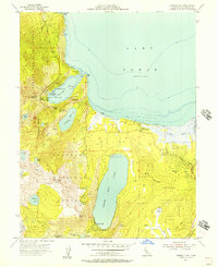 1955 Emerald Bay1957 Print · USGSThe southwestern shores of Lake Tahoe were evolving into a major recreation hub in the mid-fifties, documented here through a mix of state parks and alpine resorts. Genealogists and local historians can pinpoint the layout of Camp Richardson, the grand estate of Vikingsholm, and the remote settlement of Fallen Leaf.5 unique versions available
 - 1955 Map of Glenbrook, 1957 Print
 1955 Glenbrook1957 Print · USGSThe eastern shores of Lake Tahoe come alive in the mid-fifties, showing the developing communities of Glenbrook and Zephyr Cove. Researchers can trace old mountain routes like Genoa Peak Road or locate local landmarks including Tahoe School and Spooner Lake.4 unique versions available
 - 1955 Map of Tahoe, 1958 Print
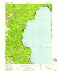 1955 Tahoe1958 Print · USGSThe northwest shore of Lake Tahoe in the mid-fifties reveals a developing landscape of lakeside lodges and mountain retreats. Genealogists and historians can trace old community footprints from Tahoe City to Meeks Bay, or locate landmarks like Chambers Lodge and the Ngorchester Mine.3 unique versions available
 - 1955 Map of Fallen Leaf Lake, 1958 Print
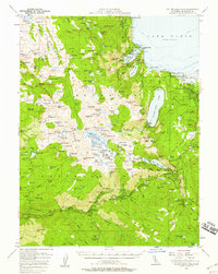 1955 Fallen Leaf Lake1958 Print · USGSThe Lake Tahoe shoreline and the high Sierra backcountry come alive in this mid-fifties survey of El Dorado County. Researchers can trace the development of legacy resorts and camps at Tallac Village, Camp Richardson, and the historic Celio Ranch.7 unique versions available
 - 1956 Map of Sacramento
 1956 Sacramento1956 Print · USGSMid-century California unfolds from the delta to the high Sierra, capturing a landscape of growing valley cities and burgeoning military airbases. Genealogists and historians can trace the rail lines and river towns from Woodland to Lodi, or explore the foothill settlements of Placerville and Jackson.2 unique versions available
 - 1956 Map of Freel Peak, 1958 Print
 1956 Freel Peak1958 Print · USGSThe South Lake Tahoe region and Carson Valley are shown here in the mid-fifties, just as alpine recreation began to expand. Genealogists and historians can trace family burial sites at Happy Homestead Cemetery or locate early settlements like Sierra House and Dangberg Camp.3 unique versions available
 - 1956 Map of Dayton, 1958 Print
 1956 Dayton1958 Print · USGSThe silver-country landscape around the Carson River is shown here in the mid-1950s, bridging the mining era and modern institutional development. Researchers can trace the Old RR Grade and locate historic sites such as Mound House and the Daney Mine.3 unique versions available
 - 1956 Map of Desert Creek Peak, 1958 Print
 1956 Desert Creek Peak1958 Print · USGSThe Nevada-California borderlands were a hub of high-desert mining and ranching during the mid-fifties. Researchers can trace the original Von Schmidt Line (1872) and locate historic sites like Rickey Mine, Sulfur (Site), and Hoye Bridge.3 unique versions available
 - 1956 Map of Topaz Lake, 1958 Print
 1956 Topaz Lake1958 Print · USGSThe Sierra Nevada borderlands come alive in the mid-1950s, showing a landscape defined by high-country mining and early mountain transit. Researchers can trace historic state boundaries along the VON SCHMIDT LINE or locate old operations at the Leviathan Mine and Topaz PO.4 unique versions available
 - 1956 Map of Carson City, 1958 Print
 1956 Carson City1958 Print · USGSIn the mid-fifties, the Nevada state capital and the eastern shores of Lake Tahoe remained distinct, separated by the Carson Range. You can trace institutional history at Stewart and the State Capitol, or locate old burials at Jacks Valley Cemetery.4 unique versions available
 - 1957 Map of Walker Lake
 1957 Walker Lake1957 Print · USGSThe Nevada-California borderlands in the mid-1950s show a rugged network of mining camps and river-valley towns centered around Walker Lake. Researchers can trace the Southern Pacific rail line and locate historical sites like Bodie, Sodaville, and the Leviathan Sulphur Mine.4 unique versions available
 - 1957 Map of Wellington
 1957 Wellington1957 Print · USGSLyon County ranching and mining enter the mid-century era as the West Walker River sustains the growing settlements of Wellington and Smith. Researchers can trace irrigation networks, family holdings like Artesia Ranch, and numerous prospects including the Ludwig Mine.4 unique versions available
 - 1957 Map of Como
 1957 Como1957 Print · USGSLyon and Douglas County mining and ranching lands are captured here in the mid-fifties, showing the high-altitude terrain before modern development. You can trace early trails and mining operations at Como, the Hercules Mine, and Sunrise Camp.3 unique versions available
 - 1957 Map of Mt. Siegel, 1959 Print
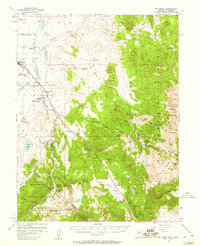 1957 Mt. Siegel1959 Print · USGSThe Douglas County high desert and mountains meet in the late 1950s, showing the intersection of ranching and mining near the California border. Genealogists can trace early landmarks like Twelvemile House, the Washoe Cemetery, and the former locations of Carters Station (Site).3 unique versions available
 - 1957 Map of Reno, 1963 Print
 1957 Reno1963 Print · USGSWestern Nevada in the early sixties is a land of sprawling desert sinks and rising mountain ranges. Genealogists and historians can trace the rail-and-river network connecting Reno, the mining legacy of Rawhide Mine, and the boundaries of the Pyramid Lake Indian Reservation.5 unique versions available
 - 1957 Map of Sacramento, 1966 Print
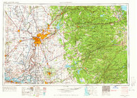 1957 Sacramento1966 Print · USGSIn the mid-twentieth century, the California heartland was a hub of river transport, rail lines, and military airbases. Genealogists and historians can trace the development of Gold Country towns like Angels Camp and Sonora or follow the path of the Southern Pacific RR through the growing suburbs of Sacramento.4 unique versions available
 - 1958 Map of Chico, 1962 Print
 1958 Chico1962 Print · USGSMid-century Northern California comes to life across the Central Valley and high Sierras as the postwar economy transformed the landscape. Trace the rail lines of the Southern Pacific RR, locate family roots near Chico Cem, or explore the early layout of Paradise and Beale Air Force Base.4 unique versions available
 - 1959 Map of Reno
 1959 Reno1959 Print · USGSWestern Nevada in the late fifties was a land of expanding military airbases and high-desert irrigation projects. You can trace the lineage of the Comstock era through Carson City, locate the Pony Express Monument, or study the rail networks of the Southern Pacific RR.
Showing maps 1-25 of 62
Top cities of Douglas County
- Gardnerville Ranchos historical maps
- Johnson Lane historical maps
- Indian Hills historical maps
- Minden historical maps
- Kingsbury historical maps
- Topaz Ranch Estates historical maps
See more
Frequently asked questions
- What are the different types of historical maps available for Douglas County?
- What is the oldest map of Douglas County?
- Where can I purchase historical maps of Douglas County for my home or office?
- Where can I download high-res historical maps of Douglas County?
- Are there historical topographic maps available for Douglas County?
- Is there historical aerial imagery available for Douglas County?
- Where are historical maps of Douglas County sourced from?