Old Maps of Douglas County, Nevada for Hiking & Exploration
Hike through history with 174 historic maps of Douglas County. Explore old trails, ghost towns, and forgotten backroads — perfect for outdoor adventurers and local explorers.
- Rediscover forgotten places: Map out old mining camps, roads, and footpaths that no longer exist on modern maps.
- Layer with modern tools: Combine with LiDAR or satellite views to plan hikes through historical terrain.
- Made for exploration: Popular among hikers, overlanders, and local history lovers.
Use these maps to find adventure and explore the hidden past of Douglas County.
Douglas County, NV maps
(174)- 1889 Map of Pyramid Peak, 1954 Print
 1889 Pyramid Peak1954 Print · USGSThe high Sierra and Lake Tahoe shores appear here in the late nineteenth century, long before the arrival of modern highways. Researchers can locate early alpine outposts and family homesteads like Uncle Toms Cabin, Glen Alpine Springs, and Yanks.
 - 1889 Map of Markleeville, 1954 Print
 1889 Markleeville1954 Print · USGSThe high Sierra and Carson Valley come alive in the late nineteenth century, showing a network of stage stops and mountain camps. Researchers can trace early settlements and family landmarks such as Markleeville, Walleys Hot Springs, and Tim Smiths.
 - 1891 Map of Carson
 1891 Carson1891 Print · USGSSilver mining and rail expansion dominate this late-century look at the Comstock Lode region, from the heights of Virginia to the capital at Carson. Researchers can trace the winding Virginia and Truckee Railroad and locate early sites like Gold Hill, Sutro, and the State Prison.
 - 1891 Map of Markleeville
 1891 Markleeville1891 Print · USGSThe High Sierra and Carson Valley frontier come alive in the late nineteenth century, showing the rugged borderlands of California and Nevada. Researchers can trace early waystations and family outposts like Twelve Mile House, Hangman's Bridge, and Walleys Hot Springs.
 - 1891 Map of Truckee
 1891 Truckee1891 Print · USGSThe High Sierra and Lake Tahoe shoreline are captured here in the late nineteenth century as the railroad transformed the mountain economy. Trace the original path of the Central Pacific Railroad through Donner Pass or locate early lakeside landings at Tahoe City and McKinney.
 - 1891 Map of Wabuska
 1891 Wabuska1891 Print · USGSWestern Nevada’s high desert comes into focus in the 1890s, centering on the vital rail connection at Wabuska. Researchers can trace the early layout of Mason Valley and locate vanished station stops and landmarks like Stockton Well and Clifton.
 - 1891 Map of Pyramid Peak
 1891 Pyramid Peak1891 Print · USGSThe High Sierra in the early 1890s appears as a land of early resorts and rugged outposts along the southwest shores of Lake Tahoe. Genealogists and historians can locate early family-named settlements like Phillips and trace the historic Strawberry Valley Road past Tragedy Spring.
 - 1891 Map of Wellington
 1891 Wellington1891 Print · USGSThe high desert borderlands of Mono and Esmeralda counties come alive in the late nineteenth century as miners and ranchers navigate the eastern Sierra. Genealogists and historians can trace the foundations of Pine Grove, Rockland, and the Ludwig Mine.
 - 1893 Map of Carson
 1893 Carson1893 Print · USGSThe Comstock Lode era is in full view here during the 1890s, centering on the silver mining centers and early rail networks of the Nevada territory. Trace the path of the Virginia and Truckee R.R. and locate historic sites like Sutro, Gold Hill, and the State Prison near Carson.9 unique versions available
 - 1893 Map of Markleeville
 1893 Markleeville1893 Print · USGSThe high Sierra and Carson Valley come alive in the 1890s, capturing the early settlements and mountain passes of the California-Nevada borderlands. Genealogists and historians can trace pioneer landmarks like Walleys Hot Springs, Twelve Mile House, and Sierra House during a time of early ranching and transit.9 unique versions available
 - 1893 Map of Truckee
 1893 Truckee1893 Print · USGSHigh Sierra transit and industry dominate this late nineteenth-century landscape as the Central Pacific Railroad crosses the divide. Trace the early footprints of Tahoe City, the remote lodges at Rubicon Springs, and the timber operations around Boca.
 - 1893 Map of Wellington, 1899 Print
 1893 Wellington1899 Print · USGSThe high valleys of the California-Nevada border were a rugged frontier of mines and ranching in the late nineteenth century. Genealogists and historians can trace early settlements like Wellington, the remote Ludwig Mine, and the mountain camps of Pine Grove and Rockland.6 unique versions available
 - 1894 Map of Wabuska
 1894 Wabuska1894 Print · USGSWestern Nevada at the close of the century shows a landscape of rail-connected outposts and river-fed valleys. Researchers can trace the early tracks of the Colorado River Railroad as it passes through Wabuska and the Walker Lake Indian Reservation.6 unique versions available
 - 1895 Map of Pyramid Peak
 1895 Pyramid Peak1895 Print · USGSThe high Sierra peaks and the southwestern shores of Lake Tahoe are captured here in the late nineteenth century. Researchers can trace early mountain transit and remote outposts like Uncle Toms Cabin, Slippery Ford, and Glen Alpine Springs.2 unique versions available
 - 1895 Map of Truckee
 1895 Truckee1895 Print · USGSThe high Sierra and Lake Tahoe's western shore are captured in the late 1800s as the railroad fueled new mountain industry. Trace the historic Central Pacific route past Boca or locate early lakeside spots like McKinney and Rubicon Springs.9 unique versions available
 - 1896 Map of Pyramid Peak, 1905 Print
 1896 Pyramid Peak1905 Print · USGSThe high Sierra Nevada backcountry of El Dorado County is captured here in the late nineteenth century, showing a landscape of early trail stops and timber camps. Researchers can trace historic routes to Slippery Ford, find the location of Uncle Toms Cabin, or locate early lakeside destinations like Tallac and Yanks.7 unique versions available
 - 1932 Map of Truckee
 1932 Truckee1932 Print · USGSThe high Sierra and Lake Tahoe's western shore are captured here in the early thirties as the region balanced industrial mining and timber with a growing seasonal economy. Trace early lakeside developments from Tahoe Tavern to Meeks Bay PO, or locate historical sites like the Walker Mine and Donner Monument.
 - 1940 Map of Truckee
 1940 Truckee1940 Print · USGSThe High Sierra and Lake Tahoe shoreline appear here in the pre-war era, showing a landscape defined by timber, tourism, and transit. Genealogists and historians can trace the early resort development at Tahoe Vista, the lumber works at Hobart Mills, and the vital Southern Pacific rail line.4 unique versions available
 - 1947 Map of Sacramento, 1948 Print
 1947 Sacramento1948 Print · USGSThe Sacramento Valley meets the high Sierra during a period of post-war expansion. Trace the historic river delta islands like Grand Island or locate early airfield footprints at McClellan Air Force Base and Mather Air Force Base.2 unique versions available
 - 1948 Map of Walker Lake
 1948 Walker Lake1948 Print · USGSThe high desert of Nevada and the eastern Sierra Nevada are captured just after the war as mining and ranching shaped the local economy. Genealogists can trace family connections to centers like Hawthorne and Mina or locate the historic Rockland Mines and Aurora.2 unique versions available
 - 1948 Map of Sacramento, 1951 Print
 1948 Sacramento1951 Print · USGSPost-war Northern California comes alive in this regional survey, capturing the era of expansion between the Central Valley and the High Sierra. Researchers can trace the rail networks of the Central California Traction and Sacramento Northern RR or locate landmarks like the State Capitol and University of California Davis.
 - 1955 Map of Meeks Bay, 1956 Print
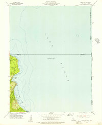 1955 Meeks Bay1956 Print · USGSThe western shores of Lake Tahoe are captured here in the mid-fifties, showing the early footprints of lakeside communities and parklands. Trace the development of Tahoma, Meeks Bay, and Paradise Flat along the edge of the Eldorado National Forest.3 unique versions available
 - 1955 Map of Bijou, 1957 Print
 1955 Bijou1957 Print · USGSThe south shore of Lake Tahoe in the mid-fifties shows a burgeoning community of lakefront resorts and mountain camps along the state line. Genealogists and researchers can trace the early development of Stateline, the Sierra House (Site), and Happy Homestead Cemetery.7 unique versions available
 - 1955 Map of Emerald Bay, 1957 Print
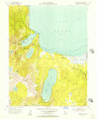 1955 Emerald Bay1957 Print · USGSThe southwestern shores of Lake Tahoe were evolving into a major recreation hub in the mid-fifties, documented here through a mix of state parks and alpine resorts. Genealogists and local historians can pinpoint the layout of Camp Richardson, the grand estate of Vikingsholm, and the remote settlement of Fallen Leaf.5 unique versions available
 - 1955 Map of Glenbrook, 1957 Print
 1955 Glenbrook1957 Print · USGSThe eastern shores of Lake Tahoe come alive in the mid-fifties, showing the developing communities of Glenbrook and Zephyr Cove. Researchers can trace old mountain routes like Genoa Peak Road or locate local landmarks including Tahoe School and Spooner Lake.4 unique versions available
Showing maps 1-25 of 174
Top cities of Douglas County
- Gardnerville Ranchos historical maps
- Johnson Lane historical maps
- Indian Hills historical maps
- Minden historical maps
- Kingsbury historical maps
- Topaz Ranch Estates historical maps
See more
Frequently asked questions
- What are the different types of historical maps available for Douglas County?
- What is the oldest map of Douglas County?
- Where can I purchase historical maps of Douglas County for my home or office?
- Where can I download high-res historical maps of Douglas County?
- Are there historical topographic maps available for Douglas County?
- Is there historical aerial imagery available for Douglas County?
- Where are historical maps of Douglas County sourced from?