Old Maps of Jiggs, Nevada for Genealogy
Trace your family roots with 13 historic maps of Jiggs. These high-res maps reveal old neighborhoods, homesites, landmarks, and streets — helping you uncover where your ancestors lived and how the area evolved over time.
- Explore historic neighborhoods: Identify where your relatives may have lived in the 1800s or 1900s.
- Compare maps over time: Trace the changes in streets, buildings, and landmarks for multi-generational research.
- Perfect for genealogy & ancestry research: Used by family historians and researchers to map out lineage and migration.
These maps are an incredible resource for exploring your personal connection to Jiggs's past.
Jiggs, NV maps
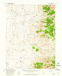
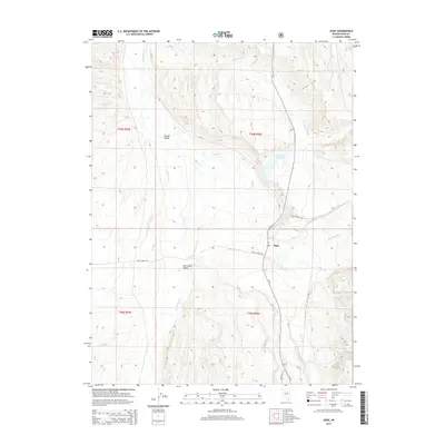
(13)- 1934 Map of Jiggs, 1955 Print
 1934 Jiggs1955 Print · USGSElko County ranching life in the 1930s is preserved here, centered on the small hub of Jiggs and the high peaks of the Ruby Mountains. Researchers can locate dozens of family-named sites, from Zunino Ranch to the Davis Ranch Hobson Post Office and the remote Johnson Cabin.
 - 1937 Map of Jiggs
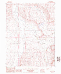
 1937 Jiggs1937 Print · USGSElko County ranching life is preserved here during the 1930s, when isolated family homesteads were the primary anchors of the high desert landscape. Genealogists and historians can trace the locations of the Davis Ranch Hobson PO, the Smith Creek Sch, and the Harrison Pass Ranger Sta.2 unique versions available
 - 1955 Map of Elko, 1974 Print
 1955 Elko1974 Print · USGSNortheastern Nevada in the mid-fifties is captured here as a crossroads of transcontinental rail and high desert ranching. Trace old rail stops from Wells to Elko or find remote landmarks like Shanty Town and Medicine Spring.3 unique versions available
 - 1958 Map of Elko
 1958 Elko1958 Print · USGSNorthern Nevada in the late fifties shows a landscape of high-desert ranching and Cold War aviation. Trace old rail lines like the Nevada Northern or locate the Victoria Mine and Wendover Air Force Base.2 unique versions available
 - 1959 Map of Jiggs, 1960 Print
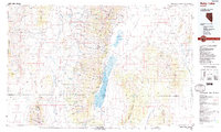
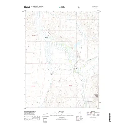
 1959 Jiggs1960 Print · USGSElko County ranching life is preserved here in the mid-twentieth century, centered on the valley floor and the Ruby Mountain foothills. Researchers can trace historic family landholdings like the Zaga Ranch and Achurra Ranch or locate the Smith Creek School.2 unique versions available
 - 1962 Map of Elko
 1962 Elko1962 Print · USGSNortheastern Nevada in the early sixties is a landscape of mountain ranges and rail corridors, where the river valleys support ranching and transit. Locate old mining operations like Battle Creek Mine, rural stops like Moleen, and the sprawling Wendover Bombing and Gunnery Range.
 - 1965 Map of Elko
 1965 Elko1965 Print · USGSElko and the northeastern Nevada desert are captured here in the mid-1960s, showcasing a landscape of high ranges and essential rail corridors. Researchers can trace the path of the Western Pacific railroad through small stops like Tobar and Ventosa, or locate remote sites like Shanty Town near the Ruby Lake wetlands.
 - 1985 Map of Jiggs, 1986 Print
 1985 Jiggs1986 Print · USGSElko County ranching and water resources are documented in the mid-eighties as they appeared in the high desert of Mound Valley. You can trace the rural infrastructure of the day, from the tiny hub of Jiggs to the Circle L Ranch and Zunino Reservoir.
 - 1988 Map of Ruby Lake
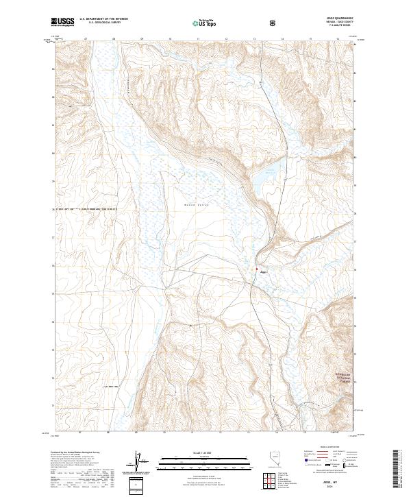
 1988 Ruby Lake1988 Print · USGSThe Ruby Mountains and surrounding desert valleys are captured here in the late eighties, showing a landscape of high-altitude passes and vital wetlands. Genealogists and researchers can trace remote sites like Jiggs, Indian Village, and the Ruby Lake National Wildlife Refuge.2 unique versions available
 - 2012 Map of Jiggs, 2012 Print
 2012 Jiggs2012 Print · USGSCovers Jiggs, including Elko County, United States, and other nearby areas
 - 2015 Map of Jiggs, 2015 Print
 2015 Jiggs2015 Print · USGSCovers Jiggs, including Elko County, United States, and other nearby areas
 - 2018 Map of Jiggs, 2018 Print
 2018 Jiggs2018 Print · USGSCovers Jiggs, including Elko County, United States, and other nearby areas
 - 2021 Map of Jiggs, 2021 Print
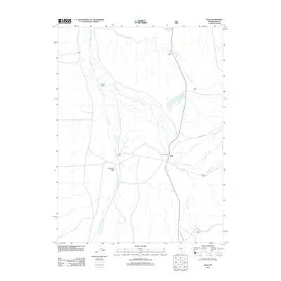
 2021 Jiggs2021 Print · USGSMound Valley and the settlement of Jiggs are shown in detail during the early 2020s. Genealogists and local historians can trace the paths of Hamilton Stage Rd and Harrison Pass Rd as they lead toward Humboldt National Forest.
End of results
Showing maps 1-13 of 13
Frequently asked questions
- What are the different types of historical maps available for Jiggs?
- What is the oldest map of Jiggs?
- Where can I purchase historical maps of Jiggs for my home or office?
- Where can I download high-res historical maps of Jiggs?
- Are there historical topographic maps available for Jiggs?
- Is there historical aerial imagery available for Jiggs?
- Where are historical maps of Jiggs sourced from?