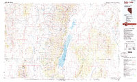
1988 Map of Ruby Lake
USGS Topo · Published 1988About this map
The Ruby Mountains divide this high-desert landscape, creating a dramatic vertical break between the Huntington Valley to the west and the expansive Ruby Valley to the east. At the heart of the region lies the Ruby Lake National Wildlife Refuge, a vital wetland complex including the North Sump and South Sump, where the seasonal waters of the Franklin River and numerous mountain springs collect. This 1988 edition reveals a sparsely populated interior with isolated ranching and mining outposts such as Jiggs and Rock House, connected by primitive roads and Nevada Highway 228. The presence of an Indian Village near the Ruby Mountains National Scenic Area and scattered Mines in the Medicine Range suggests a history defined by both indigenous presence and the extraction of natural resources in the Great Basin.
Find a feature on this map
66 named features on this map. Tap any name to fly to it.
Don’t see what you’re looking for? This feature index may not catch every label — zoom into the map to look around manually.
Map Details
Editions of this 1988 Ruby Lake Map
2 editions found
Other maps of this area

1926 · Roberts Mountains
USGS Topo · 1:250,000

1929 · Roberts Mountains
USGS Topo · 1:250,000

1934 · Jiggs
USGS Topo · 1:125,000

1935 · Halleck
USGS Topo · 1:125,000

1937 · Mineral Hill
USGS Topo · 1:48,000

1937 · Jiggs
USGS Topo · 1:125,000

1943 · Mineral Hill
USGS Topo · 1:62,500

1949 · Garden Valley
USGS Topo · 1:62,500

1951 · Garden Valley
USGS Topo · 1:62,500

1952 · Dixie Flats
USGS Topo · 1:62,500