Old Maps of Esmeralda County, Nevada for Academic Research
Study the evolution of Esmeralda County with 479 high-resolution historic maps. Whether you're teaching, researching, or modeling changes in land use, these maps provide essential visual documentation of urban, environmental, and geographic change.
- Analyze long-term change: Track patterns in development, transportation, and natural features.
- Ideal for environmental or urban studies: Support academic projects with primary historical map data.
- Use in the classroom or lab: Educators and researchers rely on these maps to bring historical context to life.
These maps are a powerful tool for teaching, research, and visualizing how Esmeralda County has changed over the decades.
Esmeralda County, NV maps
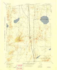
(479)- 1898 Map of Silver Peak, 1954 Print
 1898 Silver Peak1954 Print · USGSEsmeralda County mining camps and remote desert springs are captured here at the close of the nineteenth century. Researchers can trace the early industrial infrastructure of the Drinkwater Mine and the Silver Peak R.R. near the town of Blair.
 - 1900 Map of Silver Peak
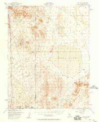
 1900 Silver Peak1900 Print · USGSSilver Peak and the surrounding mining districts were centers of industry at the turn of the century. Genealogists and historians can trace old wagon routes through Emigrant Pass and locate remote desert sites like the Drinkwater Mine or Tarantula Spring.5 unique versions available
 - 1907 Map of Tonopah, 1955 Print
 1907 Tonopah1955 Print · USGSCentral Nevada's mining heartland comes alive in this survey of the high desert and mountain ranges at the peak of the silver and gold booms. Researchers can trace the early rail networks of the Goldfield RR and locate sites like Round Mountain, the Orizaba Mine, and Darrough's Hot Springs.
 - 1908 Map of Lida
 1908 Lida1908 Print · USGSEsmeralda County enters its mining peak at the start of the twentieth century as rail lines and boomtowns transform the high desert. Researchers can trace the exact layout of the Tonopah and Goldfield RR, find remote camps like Diamondfield, and locate the Rattlesnake Mine.
 - 1908 Map of Tonopah
 1908 Tonopah1908 Print · USGSCentral Nevada's mining boom is frozen in time in this early century survey of the Tonopah and Manhattan districts. Trace the old Tonopah and Goldfield RR lines to vanished camps like Berlin and active sites such as the Nevada Mine.3 unique versions available
 - 1908 Map of Ballarat
 1908 Ballarat1908 Print · USGSInyo County was a frontier of mining and survival in the early 1900s, where water and ore dictated the settlement patterns. Researchers can locate remote camps like Skidoo and Harrisburg, or trace the vital network of desert water at Stovepipe Wells and Warm Sulphur Spring.
 - 1909 Map of Hawthorne, 1955 Print
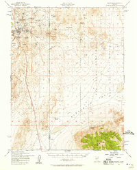
 1909 Hawthorne1955 Print · USGSWestern Nevada and the California borderlands are captured here during the height of the early mining era. Genealogists and historians can trace rail-depot life and remote outposts from Hawthorne to Belleville, including vanished sites like Oro City and Buckley Camp.
 - 1911 Map of Hawthorne
 1911 Hawthorne1911 Print · USGSEarly Nevada mining and rail history come alive in this survey of the Walker Lake region during the era of steam and silver. Researchers can trace the routes of the Southern Pacific System and locate the sites of Lucky Boy, Marietta, and Belleville.4 unique versions available
 - 1913 Map of Lida
 1913 Lida1913 Print · USGSThe Nevada and California borderlands appear here at the peak of the gold rush era, centered on the bustling streets of Goldfield. Genealogists and historians can trace the early rail networks of the Bullfrog Goldfield RR and locate camps like Gen Thomas Camp or the remote Palmetto Mine.5 unique versions available
 - 1913 Map of Ballarat
 1913 Ballarat1913 Print · USGSThe high desert of Inyo County is documented here during a period of intense mining and early water development. Genealogists and desert historians can trace the foundations of Ballarat, the Southern Pacific RR line, and active sites like Skidoo or the Cerro Gordo Mines.7 unique versions available
 - 1915 Map of Hawthorne, 1951 Print
 1915 Hawthorne1951 Print · USGSWestern Nevada at the turn of the century shows a landscape dominated by mining outposts and the reaching arms of the Southern Pacific System. Genealogists can trace early residents to sites like Candelaria, Sodaville, and Mina or locate vanished camps such as Buckley Camp.
 - 1917 Map of White Mountain
 1917 White Mountain1917 Print · USGSThe high desert borderlands of California and Nevada come alive in this survey from the mid-1910s. Researchers can trace the Southern Pacific rail line past remote outposts like Benton Sta. or locate high-altitude workings at the Sacramento Mine and Gold Hit.7 unique versions available
 - 1945 Map of Goldfield
 1945 Goldfield1945 Print · USGSEsmeralda County's high desert landscape is shown here at the end of the Second World War, capturing the region's mining roots and new military role. Genealogists and historians can trace the Tonopah and Goldfield rail line through Klondike and locate remote water sources like Stonewall Spr.
 - 1947 Map of Mariposa, 1948 Print
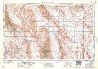
 1947 Mariposa1948 Print · USGSThe High Sierra and Owens Valley transition is captured here in the late 1940s, just as the region’s hydroelectric and tourism infrastructure was maturing. Genealogists and historians can trace old ranger stations, the Casa Diablo Mine, and rail stops along the Southern Pacific like Benton Station and Zurich.2 unique versions available
 - 1948 Map of Walker Lake
 1948 Walker Lake1948 Print · USGSThe high desert of Nevada and the eastern Sierra Nevada are captured just after the war as mining and ranching shaped the local economy. Genealogists can trace family connections to centers like Hawthorne and Mina or locate the historic Rockland Mines and Aurora.2 unique versions available
 - 1948 Map of Death Valley
 1948 Death Valley1948 Print · USGSIn the late 1940s, this desert frontier was defined by isolated mining camps and military restricted zones. Researchers can trace the routes between Furnace Creek Ranch and Rhyolite, or locate remote sites like the Modoc Mine and Ballarat.2 unique versions available
 - 1948 Map of Mariposa, 1951 Print
 1948 Mariposa1951 Print · USGSThe High Sierra and Mariposa foothills are shown here in the late 1940s as the post-war tourism and water infrastructure expanded. Genealogists and historians can locate vanished waypoints like Mormon Bar, the Glacier Point Hotel, and the granite quarries of Knowles.
 - 1952 Map of Mud Lake, 1958 Print
 1952 Mud Lake1958 Print · USGSNye County's high-desert landscape in the early fifties shows a region shifting from mining roots to military operations. Researchers can trace the Dismantled Railroad, locate the Silver King Mine, and identify Targets within the Mud Lake basin.2 unique versions available
 - 1952 Map of Goldfield, 1958 Print
 1952 Goldfield1958 Print · USGSGoldfield and its high-desert mining landscape are documented here during the early fifties as the region transitioned toward military use. Researchers can trace the remnants of a mining empire through the Columbia Mill, Florence Hill, and the local Cemetery.4 unique versions available
 - 1954 Map of Death Valley, 1966 Print
 1954 Death Valley1966 Print · USGSInyo County and the Nevada borderlands are shown during the mid-twentieth century as mining history met the atomic age. Researchers can trace the legacy of desert boomtowns and remote camps like Rhyolite, Darwin Mines, and the isolated Clay Camp.3 unique versions available
 - 1954 Map of Goldfield, 1967 Print
 1954 Goldfield1967 Print · USGSThe Nevada desert during the early Cold War era shows the convergence of traditional mining districts and military expansion. Genealogists and historians can trace the Tonopah and Tidewater Railroad route and locate remote sites like Gold Point and Scottys Castle.3 unique versions available
 - 1955 Map of Goldfield
 1955 Goldfield1955 Print · USGSThe Nevada desert in the mid-fifties reveals a landscape of mining camps and military expansion. You can trace legacy sites from the Klondike Mine to Gold Point, and locate remote outposts like Bonnie Claire and Staininger Ranch at the edge of Death Valley.
 - 1956 Map of Death Valley
 1956 Death Valley1956 Print · USGSInyo County and the Nevada borderlands appear in the mid-fifties as a rugged landscape of mining camps and military reservations. Genealogists and historians can trace the foundations of Furnace Creek Ranch, the desert roads to Ballarat, and active mining sites like the Lila C Mine.
 - 1956 Map of Tonopah, 1974 Print
 1956 Tonopah1974 Print · USGSCentral Nevada in the mid-fifties reveals a landscape shaped by mining and military footprints. Trace old silver districts near Tonopah and Manhattan, or locate early industrial sites like the Borax works at Columbus Salt Marsh.2 unique versions available
 - 1957 Map of Death Valley
 1957 Death Valley1957 Print · USGSThe High Desert in the mid-fifties reveals a landscape of extreme elevations and deep-seated mining history, from the Panamint Range to the Amargosa River. Trace the remnants of the Tonopah & Tidewater RR and remote sites like Ballarat or the Skidoo Mine.
Showing maps 1-25 of 479
Top cities of Esmeralda County
- Dyer historical maps
- Goldfield historical maps
- Silver Peak historical maps
- Gold Point historical maps
- Lida historical maps
Frequently asked questions
- What are the different types of historical maps available for Esmeralda County?
- What is the oldest map of Esmeralda County?
- Where can I purchase historical maps of Esmeralda County for my home or office?
- Where can I download high-res historical maps of Esmeralda County?
- Are there historical topographic maps available for Esmeralda County?
- Is there historical aerial imagery available for Esmeralda County?
- Where are historical maps of Esmeralda County sourced from?