1950s Maps of Esmeralda County, Nevada
Explore 18 historic maps of Esmeralda County from the 1950s. These maps offer a rare glimpse into what life looked like during the 1950s — showing old roads, neighborhoods, homes, and landmarks that have changed or disappeared over time.
Whether you're researching your family's past, planning a metal detecting trip, or studying how Esmeralda County's landscape evolved across the 1950s, these high-resolution maps are a powerful tool for exploring the history of this region.
- Focus on a specific era: All maps on this page are from the 1950s, giving you a focused view of this time period.
- See what’s changed: Compare century-old streets, trails, and buildings to today's modern landscape using overlays and satellite layers.
- Research with precision: Use these maps for genealogy, historical research, land use analysis, or educational projects.
- View, download, or print: Maps are fully viewable online in high resolution, and can be downloaded or printed for your own records.
Start exploring Esmeralda County's history through authentic maps from the 1950s. This is your window into the past.
Esmeralda County, NV maps
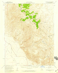
(18)- 1952 Map of Mud Lake, 1958 Print
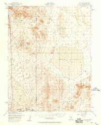 1952 Mud Lake1958 Print · USGSNye County's high-desert landscape in the early fifties shows a region shifting from mining roots to military operations. Researchers can trace the Dismantled Railroad, locate the Silver King Mine, and identify Targets within the Mud Lake basin.2 unique versions available
 - 1952 Map of Goldfield, 1958 Print
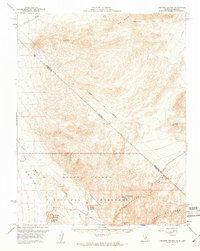
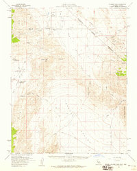
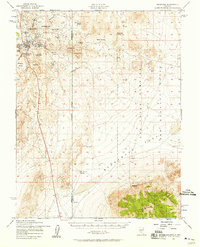 1952 Goldfield1958 Print · USGSGoldfield and its high-desert mining landscape are documented here during the early fifties as the region transitioned toward military use. Researchers can trace the remnants of a mining empire through the Columbia Mill, Florence Hill, and the local Cemetery.4 unique versions available
 - 1954 Map of Death Valley, 1966 Print
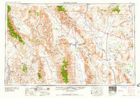
 1954 Death Valley1966 Print · USGSInyo County and the Nevada borderlands are shown during the mid-twentieth century as mining history met the atomic age. Researchers can trace the legacy of desert boomtowns and remote camps like Rhyolite, Darwin Mines, and the isolated Clay Camp.3 unique versions available
 - 1954 Map of Goldfield, 1967 Print
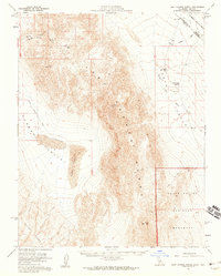
 1954 Goldfield1967 Print · USGSThe Nevada desert during the early Cold War era shows the convergence of traditional mining districts and military expansion. Genealogists and historians can trace the Tonopah and Tidewater Railroad route and locate remote sites like Gold Point and Scottys Castle.3 unique versions available
 - 1955 Map of Goldfield
 1955 Goldfield1955 Print · USGSThe Nevada desert in the mid-fifties reveals a landscape of mining camps and military expansion. You can trace legacy sites from the Klondike Mine to Gold Point, and locate remote outposts like Bonnie Claire and Staininger Ranch at the edge of Death Valley.
 - 1956 Map of Death Valley
 1956 Death Valley1956 Print · USGSInyo County and the Nevada borderlands appear in the mid-fifties as a rugged landscape of mining camps and military reservations. Genealogists and historians can trace the foundations of Furnace Creek Ranch, the desert roads to Ballarat, and active mining sites like the Lila C Mine.
 - 1956 Map of Tonopah, 1974 Print
 1956 Tonopah1974 Print · USGSCentral Nevada in the mid-fifties reveals a landscape shaped by mining and military footprints. Trace old silver districts near Tonopah and Manhattan, or locate early industrial sites like the Borax works at Columbus Salt Marsh.2 unique versions available
 - 1957 Map of Death Valley
 1957 Death Valley1957 Print · USGSThe High Desert in the mid-fifties reveals a landscape of extreme elevations and deep-seated mining history, from the Panamint Range to the Amargosa River. Trace the remnants of the Tonopah & Tidewater RR and remote sites like Ballarat or the Skidoo Mine.
 - 1957 Map of Walker Lake
 1957 Walker Lake1957 Print · USGSThe Nevada-California borderlands in the mid-1950s show a rugged network of mining camps and river-valley towns centered around Walker Lake. Researchers can trace the Southern Pacific rail line and locate historical sites like Bodie, Sodaville, and the Leviathan Sulphur Mine.4 unique versions available
 - 1957 Map of Magruder Mtn, 1959 Print
 1957 Magruder Mtn1959 Print · USGSThe high desert borderlands of Nevada and California are captured here in the late fifties, showcasing a landscape defined by mining and scarce water. Researchers can trace the remains of the Palmetto settlement and locate historic workings like the Sylvania Mine and Blue Dick Mine.2 unique versions available
 - 1957 Map of Grapevine Peak, 1959 Print
 1957 Grapevine Peak1959 Print · USGSThe high Grapevine Mountains and the floor of Death Valley meet in this mid-century survey of the California-Nevada border. Genealogists and desert historians can trace the remote Leadfield mining site, Strozzi Ranch, and the historic Von Schmidt Line.4 unique versions available
 - 1957 Map of Ubehebe Crater, 1960 Print
 1957 Ubehebe Crater1960 Print · USGSNorthern Death Valley in the late fifties showcases a landscape of volcanic craters and early desert tourism. Trace the history of the region through landmarks like Scottys Castle, the deep Ubehebe Crater, and the old Von Schmidt Line.2 unique versions available
 - 1957 Map of Mariposa, 1966 Print
 1957 Mariposa1966 Print · USGSThe High Sierra and Owens Valley appear in the mid-fifties, showing the intersection of conservation, hydroelectric power, and mountain industry. Genealogists and researchers can trace local landmarks like Yosemite Cemetery, the remote Kinsley Station, and the Pine Creek Mine.4 unique versions available
 - 1958 Map of Death Valley
 1958 Death Valley1958 Print · USGSThe High Desert and Death Valley during the mid-fifties reveal a stark landscape of mining camps and new military ranges. Historians can trace the lineage of remote outposts like Ballarat, the Skidoo Mine, and the historic Cerro Gordo Mine.
 - 1958 Map of Goldfield
 1958 Goldfield1958 Print · USGSThe Nevada-California borderlands in the late fifties show a landscape defined by mining history and emerging military ranges. Researchers can trace old routes to Scotty's Castle, identify the locations of Numerous mines near Gold Point, and find Goldfield at its peak.2 unique versions available
 - 1958 Map of Last Chance Range, 1959 Print
 1958 Last Chance Range1959 Print · USGSThe Inyo County desert interior in the late fifties reveals a landscape of high ridges and isolated water sources along the Nevada border. Trace the primitive Jeep Trail and mining history through Lead mines and Prospects near the Sand Dunes.3 unique versions available
 - 1958 Map of Soldier Pass, 1959 Print
 1958 Soldier Pass1959 Print · USGSThe California-Nevada borderlands in the late fifties reveal a landscape of isolated mining outposts and high-desert basins. Researchers can trace the historic Von Schmidt Line, find the White Mtn City (Ruin), and locate remote operations like the Copper Queen Mine.2 unique versions available
 - 1959 Map of Tonopah
 1959 Tonopah1959 Print · USGSCentral Nevada in the late fifties is a landscape of high desert ranges and mining history. Trace the remnants of old boomtowns and industrial sites like Berlin, the Gold Hill Mill, and the Victory Tungsten Mine.2 unique versions available
End of results
Showing maps 1-18 of 18
Top cities of Esmeralda County
- Dyer historical maps
- Goldfield historical maps
- Silver Peak historical maps
- Gold Point historical maps
- Lida historical maps
Frequently asked questions
- What are the different types of historical maps available for Esmeralda County?
- What is the oldest map of Esmeralda County?
- Where can I purchase historical maps of Esmeralda County for my home or office?
- Where can I download high-res historical maps of Esmeralda County?
- Are there historical topographic maps available for Esmeralda County?
- Is there historical aerial imagery available for Esmeralda County?
- Where are historical maps of Esmeralda County sourced from?