Old Maps of Esmeralda County, Nevada
Explore 151 old maps of Esmeralda County, spanning from 1898 to today. These high-resolution historic maps reveal how streets, neighborhoods, landmarks, and natural features evolved over time — perfect for genealogy, metal detecting, research, and local history exploration.
What you can do with these maps:
- See how Esmeralda County changed over time: Compare historical maps to modern-day views to trace roads, homesites, rail lines & more.
- View detailed metadata: Each map includes creators, publishers, year, scale, and archive source.
- Overlay maps with satellite & LiDAR: Visualize the past alongside modern tools to explore terrain & human change.
- Trusted historical sources: Maps sourced from the USGS, Library of Congress, and other archives.
- Access maps your way: View online, download high-res files, or order prints for personal or research use.
Start exploring old maps of Esmeralda County to uncover forgotten places, hidden landmarks, and the deep history beneath your feet.
Esmeralda County, NV maps
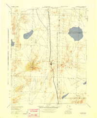
(151)- 1898 Map of Silver Peak, 1954 Print
 1898 Silver Peak1954 Print · USGSCovers Esmeralda County, including Silver Peak, Mono County, and other nearby areas
 - 1900 Map of Silver Peak
 1900 Silver Peak1900 Print · USGSCovers Esmeralda County, including Silver Peak, Mono County, and other nearby areas5 unique versions available
 - 1907 Map of Tonopah, 1955 Print
 1907 Tonopah1955 Print · USGSCovers Esmeralda County, including Tonopah, Ellsworth, and other nearby areas
 - 1908 Map of Lida
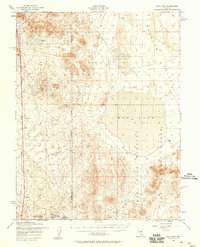
 1908 Lida1908 Print · USGSCovers Esmeralda County, including Goldfield, Silver Peak, and other nearby areas
 - 1908 Map of Tonopah
 1908 Tonopah1908 Print · USGSCovers Esmeralda County, including Tonopah, Ellsworth, and other nearby areas3 unique versions available
 - 1908 Map of Ballarat
 1908 Ballarat1908 Print · USGSCovers Esmeralda County, including Darwin, Stovepipe Wells, and other nearby areas
 - 1909 Map of Hawthorne, 1955 Print
 1909 Hawthorne1955 Print · USGSCovers Esmeralda County, including Hawthorne, Schurz, and other nearby areas
 - 1911 Map of Hawthorne
 1911 Hawthorne1911 Print · USGSCovers Esmeralda County, including Hawthorne, Schurz, and other nearby areas4 unique versions available
 - 1913 Map of Lida
 1913 Lida1913 Print · USGSCovers Esmeralda County, including Goldfield, Silver Peak, and other nearby areas5 unique versions available
 - 1913 Map of Ballarat
 1913 Ballarat1913 Print · USGSCovers Esmeralda County, including Darwin, Stovepipe Wells, and other nearby areas7 unique versions available
 - 1915 Map of Hawthorne, 1951 Print
 1915 Hawthorne1951 Print · USGSCovers Esmeralda County, including Hawthorne, Schurz, and other nearby areas
 - 1917 Map of White Mountain
 1917 White Mountain1917 Print · USGSCovers Esmeralda County, including Chalfant Valley, Benton, and other nearby areas7 unique versions available
 - 1945 Map of Goldfield
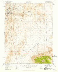
 1945 Goldfield1945 Print · USGSCovers Esmeralda County, including Goldfield, Nye County, and other nearby areas
 - 1947 Map of Mariposa, 1948 Print
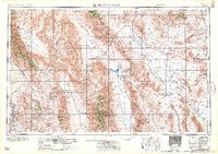
 1947 Mariposa1948 Print · USGSCovers Esmeralda County, including Mammoth Lakes, Oakhurst, and other nearby areas2 unique versions available
 - 1948 Map of Walker Lake
 1948 Walker Lake1948 Print · USGSCovers Esmeralda County, including South Lake Tahoe, Gardnerville Ranchos, and other nearby areas2 unique versions available
 - 1948 Map of Death Valley
 1948 Death Valley1948 Print · USGSCovers Esmeralda County, including Amargosa Valley, Beatty, and other nearby areas2 unique versions available
 - 1948 Map of Mariposa, 1951 Print
 1948 Mariposa1951 Print · USGSCovers Esmeralda County, including Mammoth Lakes, Oakhurst, and other nearby areas
 - 1952 Map of Mud Lake, 1958 Print
 1952 Mud Lake1958 Print · USGSCovers Esmeralda County, including Nye County, United States, and other nearby areas2 unique versions available
 - 1952 Map of Goldfield, 1958 Print
 1952 Goldfield1958 Print · USGSCovers Esmeralda County, including Goldfield, Nye County, and other nearby areas4 unique versions available
 - 1954 Map of Death Valley, 1966 Print
 1954 Death Valley1966 Print · USGSCovers Esmeralda County, including Amargosa Valley, Beatty, and other nearby areas3 unique versions available
 - 1954 Map of Goldfield, 1967 Print
 1954 Goldfield1967 Print · USGSCovers Esmeralda County, including Goldfield, Silver Peak, and other nearby areas3 unique versions available
 - 1955 Map of Goldfield
 1955 Goldfield1955 Print · USGSCovers Esmeralda County, including Goldfield, Silver Peak, and other nearby areas
 - 1956 Map of Death Valley
 1956 Death Valley1956 Print · USGSCovers Esmeralda County, including Amargosa Valley, Beatty, and other nearby areas
 - 1956 Map of Tonopah, 1974 Print
 1956 Tonopah1974 Print · USGSCovers Esmeralda County, including Tonopah, Belmont, and other nearby areas2 unique versions available
 - 1957 Map of Death Valley
 1957 Death Valley1957 Print · USGSCovers Esmeralda County, including Amargosa Valley, Beatty, and other nearby areas
Showing maps 1-25 of 151
Top cities of Esmeralda County
- Dyer historical maps
- Goldfield historical maps
- Silver Peak historical maps
- Gold Point historical maps
- Lida historical maps
Frequently asked questions
- What are the different types of historical maps available for Esmeralda County?
- What is the oldest map of Esmeralda County?
- Where can I purchase historical maps of Esmeralda County for my home or office?
- Where can I download high-res historical maps of Esmeralda County?
- Are there historical topographic maps available for Esmeralda County?
- Is there historical aerial imagery available for Esmeralda County?
- Where are historical maps of Esmeralda County sourced from?