1960s Maps of White Pine County, Nevada
Explore 16 historic maps of White Pine County from the 1960s. These maps offer a rare glimpse into what life looked like during the 1960s — showing old roads, neighborhoods, homes, and landmarks that have changed or disappeared over time.
Whether you're researching your family's past, planning a metal detecting trip, or studying how White Pine County's landscape evolved across the 1960s, these high-resolution maps are a powerful tool for exploring the history of this region.
- Focus on a specific era: All maps on this page are from the 1960s, giving you a focused view of this time period.
- See what’s changed: Compare century-old streets, trails, and buildings to today's modern landscape using overlays and satellite layers.
- Research with precision: Use these maps for genealogy, historical research, land use analysis, or educational projects.
- View, download, or print: Maps are fully viewable online in high resolution, and can be downloaded or printed for your own records.
Start exploring White Pine County's history through authentic maps from the 1960s. This is your window into the past.
White Pine County, NV maps
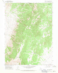
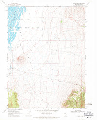
(16)- 1960 Map of Lund
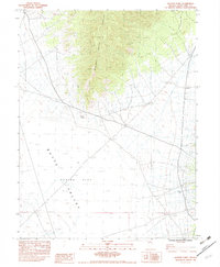
 1960 Lund1960 Print · USGSEastern Nevada and the Utah borderlands are mapped here during the mid-twentieth century, showing a landscape of high peaks and isolated ranching outposts. Researchers can locate remote mining sites like the Tungsten Queen Mine and early settlements including Lund and Shoshone.
 - 1962 Map of Elko
 1962 Elko1962 Print · USGSNortheastern Nevada in the early sixties is a landscape of mountain ranges and rail corridors, where the river valleys support ranching and transit. Locate old mining operations like Battle Creek Mine, rural stops like Moleen, and the sprawling Wendover Bombing and Gunnery Range.
 - 1962 Map of Hunter Point, 1983 Print
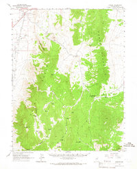
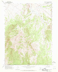
 1962 Hunter Point1983 Print · USGSWhite Pine County ranching and mining lands are captured here during the late 1970s and early 1980s. Local researchers can trace the arid landscape from the heights of the Cherry Creek Range down to Hunter Point and a lone Prospect in the valley.
 - 1963 Map of Ely
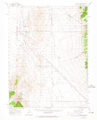
 1963 Ely1963 Print · USGSEastern Nevada's high basins and mountain ranges are captured here in the early sixties, showing a landscape defined by mining and ranching. Trace family roots at the Thompson Ranch or follow the Nevada Northern Railroad through Steptoe Valley.
 - 1964 Map of Duckwater, 1965 Print
 1964 Duckwater1965 Print · USGSRailroad Valley life in the early sixties centers on the Duckwater Indian Res, a place defined by its life-giving thermal springs. Researchers can locate the Duckwater Sch, trace the Flume irrigation lines, and find remote family-named landmarks like Leoman Spring.2 unique versions available
 - 1964 Map of Currant Mtn, 1965 Print
 1964 Currant Mtn1965 Print · USGSNye County, Nevada, in the early sixties is a landscape of high desert summits and remote outposts. Genealogists and historians can trace old routes like the Midland Trail and locate isolated landmarks such as Stone Cabin and the El Padre Mine.
 - 1964 Map of Moody Peak, 1966 Print
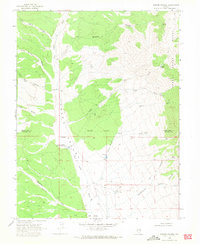
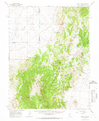 1964 Moody Peak1966 Print · USGSThe high desert of central Nevada is captured here in the 1960s, showing the intersection of Eureka, Nye, and White Pine counties. Researchers can locate remote outposts like Pogues Station, several prospects, and vital water sources like Soda Spring.
 - 1965 Map of Elko
 1965 Elko1965 Print · USGSElko and the northeastern Nevada desert are captured here in the mid-1960s, showcasing a landscape of high ranges and essential rail corridors. Researchers can trace the path of the Western Pacific railroad through small stops like Tobar and Ventosa, or locate remote sites like Shanty Town near the Ruby Lake wetlands.
 - 1968 Map of Ruby Lake SE, 1971 Print
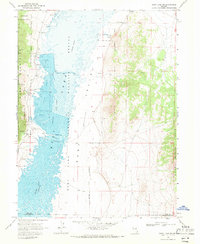
 1968 Ruby Lake SE1971 Print · USGSThe high desert of White Pine County comes into focus in the late sixties, showing the rugged Maverick Springs Range and its surrounding basins. Trace the remote trails and critical water points of the era like Willow Spring and Salas Spring.2 unique versions available
 - 1968 Map of Ruby Lake NW, 1971 Print
 1968 Ruby Lake NW1971 Print · USGSRuby Valley in the late 1960s was a landscape defined by water and wildlife management at the edge of the Ruby Mountains. Trace the layout of the Gallagher State Fish Hatchery, the location of Bressman Cabin, and the site of the Cave Creek Sch.2 unique versions available
 - 1968 Map of Ruby Lake NE, 1971 Print
 1968 Ruby Lake NE1971 Print · USGSThe high-desert terrain of the Maverick Springs Range is captured here in the late sixties, straddling the Elko and White Pine line. Researchers can trace the network of old Jeep Trails connecting isolated points like Rock Cabin Well and Maverick Springs.2 unique versions available
 - 1969 Map of Parker Station, 1971 Print
 1969 Parker Station1971 Print · USGSCave Valley and the Schell Creek Range appear here in the late sixties, capturing a landscape of historic transit and high-desert outposts. Researchers can locate the Parker Station (Old Stagecoach Station), Mike Urrutia Well, and Cave Spring Cave.
 - 1969 Map of Station Butte, 1971 Print
 1969 Station Butte1971 Print · USGSWhite Pine County's high-desert basin is captured here in the late sixties, showcasing the vital water sources of the Ruby Valley. Researchers can locate the Site of Ruby Valley Pony Express Station and trace the Overland Road near Station Butte.
 - 1969 Map of Moorman Spring NW, 1971 Print
 1969 Moorman Spring NW1971 Print · USGSNye County ranching and water history is preserved here in the late sixties, where the valley meets the western high country. Genealogists and historians can trace water rights and grazing sites through named landmarks like Carter Well, Gubler Well, and Cabin Well.2 unique versions available
 - 1969 Map of Moorman Spring NE, 1971 Print
 1969 Moorman Spring NE1971 Print · USGSThe high-desert basins of Nye and White Pine counties come into focus during the late sixties, showing a landscape shaped by ranching and water rights. Researchers can trace the cattle-driven economy through labels like Sheep Pass Corral, Ruppes Boghole, and the White Horse Pasture.2 unique versions available
 - 1969 Map of Haggerty Spring, 1971 Print
 1969 Haggerty Spring1971 Print · USGSHigh desert springs and mountain passes define this area of the Egan Range in the late sixties. Researchers can trace historical movement via the Sheep Pass Trail and locate vital water sources like Stink Pot Spring and Haggerty Spring.2 unique versions available
End of results
Showing maps 1-16 of 16
Top cities of White Pine County
Frequently asked questions
- What are the different types of historical maps available for White Pine County?
- What is the oldest map of White Pine County?
- Where can I purchase historical maps of White Pine County for my home or office?
- Where can I download high-res historical maps of White Pine County?
- Are there historical topographic maps available for White Pine County?
- Is there historical aerial imagery available for White Pine County?
- Where are historical maps of White Pine County sourced from?