1970s Maps of White Pine County, Nevada
Explore 21 historic maps of White Pine County from the 1970s. These maps offer a rare glimpse into what life looked like during the 1970s — showing old roads, neighborhoods, homes, and landmarks that have changed or disappeared over time.
Whether you're researching your family's past, planning a metal detecting trip, or studying how White Pine County's landscape evolved across the 1970s, these high-resolution maps are a powerful tool for exploring the history of this region.
- Focus on a specific era: All maps on this page are from the 1970s, giving you a focused view of this time period.
- See what’s changed: Compare century-old streets, trails, and buildings to today's modern landscape using overlays and satellite layers.
- Research with precision: Use these maps for genealogy, historical research, land use analysis, or educational projects.
- View, download, or print: Maps are fully viewable online in high resolution, and can be downloaded or printed for your own records.
Start exploring White Pine County's history through authentic maps from the 1970s. This is your window into the past.
White Pine County, NV maps
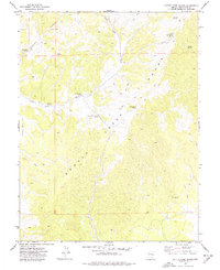
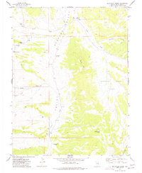
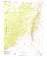
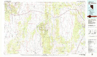
(21)- 1972 Map of Tweedy Wash, 1975 Print
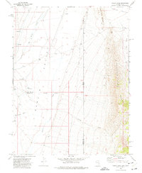 1972 Tweedy Wash1975 Print · USGSHamlin Valley at the Nevada-Utah border was a remote ranching and grazing corridor in the early seventies. Genealogists and desert historians can trace early water sources and outposts like North Little Springs, The Pots, and the Corral along the Mountain Home Range.
 - 1972 Map of Big Springs, 1975 Print
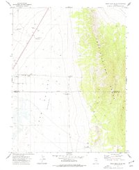
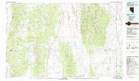
 1972 Big Springs1975 Print · USGSHamlin Valley and the Snake Range foothills appear in the early 1970s, showcasing a remote Nevada landscape defined by ranching and desert washes. Researchers can locate the Big Springs Ranch, a local Gravel Pit, and various Jeep Trails across the Humboldt National Forest.
 - 1973 Map of White Rock Creek, 1977 Print
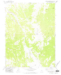
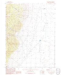
 1973 White Rock Creek1977 Print · USGSEastern Nevada in the 1970s was a landscape defined by ranching infrastructure and remote mountain springs. Researchers can trace historic routes along jeep trails to reach White Rock Spring, Basque Canyon, and the Horse Camp Well in the high desert.
 - 1973 Map of Indian Springs Knolls, 1977 Print
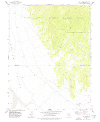
 1973 Indian Springs Knolls1977 Print · USGSHigh-desert Nevada at the start of the 1970s is shown here as a landscape defined by water and distance. Genealogists and historians can trace the remote wells and primitive routes through the Fortification Range, such as South Well and Johns Wash Well.
 - 1973 Map of Cattle Camp Spring, 1977 Print
 1973 Cattle Camp Spring1977 Print · USGSThe Schell Creek Range in the early 1970s reveals a landscape defined by its vital water sources and remote mining history. Researchers can trace early tracks and land use through Robbers Roost Basin or locate family-named sites like Virginia Dale Spring and John Spring.
 - 1973 Map of North Spring Point, 1977 Print
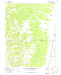
 1973 North Spring Point1977 Print · USGSWhite Pine County in the early seventies reveals a landscape of isolated water points and desert tracks along the Schell Creek Range. Researchers can trace the development of high-desert infrastructure through sites like Dales Well, North Spring Point, and the path of Highline Road.
 - 1973 Map of Mount Grafton NE, 1977 Print
 1973 Mount Grafton NE1977 Print · USGSThe border of White Pine and Lincoln counties was a land of desert basins and high peaks in the 1970s. Researchers can trace remote water infrastructure and early trails, from Travis Reservoir and North Gouge Eye Well to the steep slopes of the Fortification Range.
 - 1973 Map of Horse Camp Springs, 1977 Print
 1973 Horse Camp Springs1977 Print · USGSHigh in the eastern Nevada mountains during the 1970s, this area reveals a landscape shaped by ranching and remote springs. You can trace the rugged network of jeep trails connecting isolated water sources like Horse Camp Springs, Cold Springs, and Basque Canyon.
 - 1973 Map of Red Ledges, 1977 Print
 1973 Red Ledges1977 Print · USGSIn the early seventies, this part of the Nevada high desert remained a land of sparse outposts and difficult travel. Researchers can trace the rugged access via the Jeep Trail and locate water sources at The Troughs and various Spring sites.
 - 1977 Map of Bullwhack Summit
 1977 Bullwhack Summit1977 Print · USGSWhite Pine County in the 1970s reveals a high-desert landscape shaped by ranching and remote outposts. Researchers can trace historic water sources and landmarks like Mollys Nipples, Robbers Roost Spring, and the cattle-tending infrastructure at Cattle Camp Wash.
 - 1977 Map of Brown Knoll
 1977 Brown Knoll1977 Print · USGSThe high desert of White Pine County comes into focus in the late seventies, detailing the livestock and water infrastructure of the Egan Range. Researchers can trace the legacy of regional ranching through landmarks like Basque, the Milk Ranch Corral, and the isolated Schoolhouse.
 - 1977 Map of Sawmill Canyon
 1977 Sawmill Canyon1977 Print · USGSThe eastern Nevada high desert of the late seventies is captured here at the junction of the mountain and valley. Trace the legacy of mineral exploration and remote ranching at the Johnson Boys Mine, the Corral, and water sites like Mahogany Hotel Spring.
 - 1978 Map of Lund
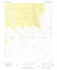
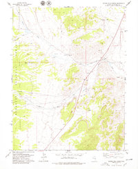
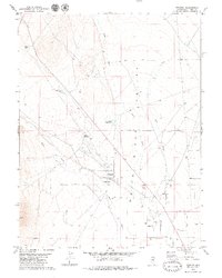
 1978 Lund1978 Print · USGSWhite Pine County in the late seventies is centered on the ranching community of Lund and the surrounding White River Valley. Researchers can trace the local infrastructure including the High Sch, Rodeo Arena, and the remote ranch at Ruppes Place.
 - 1978 Map of Douglas
 1978 Douglas1978 Print · USGSThe high-desert terrain near the border of White Pine and Nye counties is captured here in the late 1970s. Trace the remote settlement of Douglas and look for isolated landmarks like the Drill Hole and several mountain Springs along the Jeep Trail.
 - 1978 Map of Mt. Grafton
 1978 Mt. Grafton1978 Print · USGSHigh peaks and desert valleys meet along the White Pine and Lincoln County border in the late 1970s. Researchers can locate remote ranching and mining sites like Geyser Ranch, Prospects, and the distinct Geyser Landing Strip.
 - 1978 Map of Lake Valley Summit
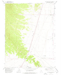 1978 Lake Valley Summit1978 Print · USGSHigh desert basins in White Pine County meet in the late seventies at the critical pass between Lake Valley and Spring Valley. Local history researchers can trace the vital water sources of the era, from North Fox Well to the remote Kirkeby Knoll.
 - 1978 Map of Badger Hole Spring, 1979 Print
 1978 Badger Hole Spring1979 Print · USGSWhite Pine County in the late 1970s was a landscape where high-desert ranching and mineral exploration converged along the White River. Researchers can trace the layout of Gardner Ranch, locate a small riverside Cem, and identify old Mine workings and Prospects.
 - 1979 Map of Mt. Hamilton
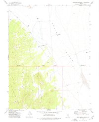
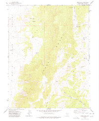
 1979 Mt. Hamilton1979 Print · USGSWhite Pine County's high-desert mining and ranching corridors are captured in the late 1970s, from the basins of Newark Valley to the Egan Range. Researchers can trace the legacies of the silver boom at Hamilton and locate operations like the Treasure Hill Mine or the Belmont Mill.2 unique versions available
 - 1979 Map of Preston
 1979 Preston1979 Print · USGSThe rural community of Preston and the surrounding ranchlands are captured here during the late 1970s. Genealogists and local historians can trace family-named water sources like Arnoldson Spr and Nicholas Spr or locate the Ruins near Cold Spring.2 unique versions available
 - 1979 Map of Garrison, 1980 Print
 1979 Garrison1980 Print · USGSThe high desert borderlands of Utah and Nevada come into focus in the late seventies, showing the rugged mining and ranching outposts of the Snake Range. Trace old mining operations like the Tungsten Queen Mine or find remote water stops such as Parker Station and Lund Group Well.
 - 1979 Map of Sunset Reservoir, 1991 Print
 1979 Sunset Reservoir1991 Print · USGSWhite Pine County's high desert landscape is shown here in the 1980s, where water management is critical for survival in the Antelope Depression Valley. Genealogists and historians can locate the site of Tippett, Tippett Springs, and mineral interests like a mountain Prospect.
End of results
Showing maps 1-21 of 21
Top cities of White Pine County
Frequently asked questions
- What are the different types of historical maps available for White Pine County?
- What is the oldest map of White Pine County?
- Where can I purchase historical maps of White Pine County for my home or office?
- Where can I download high-res historical maps of White Pine County?
- Are there historical topographic maps available for White Pine County?
- Is there historical aerial imagery available for White Pine County?
- Where are historical maps of White Pine County sourced from?