Old Maps of White Pine County, Nevada for Genealogy
Trace your family roots with 939 historic maps of White Pine County. These high-res maps reveal old neighborhoods, homesites, landmarks, and streets — helping you uncover where your ancestors lived and how the area evolved over time.
- Explore historic neighborhoods: Identify where your relatives may have lived in the 1800s or 1900s.
- Compare maps over time: Trace the changes in streets, buildings, and landmarks for multi-generational research.
- Perfect for genealogy & ancestry research: Used by family historians and researchers to map out lineage and migration.
These maps are an incredible resource for exploring your personal connection to White Pine County's past.
White Pine County, NV maps
(939)- 1934 Map of Jiggs, 1955 Print
 1934 Jiggs1955 Print · USGSElko County ranching life in the 1930s is preserved here, centered on the small hub of Jiggs and the high peaks of the Ruby Mountains. Researchers can locate dozens of family-named sites, from Zunino Ranch to the Davis Ranch Hobson Post Office and the remote Johnson Cabin.
 - 1937 Map of Jiggs
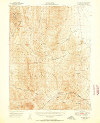
 1937 Jiggs1937 Print · USGSElko County ranching life is preserved here during the 1930s, when isolated family homesteads were the primary anchors of the high desert landscape. Genealogists and historians can trace the locations of the Davis Ranch Hobson PO, the Smith Creek Sch, and the Harrison Pass Ranger Sta.2 unique versions available
 - 1948 Map of Wheeler Peak, 1961 Print
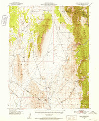
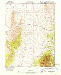
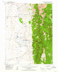 1948 Wheeler Peak1961 Print · USGSThe Snake Range and high desert flats of White Pine County come into focus shortly after the war, showing a landscape shaped by high-altitude mining and ranching. Researchers can trace historic family holdings like Yelton Ranch and locate remote operations including the Silver Bell Mine and Hub Mine.2 unique versions available
 - 1949 Map of Garrison, 1957 Print
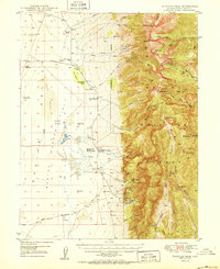
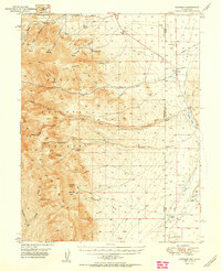
 1949 Garrison1957 Print · USGSThe high desert border of White Pine County and Utah’s Millard County comes into focus in the late 1940s as a land of isolated ranches and mountain peaks. Genealogists and historians can locate family landmarks like Davies Ranch and Burbank Cem or trace the early paths to Lehman Caves National Monument.4 unique versions available
 - 1949 Map of Treasure Hill, 1960 Print
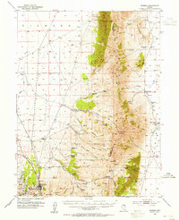
 1949 Treasure Hill1960 Print · USGSMining operations and remote desert outposts define the White Pine landscape in the late 1940s. Genealogists and historians can trace the legacy of the silver boom through sites like Eberhardt, the Hidden Treasure Mine, and Ellison Ranger Station.2 unique versions available
 - 1950 Map of Wheeler Peak
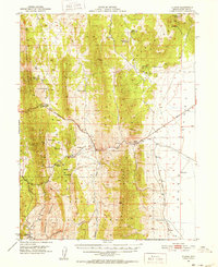
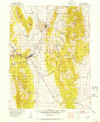
 1950 Wheeler Peak1950 Print · USGSEastern Nevada's high-mountain terrain and valley floors come into focus during the late 1940s, showing a landscape shaped by mining and ranching. Genealogists and historians can trace family-held sites like Kirkeby Ranch, find the Shoshone PO Swallow Ranch, and locate various extraction sites including the Everett Mines.2 unique versions available
 - 1950 Map of Treasure Hill
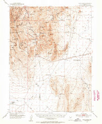
 1950 Treasure Hill1950 Print · USGSThe White Pine mining district is captured here at mid-century, revealing the legacy of Nevada's silver boom. Genealogists and historians can trace the foundations of Eberhardt (Site), the Treasure Cem, and various tunnels like the Icehouse Tunnel.2 unique versions available
 - 1951 Map of Garrison
 1951 Garrison1951 Print · USGSThe Nevada-Utah borderlands are captured here in the early fifties, where the high peaks of the Snake Range descend into the ranching country of Snake Valley. Researchers can trace early family landholdings at Davies Ranch and Dearden Ranch, or locate the Burbank Cem near the state line.2 unique versions available
 - 1951 Map of Green Springs, 1952 Print
 1951 Green Springs1952 Print · USGSWhite Pine County mining and ranching are recorded here in the early fifties. Local historians can trace old silver operations like the Ne Plus Ultra Mine or locate sites such as Shermantown and the Bull Creek Ranch.4 unique versions available
 - 1951 Map of Illipah, 1952 Print
 1951 Illipah1952 Print · USGSIn the early 1950s, this area of White Pine County centered on the intersection of ranching life and the early auto age. Genealogists and historians can trace the Lincoln Highway through the Illipah (Moorman Ranch) and explore the site of Hamilton (Historic Ruins).4 unique versions available
 - 1951 Map of Pancake Summit, 1952 Print
 1951 Pancake Summit1952 Print · USGSWhite Pine County's high-altitude mining and transit corridors are captured here in the early fifties as they existed before modern bypasses. Researchers can trace the Hamilton-Elko Stage Line and explore mining operations like the Belmont Mill and Seligman Mine.3 unique versions available
 - 1952 Map of Ely, 1954 Print
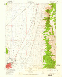
 1952 Ely1954 Print · USGSCentral Nevada's mining heartland is captured here during the mid-fifties copper boom. Genealogists and historians can trace the Nevada Northern RR between the copper pits of Ruth and the industrial infrastructure of McGill and East Ely.3 unique versions available
 - 1953 Map of Pinto Summit, 1955 Print
 1953 Pinto Summit1955 Print · USGSThe high desert of Eureka and White Pine Counties is shown here in the 1950s as a landscape of deep mines and remote outposts. Researchers can trace the legacy of mining at the Windfall Mine or find historical locations like Eighteenmile House (Site) and Schaefer Ranch.4 unique versions available
 - 1953 Map of Eureka, 1955 Print
 1953 Eureka1955 Print · USGSThe Nevada mining town of Eureka is shown at mid-century during a period of transition for the high desert silver-lead district. Genealogists and historians can locate numerous family holdings such as Palmer Ranch and trace the path of the Eureka Nevada RR past the historic Charcoal Kiln.3 unique versions available
 - 1955 Map of Elko, 1974 Print
 1955 Elko1974 Print · USGSNortheastern Nevada in the mid-fifties is captured here as a crossroads of transcontinental rail and high desert ranching. Trace old rail stops from Wells to Elko or find remote landmarks like Shanty Town and Medicine Spring.3 unique versions available
 - 1956 Map of Lund, 1963 Print
 1956 Lund1963 Print · USGSEastern Nevada and the Utah borderlands are mapped here during the mid-fifties, showing a landscape of high-desert ranches and mountain mining camps. Genealogists and historians can trace family locations through sites like Bristol Silver Mines, Lund, and the Sunnyside Whipple Ranch.2 unique versions available
 - 1956 Map of Ely, 1968 Print
 1956 Ely1968 Print · USGSEastern Nevada in the mid-fifties is a land of massive mountain ranges and silver-boom history. Trace the legacy of mining ruins at Hamilton and Treasure City or follow the path of the Nevada Northern RR through Ely.5 unique versions available
 - 1957 Map of Buck Mountain, 1958 Print
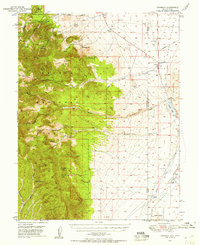
 1957 Buck Mountain1958 Print · USGSIn the high desert of White Pine County in the late fifties, this map captures the remote transition between Great Basin valleys. Genealogists and historians can trace the Elko-Hamilton Stage Route and find family-named landmarks like Buck Station and Goicoechea Well.3 unique versions available
 - 1957 Map of Currant Mtn, 1958 Print
 1957 Currant Mtn1958 Print · USGSNye County ranching and mining life are captured in the late 1950s as the high desert reaches of the White Pine Range were being mapped. Researchers can locate remote landmarks like the Currant Creek School, Angleworm Ranch, and the Gold Point Mine.3 unique versions available
 - 1957 Map of Diamond Springs, 1959 Print
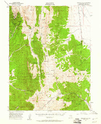
 1957 Diamond Springs1959 Print · USGSThe high desert of central Nevada is captured here during the late 1950s, showing a landscape of remote ranches and vital water holes. Genealogists and historians can trace family locations at Thompson Ranch and Goicoechea Ranch or locate the historic Overland Pass.3 unique versions available
 - 1957 Map of Cold Creek Ranch, 1959 Print
 1957 Cold Creek Ranch1959 Print · USGSHuntington Valley in the late fifties was a landscape of remote cattle operations and high-altitude mining prospects. Trace the Elko-Hamilton Stage Route or locate old water sources at Cold Creek Ranch and Bourne Tunnel Spring.3 unique versions available
 - 1958 Map of Elko
 1958 Elko1958 Print · USGSNorthern Nevada in the late fifties shows a landscape of high-desert ranching and Cold War aviation. Trace old rail lines like the Nevada Northern or locate the Victoria Mine and Wendover Air Force Base.2 unique versions available
 - 1958 Map of McGill, 1960 Print
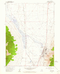 1958 McGill1960 Print · USGSThe industrial heart of White Pine County is captured here in the late fifties, centered on the intensive mining operations at McGill. Researchers can trace the legacy of the copper industry through the Copper Smelter, the Nevada Northern rail lines, and local landmarks like Romeo Ranch.4 unique versions available
 - 1958 Map of Ruth, 1960 Print
 1958 Ruth1960 Print · USGSMining operations in the Egan Range were at their peak during the late fifties, transforming the landscape around Ruth. Researchers can trace the extensive rail network of the Nevada Northern and locate historic shafts like the Elijah Mine or Ada Shaft.3 unique versions available
 - 1958 Map of East Ely, 1961 Print
 1958 East Ely1961 Print · USGSEast Ely and the surrounding Steptoe Valley are captured here in the late fifties, showcasing a landscape defined by rail and early aviation. Researchers can trace the Nevada Northern railroad, locate the Baltimore Mill, and see the footprint of Yelland Field.2 unique versions available
Showing maps 1-25 of 939
Top cities of White Pine County
Frequently asked questions
- What are the different types of historical maps available for White Pine County?
- What is the oldest map of White Pine County?
- Where can I purchase historical maps of White Pine County for my home or office?
- Where can I download high-res historical maps of White Pine County?
- Are there historical topographic maps available for White Pine County?
- Is there historical aerial imagery available for White Pine County?
- Where are historical maps of White Pine County sourced from?