2020s Maps of White Pine County, Nevada
Explore 182 historic maps of White Pine County from the 2020s. These maps offer a rare glimpse into what life looked like during the 2020s — showing old roads, neighborhoods, homes, and landmarks that have changed or disappeared over time.
Whether you're researching your family's past, planning a metal detecting trip, or studying how White Pine County's landscape evolved across the 2020s, these high-resolution maps are a powerful tool for exploring the history of this region.
- Focus on a specific era: All maps on this page are from the 2020s, giving you a focused view of this time period.
- See what’s changed: Compare century-old streets, trails, and buildings to today's modern landscape using overlays and satellite layers.
- Research with precision: Use these maps for genealogy, historical research, land use analysis, or educational projects.
- View, download, or print: Maps are fully viewable online in high resolution, and can be downloaded or printed for your own records.
Start exploring White Pine County's history through authentic maps from the 2020s. This is your window into the past.
White Pine County, NV maps
(182)- 2020 Map of Spring Mountain, 2020 Print
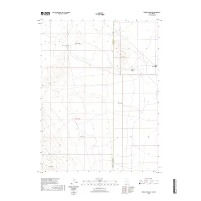 2020 Spring Mountain2020 Print · USGSCovers White Pine County, including Millard County, United States, and other nearby areas
 - 2020 Map of Needle Point Spring, 2020 Print
 2020 Needle Point Spring2020 Print · USGSCovers White Pine County, including Millard County, United States, and other nearby areas
 - 2020 Map of Garrison, 2020 Print
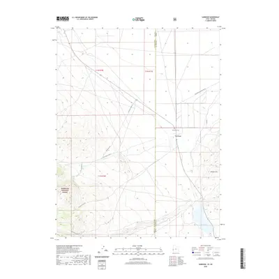 2020 Garrison2020 Print · USGSCovers White Pine County, including Garrison, Millard County, and other nearby areas
 - 2021 Map of Kalamazoo Creek, 2021 Print
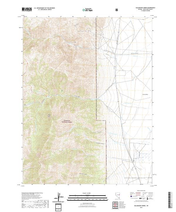 2021 Kalamazoo Creek2021 Print · USGSThe high peaks of the Schell Creek Range meet the vast flats of Spring Valley in this modern survey of eastern Nevada. Trace the remote drainages and spring sites of the Humboldt National Forest, including Muncy Spring and Fandango Canyon.
 - 2021 Map of Baker, 2021 Print
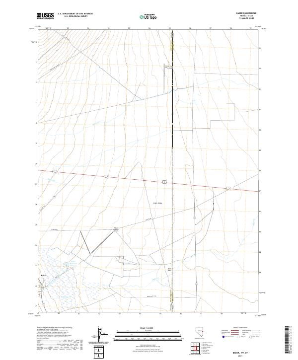 2021 Baker2021 Print · USGSThe high desert borderlands of Nevada and Utah come into focus in this contemporary survey of the Snake Valley. Genealogists and researchers can trace the modern layout of Baker and locate water features like Baker Reservoir and the Sinks of Baker.
 - 2021 Map of Blue Mass Canyon, 2021 Print
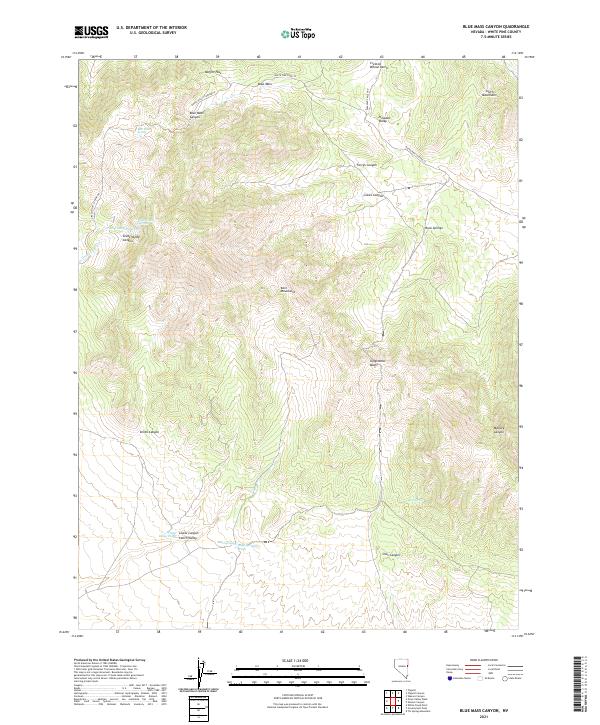 2021 Blue Mass Canyon2021 Print · USGSWhite Pine County ranching and mountain landscapes are captured here in the early twenty-first century. Researchers can trace the water network of Blue Mass Spring and Rock Springs or explore the heights of the Kern Mountains.
 - 2021 Map of Grass Valley Wash, 2021 Print
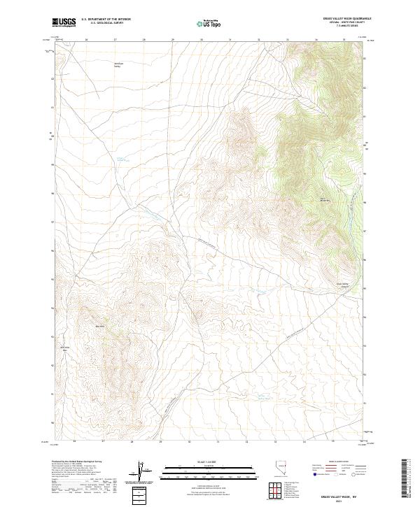 2021 Grass Valley Wash2021 Print · USGSWhite Pine County's high-desert basins and peaks are captured here in the early twenty-first century. Researchers can trace the path of Grass Valley Canyon Rd through the foothills of the Kern Mountains and identify the crossing at Red Hills Pass.
 - 2021 Map of Preston, 2021 Print
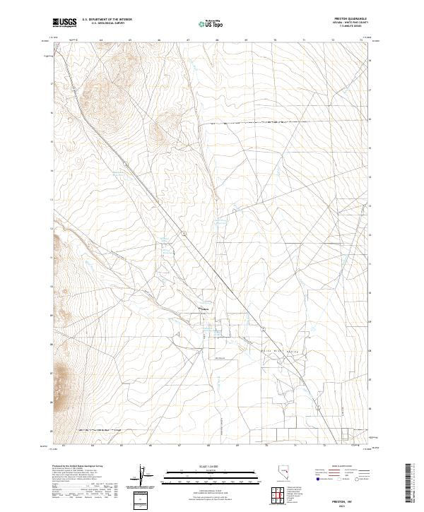 2021 Preston2021 Print · USGSThe White River Valley comes into focus in this recent survey of eastern Nevada. Researchers can trace the local water network through landmarks like Preston Big Spring, Blackjack Reservoir, and the streets of Preston.
 - 2021 Map of Long Valley Slough, 2021 Print
 2021 Long Valley Slough2021 Print · USGSWhite Pine County's high-desert basins and carved canyons are captured here in the early twenty-first century. Researchers can trace the drainage of Long Valley Slough and follow the remote paths of White Pine Co Road 3 through Mooney Basin.
 - 2021 Map of Hunter Point, 2021 Print
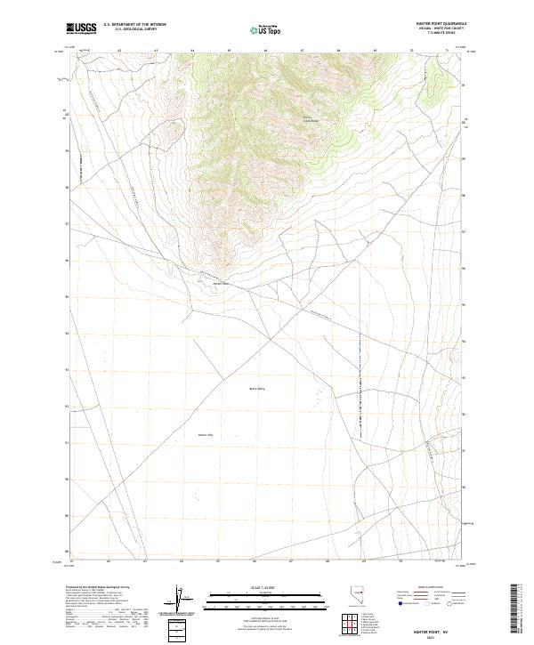 2021 Hunter Point2021 Print · USGSWhite Pine County remains a quiet expanse of basin and range country in the early twenty-first century. Researchers can trace local routes like White Pine Co Road 19 and the topography of Hunter Point and Butte Valley.
 - 2021 Map of Robinson Summit, 2021 Print
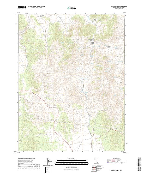 2021 Robinson Summit2021 Print · USGSThe high Nevada desert and the peaks of the Egan Range are captured here in the early twenty-first century. Genealogists and local historians can trace named water sources and old passes like Schoolhouse Spring, Piscevich Summit, and Jamestown Spring.
 - 2021 Map of Yelland Dry Lake, 2021 Print
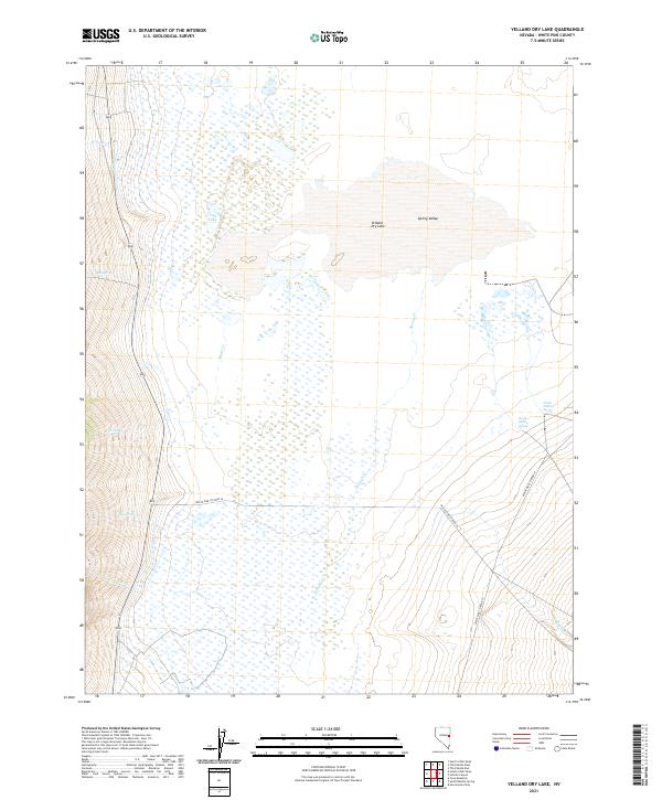 2021 Yelland Dry Lake2021 Print · USGSSpring Valley's high desert landscape is captured here in the early twenty-first century, documenting a remote corner of White Pine County. Researchers can trace vital water sources like North Millick Spring and the drainage of McCoy Cr into the expansive Yelland Dry Lake.
 - 2021 Map of White Sage Well, 2021 Print
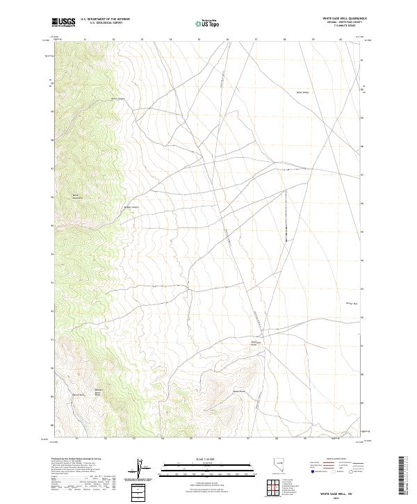 2021 White Sage Well2021 Print · USGSWhite Pine County remains a landscape of wide-open basins and sharp ridges in this recent survey. Local historians can trace the paths through Butte Mountains and locate landmarks like Robbers Roost Ridge and Eightmile Point.
 - 2021 Map of Mooney Basin Summit, 2021 Print
 2021 Mooney Basin Summit2021 Print · USGSWhite Pine County at the start of the 2020s remains a landscape of high-elevation summits and desert basins. Researchers can trace the routes of White Pine Co Road 1 past Goicoechea Warm Springs and into the Ruby Mountains.
 - 2021 Map of North Spring Point, 2021 Print
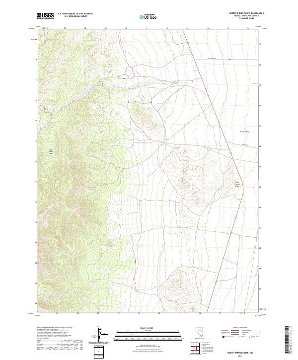 2021 North Spring Point2021 Print · USGSWhite Pine County's high-desert landscape is captured here in the early twenty-first century, showing the transition from mountain peaks to valley floors. Trace the drainage of John Henry Wash or locate Basin Spring and the landmark at North Spring Point.
 - 2021 Map of Sunshine Well, 2021 Print
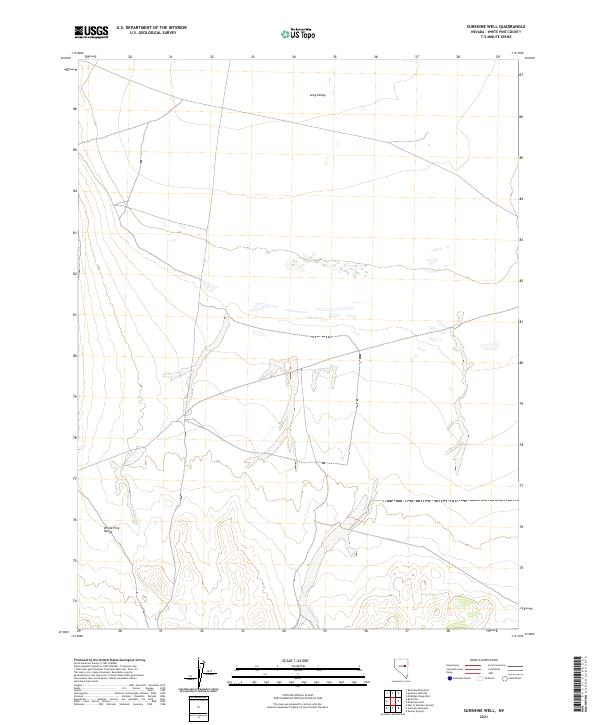 2021 Sunshine Well2021 Print · USGSWhite Pine County's high-desert basin and mountain slopes are captured here in the early twenty-first century. Researchers can trace the elevation changes from the White Pine Range to the wetlands of Long Valley and navigate the survey boundaries of T20N R58E.
 - 2021 Map of Green Springs, 2021 Print
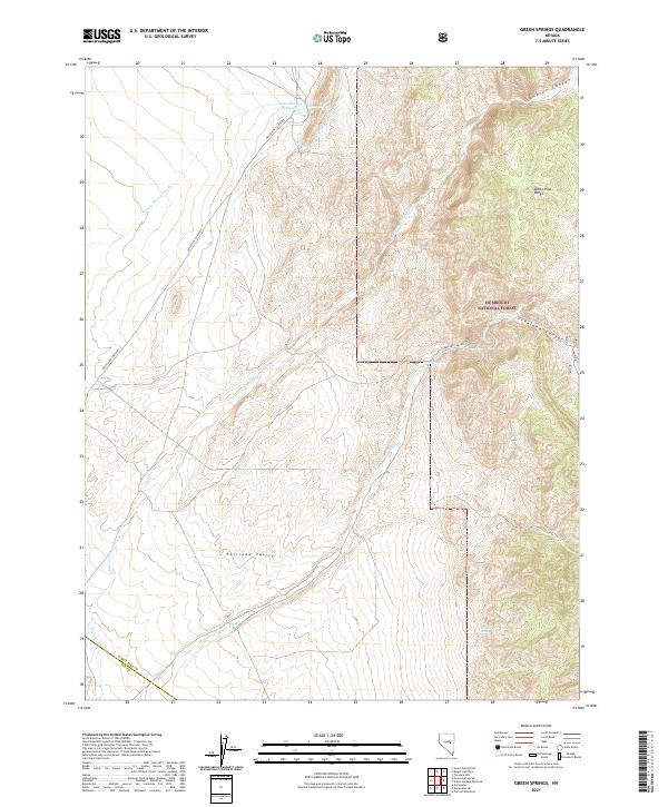 2021 Green Springs2021 Print · USGSWhite Pine County's high-desert basins and mountain ranges are documented here in the early twenty-first century. Genealogists and historians can trace water rights and access routes around Green Springs Reservoir, Mustang Spring, and the Railroad Valley.
 - 2021 Map of Antelope Mountain, 2021 Print
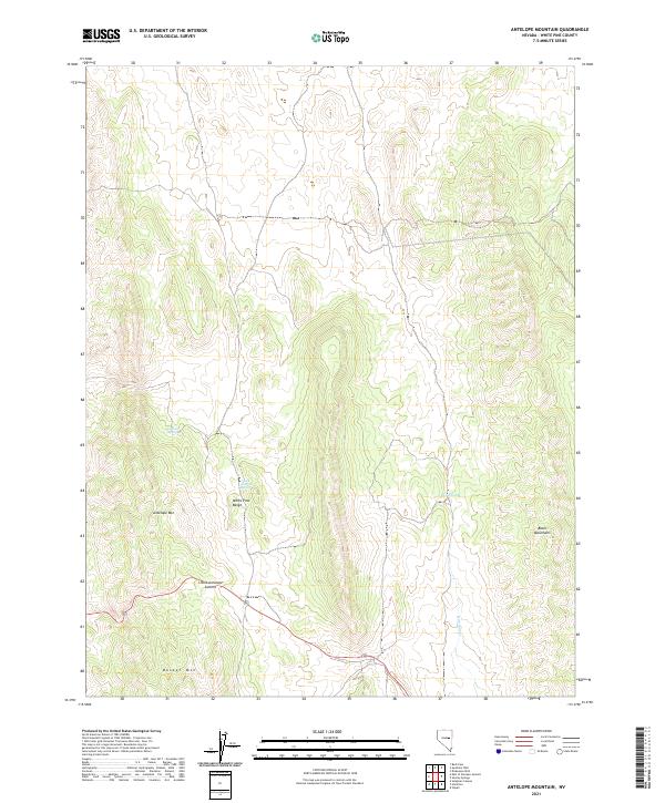 2021 Antelope Mountain2021 Print · USGSWhite Pine County's high-desert interior is shown in this contemporary study of its prominent mountain ranges and summits. Researchers can trace historical routes through Little Antelope Summit and locate remote water sources like Antelope Spring and Divide Spring.
 - 2021 Map of Rock Springs Pass, 2021 Print
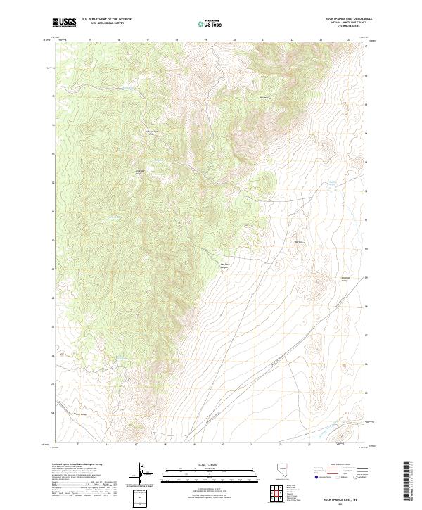 2021 Rock Springs Pass2021 Print · USGSWhite Pine County's high desert landscape is detailed here in the early twenty-first century. Researchers can trace the critical network of desert water sources and mountain passes, including Rock Springs Pass, Dipping Tank Spring, and the prominent landmark of The Mitten.
 - 2021 Map of Mount Grafton, 2021 Print
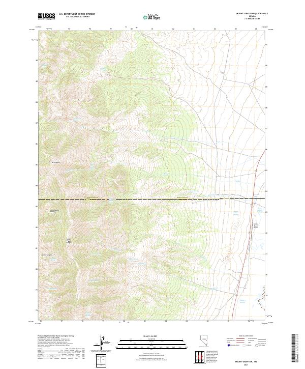 2021 Mount Grafton2021 Print · USGSThe high peaks of the Schell Creek Range define this eastern Nevada landscape at the start of the twenty-first century. Researchers can trace remote water sources and aviation history through features like Schwartz Tunnel Spring and the Geyser Ranch Airport.
 - 2021 Map of Tin Springs Mountain, 2021 Print
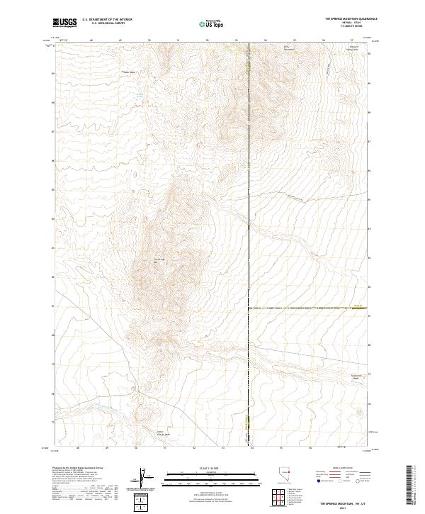 2021 Tin Springs Mountain2021 Print · USGSThe high-desert border between Nevada and Utah is documented here as it appeared in the early twenty-first century. Researchers can trace the drainages of the Kern Mountains and locate remote landmarks like Sulphur Spring, Tin Spring, and Tungstonia Wash.
 - 2021 Map of Red Ledges, 2021 Print
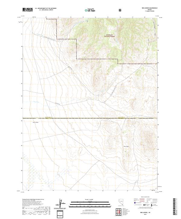 2021 Red Ledges2021 Print · USGSThe high desert borderlands of White Pine and Lincoln counties are shown in detail during the early twenty-first century. Researchers can trace remote transit routes like Johns Wash Rd and explore the rugged geology of the Red Ledges and West Fork Canyon.
 - 2021 Map of Stonehouse, 2021 Print
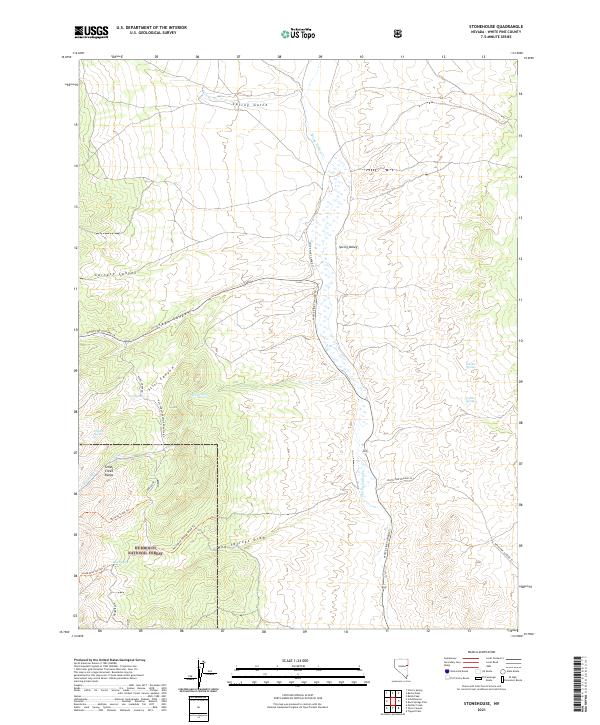 2021 Stonehouse2021 Print · USGSWhite Pine County remains a landscape of high-basin springs and forested peaks in the early twenty-first century. Researchers can trace historic access routes like Siegel Creek Rd and locate vital water sources including Mud Springs and Golden Springs.
 - 2021 Map of Minerva Canyon, 2021 Print
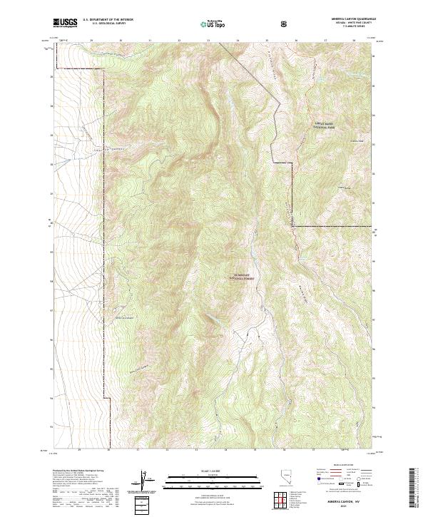 2021 Minerva Canyon2021 Print · USGSWhite Pine County in the early 2020s remains a high-altitude wilderness defined by the dramatic peaks of the Snake Range. Map enthusiasts can trace the rugged access via Swallow Canyon Rd or locate vital water at Mustang Spring and Decathon Spring.
 - 2021 Map of Duckwater NE, 2021 Print
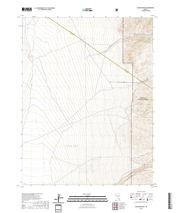 2021 Duckwater NE2021 Print · USGSRailroad Valley and the Humboldt National Forest meet in this 2021 survey of the Nye and White Pine county line. Researchers can trace remote desert water sources like Blackrock Spring and mountain paths through White River Pass Canyon.
Showing maps 1-25 of 182
Top cities of White Pine County
Frequently asked questions
- What are the different types of historical maps available for White Pine County?
- What is the oldest map of White Pine County?
- Where can I purchase historical maps of White Pine County for my home or office?
- Where can I download high-res historical maps of White Pine County?
- Are there historical topographic maps available for White Pine County?
- Is there historical aerial imagery available for White Pine County?
- Where are historical maps of White Pine County sourced from?