1980s Maps of White Pine County, Nevada
Explore 100 historic maps of White Pine County from the 1980s. These maps offer a rare glimpse into what life looked like during the 1980s — showing old roads, neighborhoods, homes, and landmarks that have changed or disappeared over time.
Whether you're researching your family's past, planning a metal detecting trip, or studying how White Pine County's landscape evolved across the 1980s, these high-resolution maps are a powerful tool for exploring the history of this region.
- Focus on a specific era: All maps on this page are from the 1980s, giving you a focused view of this time period.
- See what’s changed: Compare century-old streets, trails, and buildings to today's modern landscape using overlays and satellite layers.
- Research with precision: Use these maps for genealogy, historical research, land use analysis, or educational projects.
- View, download, or print: Maps are fully viewable online in high resolution, and can be downloaded or printed for your own records.
Start exploring White Pine County's history through authentic maps from the 1980s. This is your window into the past.
White Pine County, NV maps
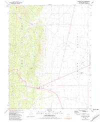
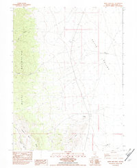
(100)- 1980 Map of Duckwater, 1981 Print
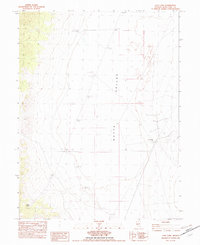
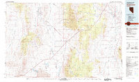 1980 Duckwater1981 Print · USGSNye County and White Pine County are shown here in the early eighties as a landscape of isolated valleys and high mountain ranges. Genealogists and researchers can trace remote settlements like Duckwater, locate the Gold Point Mine, or find the unique Meteorite Crater.2 unique versions available
 - 1981 Map of Tippett Canyon
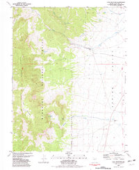
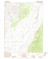
 1981 Tippett Canyon1981 Print · USGSWhite Pine County ranching and reservation lands are captured in the early 1980s, showcasing the high-desert terrain near the Goshute Indian Reservation Boundary. Researchers can trace old stock routes and mining activity near Tippett Canyon, Moffitt Spring, and the Prospects in the South Mountains.
 - 1981 Map of Spring Creek Flat NW
 1981 Spring Creek Flat NW1981 Print · USGSEastern Nevada's high desert reveals its frontier history in the early eighties, specifically along the Goshute Indian Reservation Boundary. Researchers can locate the Pony Express Historical Monument and trace old routes like Whiskey Road across Spring Creek Flat.
 - 1981 Map of North Schell Peak
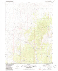
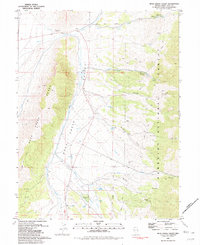
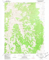
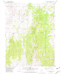
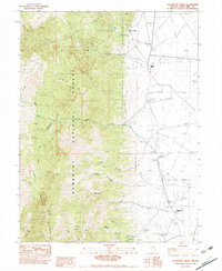
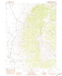
 1981 North Schell Peak1981 Print · USGSThe Schell Creek Range and Spring Valley met in the early 1980s at a landscape of high forest and valley-floor ranching. Trace early pioneer footprints at Piermont (Historic Site), locate family-named landmarks like Bassett Ranch, or find the secluded Grave near the creek.2 unique versions available
 - 1981 Map of Duck Creek Valley
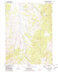
 1981 Duck Creek Valley1981 Print · USGSThe high desert of eastern Nevada is captured here in the early eighties, showcasing a working landscape of ranching and recreation. Researchers can trace family-named sites like Pescio Ranch and Pat and Mike Springs or locate the Brennen Mine.2 unique versions available
 - 1981 Map of Georgetta Ranch
 1981 Georgetta Ranch1981 Print · USGSThe Nevada-Utah borderlands are captured in the early eighties as a landscape of remote ranching and desert transit. Genealogists and historians can trace the foundations of Georgetta Ranch, the route of Whiskey Road, and the extent of the Goshute Indian Reservation.
 - 1981 Map of Weaver Canyon
 1981 Weaver Canyon1981 Print · USGSThe Nevada-Utah borderlands are captured here in the early eighties, where the Goshute lands meet the Great Basin high country. Family researchers and historians can trace the remote Thomas Place ranch and old mineral claims like the Lucky Strike Mine.
 - 1981 Map of Connors Pass
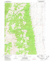
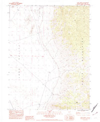
 1981 Connors Pass1981 Print · USGSThe Schell Creek Range was a hub of silver mining activity in the early 1980s. Local historians and mineral hunters can trace industrial sites like the Monitor Mine and Taylor Shaft alongside the older foundations of Taylor.3 unique versions available
 - 1981 Map of Majors Place
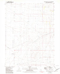
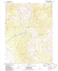
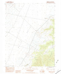
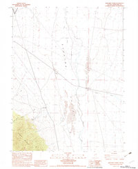
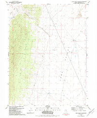
 1981 Majors Place1981 Print · USGSIn the early 1980s, the crossroads at Majors Place anchored this high-desert landscape at the edge of the Humboldt National Forest. Researchers can trace old resource extraction sites at Rattlesnake Knoll and locate historical Ruins near the canyon mouth.3 unique versions available
 - 1981 Map of South Schell Peak, 1982 Print
 1981 South Schell Peak1982 Print · USGSThe high peaks of the Nevada wilderness come into focus in the early 1980s, revealing a landscape defined by water management and mineral exploration. Researchers can trace the path of an aqueduct and a remote Prospect near the rugged summits of South Schell Peak and Taft Peak.2 unique versions available
 - 1981 Map of Cleve Creek Baldy, 1982 Print
 1981 Cleve Creek Baldy1982 Print · USGSThe high country of the Schell Creek Range in the early 1980s reveals a rugged landscape of mining and ranching activity. Genealogists and historians can trace family-named sites like Pescio Ranch or locate industrial history at the Success Mine and Brennen Mine.2 unique versions available
 - 1981 Map of Cave Creek, 1982 Print
 1981 Cave Creek1982 Print · USGSWhite Pine County in the early 1980s reveals a landscape of high-country mining and vital water resources. You can trace the rugged drainages of the Schell Creek Range to find the Kolcheck Mine, Cave Creek Reservoir, and secluded springs like East Canyon Spring.2 unique versions available
 - 1981 Map of Cave Mountain, 1982 Print
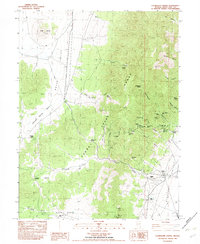
 1981 Cave Mountain1982 Print · USGSThe Schell Creek Range and Spring Valley meet in this early 1980s survey of eastern Nevada. Researchers can locate Bastian Creek Ranch, the Cleve Creek Campground, and numerous remote prospects and springs.2 unique versions available
 - 1982 Map of Chin Creek Spring
 1982 Chin Creek Spring1982 Print · USGSNortheastern Nevada's high desert reveals its sparse water network and mining history in the early 1980s. Researchers can locate remote resource points like Stockade Spring and Chin Creek Spring or trace mining prospects along the Antelope Range.
 - 1982 Map of Ninemile Well
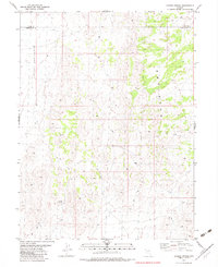
 1982 Ninemile Well1982 Print · USGSWhite Pine County in the late seventies is a land of isolated water points and high desert peaks. Trace the geography of the Cherry Creek Range and locate essential desert landmarks like Ninemile Well, Pot Spring, and Mustang Hill.
 - 1982 Map of Ayarbe Spring
 1982 Ayarbe Spring1982 Print · USGSNortheastern Nevada in the early eighties was a landscape of open range and high-desert cattle country. Trace the remote boundary of White Pine Co through Ayarbe Spring, Domingo Well, and the difficult terrain of the Badlands.
 - 1982 Map of Junction Well
 1982 Junction Well1982 Print · USGSWhite Pine County ranching and survey history are preserved in this early 1980s study of the high desert basin. Researchers can locate remote water sources and early tracks, including Junction Well, Cabin Spring, and the network of 4WD trails crossing Long Valley.
 - 1982 Map of Kalamazoo Creek
 1982 Kalamazoo Creek1982 Print · USGSWhite Pine County ranching and water management are captured here in the early eighties. Researchers can trace the irrigation networks of the Eldridge Ranch and the mountain drainages of Kalamazoo Creek and Fandango Canyon.2 unique versions available
 - 1982 Map of Cabin Spring
 1982 Cabin Spring1982 Print · USGSHigh desert ranching life in the early eighties defines this White Pine County basin. Researchers can trace remote water sources and grazing camps like Cow Camp, Tognini Spring, and McBrides Sheep Well along the edge of the Butte Mountains.
 - 1982 Map of Borchert Spring
 1982 Borchert Spring1982 Print · USGSSteptoe Valley was a landscape of remote ranching and desert drainage during the early eighties. Genealogists and local historians can trace the foundations of Borchert Ranch and locate points like Ray, Raiff, and the Borchert Spring.
 - 1982 Map of White Sage Well
 1982 White Sage Well1982 Print · USGSWhite Pine County ranching and terrain are captured in this early 1980s record of the Nevada high desert. Researchers can locate critical water sources and livestock markers like Uhalde Well, White Sage Well, and the prominent Eightmile Point.
 - 1982 Map of McBrides Sheep Well
 1982 McBrides Sheep Well1982 Print · USGSWhite Pine County ranching life is captured in the early 1980s as the valley floor meets the high desert peaks. Researchers can locate remote outposts like McBrides Sheep Well, the Thirtymile Ranch, and the settlement of Purple.
 - 1982 Map of Long Valley Slough
 1982 Long Valley Slough1982 Print · USGSWhite Pine County's high desert landscape was thoroughly documented in the early eighties, capturing a remote region of basins and ridges. Researchers can trace historic water sources and ranching landmarks like Mooney Basin Well, Jesses Well, and the seasonal Long Valley Slough.
 - 1982 Map of Exchequer Spring
 1982 Exchequer Spring1982 Print · USGSWhite Pine County mining and ranching life are captured here in the early eighties as operations clustered in the high canyons. Genealogists and historians can trace family-named sites like Madellina Ranch and Salvi Ranch or locate the former settlement of Niptown.
 - 1982 Map of Cow Camp
 1982 Cow Camp1982 Print · USGSWhite Pine County in the early eighties reveals a working landscape centered on the ranching and resource exploration of Butte Valley. Researchers can trace the vital network of desert water sources like Robison Well and the remote outpost at Cow Camp.
Showing maps 1-25 of 100
Top cities of White Pine County
Frequently asked questions
- What are the different types of historical maps available for White Pine County?
- What is the oldest map of White Pine County?
- Where can I purchase historical maps of White Pine County for my home or office?
- Where can I download high-res historical maps of White Pine County?
- Are there historical topographic maps available for White Pine County?
- Is there historical aerial imagery available for White Pine County?
- Where are historical maps of White Pine County sourced from?