1920s Maps of New Hampshire
Explore 28 historic maps of New Hampshire from the 1920s. These maps offer a rare glimpse into what life looked like during the 1920s — showing old roads, neighborhoods, homes, and landmarks that have changed or disappeared over time.
Whether you're researching your family's past, planning a metal detecting trip, or studying how New Hampshire's landscape evolved across the 1920s, these high-resolution maps are a powerful tool for exploring the history of this region.
- Focus on a specific era: All maps on this page are from the 1920s, giving you a focused view of this time period.
- See what’s changed: Compare century-old streets, trails, and buildings to today's modern landscape using overlays and satellite layers.
- Research with precision: Use these maps for genealogy, historical research, land use analysis, or educational projects.
- View, download, or print: Maps are fully viewable online in high resolution, and can be downloaded or printed for your own records.
Start exploring New Hampshire's history through authentic maps from the 1920s. This is your window into the past.
New Hampshire maps
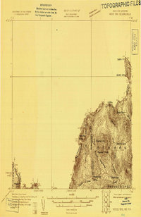
(28)- 1920 Map of York
 1920 York1920 Print · USGSThe Maine and New Hampshire shoreline comes to life during the late 1910s, showing a region balanced between naval defense and coastal commerce. Genealogists and historians can locate old landmarks like the Lincoln School, the Coast Guard Sta, and the path of the Electric Railway.6 unique versions available
 - 1920 Map of Guildhall
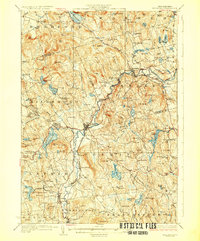
 1920 Guildhall1920 Print · USGSThe upper Connecticut River valley is captured here in the early twentieth century as a bustling railroad corridor on the border of Vermont and New Hampshire. Genealogists can trace family names at Wheeler Corner or Hapgood Corner and locate regional hubs like North Stratford and Guildhall Station.
 - 1921 Map of Suncook
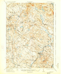
 1921 Suncook1921 Print · USGSMerrimack and Suncook River valleys thrive in the early 1920s as bustling centers of rail travel and local education. Genealogists can locate family homesteads near dozens of rural schoolhouses like Borough School or trace the old Boston and Maine Railroad through Suncook and Hooksett.5 unique versions available
 - 1921 Map of Lowell
 1921 Lowell1921 Print · USGSThe industrial corridor of the Merrimack Valley is captured here during the early twentieth century, showing the dense urban grid of Lowell alongside rural Middlesex County. Researchers can trace the extensive reach of the Boston and Maine Railroad and locate local landmarks like the Poor Farm or Flat Rock Quarry.
 - 1925 Map of Indian Stream
 1925 Indian Stream1925 Print · USGSThe northern tip of New Hampshire is captured here in the mid-1920s, showing a rugged territory of logging camps and border schools. Researchers can trace the lineage of remote settlements through Indian Stream School, Greeleys Camp, and the community at Happy Corner.
 - 1925 Map of Holderness, 1956 Print
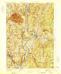
 1925 Holderness1956 Print · USGSCentral New Hampshire in the mid-twenties centers on the Pemigewasset River and the bustling rail corridor. Genealogists can trace a network of rural schoolhouses like Sargent School and landmarks including Profile Falls and the Bay Meeting House.
 - 1926 Map of Hillsboro
 1926 Hillsboro1926 Print · USGSHillsborough County's mill towns and hill farms are captured here in the mid-1920s as the rail-and-river economy remained the local heartbeat. Researchers can trace the Boston and Maine line through Slab City or locate the Birthplace of Franklin Pierce near Jackman Reservoir.2 unique versions available
 - 1926 Map of Indian Stream
 1926 Indian Stream1926 Print · USGSUpper Coos County at the Canadian border comes alive in this survey of northern New Hampshire's timberlands and early settlements. Genealogists and historians can trace rural schoolhouses like Wheeler School and Indian Stream School, or locate old camps such as Happy Corner and Depot Camp.4 unique versions available
 - 1926 Map of Claremont, 1955 Print
 1926 Claremont1955 Print · USGSThe Connecticut River valley thrives in the mid-twenties as a hub of industry and transit between Vermont and New Hampshire. Tracing these hills reveals historic crossings like Cornish Bridge, the Sullivan County Farm, and the early Claremont Airport.
 - 1927 Map of Concord
 1927 Concord1927 Print · USGSMerrimack and Hillsborough counties show a landscape of river-driven industry and rural school districts during the mid-twenties. Genealogists can trace family lines through dozens of local schoolhouses and institutions like St Pauls School or the Quaker Church.6 unique versions available
 - 1927 Map of Bellows Falls
 1927 Bellows Falls1927 Print · USGSThe borderlands of the Connecticut River valley are captured in the late 1920s, showing the vital rail links between Vermont and New Hampshire. Genealogists and local historians can trace rural schoolhouse districts like Mica Mine Sch, the grounds of the Kern-Hattin Home, and the layout of Westmoreland Depot.4 unique versions available
 - 1927 Map of Penacook
 1927 Penacook1927 Print · USGSThe Merrimack and Winnipesaukee valleys in the mid-1920s reveal a landscape of river-powered industry and rural school districts. Researchers can trace dozens of family-named landmarks and institutions, from Kezer Seminary to the Soldiers Home and Swetts Mills.8 unique versions available
 - 1927 Map of Indian Stream
 1927 Indian Stream1927 Print · USGSThe northern reaches of Coos County are captured here in the mid-1920s, showing the remote borderlands between New Hampshire and Canada. Genealogists and historians can locate rural landmarks like the Clarksville Town Hall, the Wheeler School, and numerous timber camps like Varney Camp.5 unique versions available
 - 1927 Map of Moose Bog
 1927 Moose Bog1927 Print · USGSThe wilderness of the North Woods is charted in the late twenties along the border where Maine, New Hampshire, and Quebec meet. Researchers can trace the remote Bowman Farm and the high-elevation wetlands of Moose Bog and the Third East Branch Magalloway River.3 unique versions available
 - 1927 Map of Gilmanton
 1927 Gilmanton1927 Print · USGSBelknap and Merrimack Counties appear here in the late twenties, showing a landscape of rural schoolhouses and established hill towns. Genealogists can trace family names through landmarks like Smith Meetinghouse, Shaker Village, and the South Pittsfield Friends Meetinghouse.5 unique versions available
 - 1927 Map of Holderness
 1927 Holderness1927 Print · USGSThe Lakes Region in the late twenties reveals a landscape of small hill-town schools and winding river valleys. Genealogists can locate family landmarks like Sargent School, Dana Church, and numerous small waters from Squam Lake to Wickwas Pond.6 unique versions available
 - 1927 Map of Second Lake, 1955 Print
 1927 Second Lake1955 Print · USGSNorthern New Hampshire's high timberlands and the Connecticut River headwaters appear in the late twenties, spanning from the Canadian border down to the academy grants. Researchers can locate remote logging outposts like Depot Camp and Camp No 32 or trace the early shorelines of Second Lake and First Connecticut Lake.6 unique versions available
 - 1927 Map of Cardigan, 1957 Print
 1927 Cardigan1957 Print · USGSGrafton and Merrimack Counties were defined by rail-side industry and early lakeside tourism in the late 1920s. Genealogists and historians can trace defunct schoolhouses like School No 8 and find deep-woods sites like the Alexandria Mica Mine.
 - 1927 Map of Mascoma, 1957 Print
 1927 Mascoma1957 Print · USGSGrafton County's hill towns and valleys are caught in detail during the late 1920s, showing the settled character of the New Hampshire interior. Genealogists can trace family names through landmarks like Washburn Corner or locate the distinctive Lower Shaker Village and Upper Shaker Village.3 unique versions available
 - 1928 Map of Mount Kearsarge
 1928 Mount Kearsarge1928 Print · USGSMerrimack County and the surrounding highlands are captured in the late 1920s as the rail-and-river economy flourished. Genealogists and historians can trace defunct schools and rural crossroads like Scribners Corner, the BOSTON AND MAINE RR corridor, and the COAL HEARTH CEMETERY.5 unique versions available
 - 1928 Map of Wolfeboro
 1928 Wolfeboro1928 Print · USGSThe Lakes Region thrives in the late twenties as a premier destination for rail travelers and summer residents. Trace family history through Wolfeboro landmarks like Brewster Academy or find old stop-offs along the Boston and Maine RR.7 unique versions available
 - 1928 Map of Plymouth, 1953 Print
 1928 Plymouth1953 Print · USGSGrafton County is captured in the late 1920s as its river towns and mountain resorts began to modernize. Genealogists can trace family footprints at Blair Cemetery or locate old schoolhouses like Pulsifer Hill Sch and Thornton Center Sch along the valley roads.5 unique versions available
 - 1928 Map of Rumney, 1955 Print
 1928 Rumney1955 Print · USGSGrafton County is shown here in the late twenties as a bustling corridor of rail and river industry. Genealogists can trace the rural schoolhouses and stops along the Boston and Maine Railroad, from West Rumney PO to the logging outposts at Camp No 5.3 unique versions available
 - 1929 Map of Claremont
 1929 Claremont1929 Print · USGSThe Upper Connecticut River Valley thrives in the late twenties as a hub of manufacturing and mountain farming. You can trace early rail-and-river industrial sites at Claremont and Windsor, or locate ancestral rural schoolhouses like Brick Sch and Red Sch.4 unique versions available
 - 1929 Map of Hillsboro
 1929 Hillsboro1929 Print · USGSCentral New Hampshire in the late twenties reveals a landscape of river-powered towns and remote hill farms. Trace family history at the Birthplace of Franklin Pierce or locate old schoolhouses like Liberty Union Sch and Hemlock Sch.5 unique versions available
Showing maps 1-25 of 28
Top cities of New Hampshire
- Manchester historical maps
- Nashua historical maps
- Concord historical maps
- Derry historical maps
- Dover historical maps
- Rochester historical maps
See more
Top counties of New Hampshire
- Hillsborough County historical maps
- Rockingham County historical maps
- Merrimack County historical maps
- Strafford County historical maps
- Grafton County historical maps
- Cheshire County historical maps
See more
Frequently asked questions
- What are the different types of historical maps available for New Hampshire?
- What is the oldest map of New Hampshire?
- Where can I purchase historical maps of New Hampshire for my home or office?
- Where can I download high-res historical maps of New Hampshire?
- Are there historical topographic maps available for New Hampshire?
- Is there historical aerial imagery available for New Hampshire?
- Where are historical maps of New Hampshire sourced from?