1960s Maps of New Hampshire
Explore 52 historic maps of New Hampshire from the 1960s. These maps offer a rare glimpse into what life looked like during the 1960s — showing old roads, neighborhoods, homes, and landmarks that have changed or disappeared over time.
Whether you're researching your family's past, planning a metal detecting trip, or studying how New Hampshire's landscape evolved across the 1960s, these high-resolution maps are a powerful tool for exploring the history of this region.
- Focus on a specific era: All maps on this page are from the 1960s, giving you a focused view of this time period.
- See what’s changed: Compare century-old streets, trails, and buildings to today's modern landscape using overlays and satellite layers.
- Research with precision: Use these maps for genealogy, historical research, land use analysis, or educational projects.
- View, download, or print: Maps are fully viewable online in high resolution, and can be downloaded or printed for your own records.
Start exploring New Hampshire's history through authentic maps from the 1960s. This is your window into the past.
New Hampshire maps
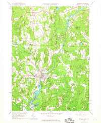
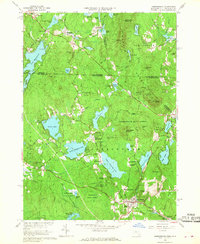
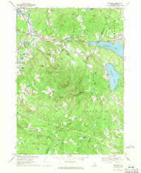
(52)- 1961 Map of Lewiston
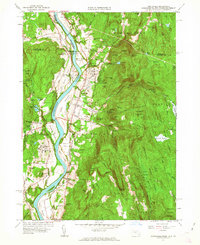
 1961 Lewiston1961 Print · USGSWestern Maine and the White Mountains appear here during the early sixties, showing the industrial river towns and vast timberlands before the modern interstate era. Genealogists and historians can trace the Grand Trunk RR through Berlin or locate landmarks like Old Speck Mountain and Elephant Mountain.
 - 1961 Map of Boston
 1961 Boston1961 Print · USGSThe Massachusetts coastline and its industrial interior are detailed here in the mid-twentieth century, from the Monadnock highlands to Cape Cod. Researchers can trace the rail routes of the Boston and Maine or locate landmarks like Fort Devens and the Wachusett Reservoir.2 unique versions available
 - 1961 Map of Mt Grace, 1963 Print
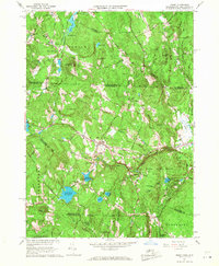
 1961 Mt Grace1963 Print · USGSUpper Franklin County and the New Hampshire borderlands are captured here in the early 1960s as a region of forestry and small rural hamlets. Genealogists can locate family sites at South Cem or Newton Cem, while hikers can trace the terrain around Mt Grace and Tully Mtn.
 - 1961 Map of Northfield, 1963 Print
 1961 Northfield1963 Print · USGSThe Connecticut River valley at the tri-state border was a hub of academic and rail life in the early sixties. Genealogists can trace family plots at West Northfield Cem and Coller Cem or locate the sprawling grounds of the Northfield School for Boys.2 unique versions available
 - 1962 Map of Lewiston
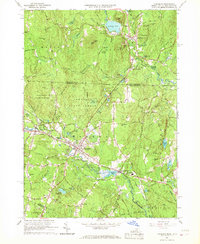
 1962 Lewiston1962 Print · USGSThe industrial river valleys and high peaks of Maine and New Hampshire define the region in the early sixties. Trace the rail-and-river network from Lewiston to the White Mountains, passing through mill towns like Berlin and Rumford.
 - 1962 Map of Albany
 1962 Albany1962 Print · USGSThe Hudson and Connecticut River valleys meet the Green Mountains and Berkshires in this mid-century overview of the Northeast. Genealogists and historians can trace the industrial hearts of Albany and Springfield or locate features like Quabbin Reservoir and Westover Air Force Base.
 - 1962 Map of Lake Champlain, 1975 Print
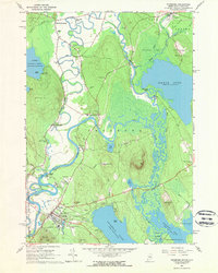
 1962 Lake Champlain1975 Print · USGSLake Champlain and the high peaks of the Adirondacks and Green Mountains are captured here during the mid-twentieth century. Researchers can trace the industrial legacy of the Lyon Mountain Mine and the rail corridors of the Central Vermont RR and Delaware & Hudson RR.3 unique versions available
 - 1963 Map of Portland
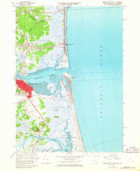
 1963 Portland1963 Print · USGSCoastal Maine and New Hampshire thrived as maritime and industrial hubs during the mid-sixties, linked by a dense network of rail and river. Researchers can trace historic transit corridors like the Maine Central RR and locate key sites such as the Portsmouth Naval Shipyard or Pease Air Force Base.3 unique versions available
 - 1963 Map of Jackman
 1963 Jackman1963 Print · USGSThe international borderlands of Maine and Quebec come alive in the mid-twentieth century, showing a landscape of timber towns and rail connections. Genealogists and historians can trace the paths of the Canadian Pacific Railway through Jackman or locate families in Sherbrooke and Megantic.
 - 1963 Map of Fryeburg, 1965 Print
 1963 Fryeburg1965 Print · USGSOxford County settlement and the meandering Saco River define this mid-century survey of the Maine-New Hampshire border. Genealogists and local historians can locate numerous family burial grounds like Riverside Cem and Wiley Cem, along with landmarks like Fryeburg Academy.2 unique versions available
 - 1964 Map of Glens Falls
 1964 Glens Falls1964 Print · USGSThe tri-state borderlands of New York, Vermont, and New Hampshire appear here in the mid-1960s. Researchers can trace the rail routes of the Rutland RR and find historic sites like Ticonderoga and Saratoga National Historical Park.
 - 1964 Map of Brownfield, 1966 Print
 1964 Brownfield1966 Print · USGSOxford County settlement and the Saco River valley are captured here in the mid-sixties. Genealogists and local historians can trace family burial sites at Merrill Cem and Wentworth Cem or follow the path of the Maine Central Railroad.2 unique versions available
 - 1964 Map of Kezar Falls, 1966 Print
 1964 Kezar Falls1966 Print · USGSThe Maine-New Hampshire borderlands near Kezar Falls are captured here in the mid-sixties, showing a landscape of river-driven towns and upland ponds. Genealogists can trace family lines through numerous rural burial grounds like Churchill Cem and local landmarks such as the Parsonsfield Seminary.4 unique versions available
 - 1965 Map of Pepperell, 1967 Print
 1965 Pepperell1967 Print · USGSThe Nashua River Valley comes alive in the mid-1960s as it spans the border between New Hampshire and Massachusetts. Genealogists and historians can trace the Boston and Maine Railroad, locate the Covered Bridge, and find old burials at Blood Cem or South Cem.3 unique versions available
 - 1965 Map of Townsend, 1967 Print
 1965 Townsend1967 Print · USGSTownsend and Brookline are captured in the mid-1960s as the rail and river corridor through the Squannacook River valley remained central to local life. Researchers can trace historic family landmarks and civic sites like Lakeview Cem, Daniels Academy, and the Boston and Maine rail line.5 unique versions available
 - 1965 Map of Ashby, 1968 Print
 1965 Ashby1968 Print · USGSThe hill towns of the Massachusetts borderlands are captured here in the mid-1960s, showing a landscape of state forests and quiet village centers. Genealogists can locate family plots in Glenwood Cem or West Cem and trace the paths through South Village and Gibson Four Corners.4 unique versions available
 - 1965 Map of Nashua South, 1968 Print
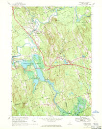
 1965 Nashua South1968 Print · USGSThe Merrimack River valley and the expanding outskirts of Nashua come into sharp focus in the mid-sixties. Genealogists and local historians can trace the foundations of Dunstable and Tyngsborough, locating Evergreen Cem and Whidden Corner.7 unique versions available
 - 1965 Map of Ashburnham, 1968 Print
 1965 Ashburnham1968 Print · USGSThe Worcester County highlands during the mid-sixties show a landscape of glacial lakes and quiet hill towns. Genealogists can locate family sites near St Dennis Cem or trace the early industrial footprint of Factory Village and Cushing Academy.5 unique versions available
 - 1966 Map of Sherbrooke
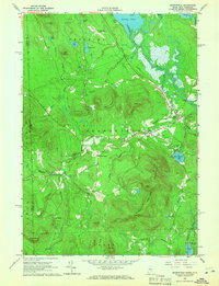
 1966 Sherbrooke1966 Print · USGSThe borderlands of Quebec and Maine come alive in the mid-1960s, documenting the industrial towns and deep woods of the Northeast. Genealogists can trace family lines through Sherbrooke and Coaticook, or locate remote logging outposts along the Moose River and Flagstaff Lake.
 - 1966 Map of Newburyport East, 1968 Print
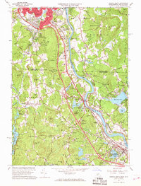
 1966 Newburyport East1968 Print · USGSCoastal Massachusetts and New Hampshire meet at the Merrimack during the mid-sixties, capturing the maritime character of this historic estuary. Genealogists can locate family plots in Oak Hill Cem or the First Parish Burying Ground, while maritime historians can trace the Newburyport Light and U S Coast Guard Station.3 unique versions available
 - 1966 Map of Lawrence, 1968 Print
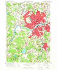 1966 Lawrence1968 Print · USGSThe industrial heart of the Merrimack Valley is captured here in the mid-sixties, showing the intersection of historic rail corridors and new interstate highways. Genealogists can trace family sites across Bellevue Cemetery, Phillips Academy, and the distinct neighborhoods of South Lawrence and Methuen.2 unique versions available
 - 1966 Map of Lowell, 1968 Print
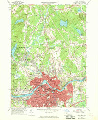 1966 Lowell1968 Print · USGSMid-century Lowell and Dracut are captured here just as the river-based industry was being joined by suburban expansion and interstate connectors. Genealogists and local historians can trace family sites from the Israel Brotherhood Cem to the Lowell Technological Institute and old Middlesex Village.5 unique versions available
 - 1967 Map of Gossville, 1971 Print
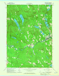
 1967 Gossville1971 Print · USGSThe Suncook River valley and the highlands of Merrimack County are captured here in the late sixties as traditional village life met growing state parklands. Trace the route of the Suncook Valley RR and locate local landmarks like Epsom Central Sch or the McClary Cem.4 unique versions available
 - 1967 Map of Hopkinton, 1971 Print
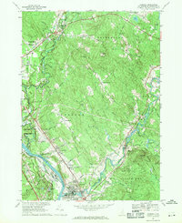
 1967 Hopkinton1971 Print · USGSMerrimack County during the late 1960s shows a landscape transformed by the Hopkinton-Everett Reservoir and modern highway interchanges. Researchers can trace ancestral roots at Putney Cem or explore the transit history of the Claremont and Concord Railroad and the landmark Covered Bridge.2 unique versions available
 - 1967 Map of Suncook, 1971 Print
 1967 Suncook1971 Print · USGSMerrimack County communities are captured in the late sixties as the river-and-rail economy transitioned toward modern regional growth. Researchers can trace family roots at Stanley Cem, explore the historic Pembroke Academy, or follow the Boston and Maine Railroad through Suncook.3 unique versions available
Showing maps 1-25 of 52
Top cities of New Hampshire
- Manchester historical maps
- Nashua historical maps
- Concord historical maps
- Derry historical maps
- Dover historical maps
- Rochester historical maps
See more
Top counties of New Hampshire
- Hillsborough County historical maps
- Rockingham County historical maps
- Merrimack County historical maps
- Strafford County historical maps
- Grafton County historical maps
- Cheshire County historical maps
See more
Frequently asked questions
- What are the different types of historical maps available for New Hampshire?
- What is the oldest map of New Hampshire?
- Where can I purchase historical maps of New Hampshire for my home or office?
- Where can I download high-res historical maps of New Hampshire?
- Are there historical topographic maps available for New Hampshire?
- Is there historical aerial imagery available for New Hampshire?
- Where are historical maps of New Hampshire sourced from?