1930s Maps of New Hampshire
Explore 66 historic maps of New Hampshire from the 1930s. These maps offer a rare glimpse into what life looked like during the 1930s — showing old roads, neighborhoods, homes, and landmarks that have changed or disappeared over time.
Whether you're researching your family's past, planning a metal detecting trip, or studying how New Hampshire's landscape evolved across the 1930s, these high-resolution maps are a powerful tool for exploring the history of this region.
- Focus on a specific era: All maps on this page are from the 1930s, giving you a focused view of this time period.
- See what’s changed: Compare century-old streets, trails, and buildings to today's modern landscape using overlays and satellite layers.
- Research with precision: Use these maps for genealogy, historical research, land use analysis, or educational projects.
- View, download, or print: Maps are fully viewable online in high resolution, and can be downloaded or printed for your own records.
Start exploring New Hampshire's history through authentic maps from the 1930s. This is your window into the past.
New Hampshire maps
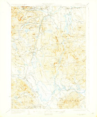
(66)- 1930 Map of Cardigan
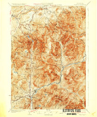
 1930 Cardigan1930 Print · USGSGrafton County's granite hills and lakeside settlements are captured here in the late prohibition era. Genealogists and hikers can trace the original locations of rural schoolhouses like Crawford Sch, the workings of the Alexandria Mica Mines, and the old rail stops at Grafton Sta.7 unique versions available
 - 1930 Map of Ossipee Lake
 1930 Ossipee Lake1930 Print · USGSCarroll County at the dawn of the 1930s shows a landscape of lakeside villages and mountain resorts connected by the Boston and Maine Railroad. Genealogy researchers can trace family sites like the Albany Cem, Mountain Ch, or old schoolhouses like the Nickerson Sch.8 unique versions available
 - 1930 Map of Lovewell Mountain
 1930 Lovewell Mountain1930 Print · USGSThe Cheshire and Sullivan County borderlands come alive in this late 1920s survey of the New Hampshire highlands. Researchers can locate long-standing crossroads like East Lempster, find vanished rural education at Fifield Sch, or trace the old Loverens Mill site.4 unique versions available
 - 1930 Map of Bellows Falls
 1930 Bellows Falls1930 Print · USGSThe Connecticut River valley thrives between Vermont and New Hampshire in the late twenties, anchored by the rail hub at Bellows Falls. Researchers can trace old district schools like Derry Hill Sch and find family-named landmarks such as Dodge Tavern.7 unique versions available
 - 1930 Map of Milan, 1952 Print
 1930 Milan1952 Print · USGSThe upper Androscoggin River valley is captured here in the early thirties, showing a rugged landscape of timber ridges and river-fed settlements. Genealogists can locate several local schools such as Jewett Sch and the rail-side village of Milan.3 unique versions available
 - 1930 Map of Percy, 1953 Print
 1930 Percy1953 Print · USGSCoos County at the start of the thirties centers on the river valleys and rail lines of the North Country. Genealogists can trace the rural schoolhouses of Blake Sch and Hodgdon Hill Sch or locate family landmarks like Beach Hill and Cummings Mtn.5 unique versions available
 - 1930 Map of Dixville, 1954 Print
 1930 Dixville1954 Print · USGSNorthern New Hampshire at the start of the 1930s reveals a landscape of isolated hill farms and small timber towns. Genealogists can locate family-named landmarks like Piper Hill Cem and numerous district schools including Cedar Brook Sch and Forbes Sch.5 unique versions available
 - 1930 Map of Errol, 1955 Print
 1930 Errol1955 Print · USGSThe timberlands along the New Hampshire and Maine border come alive in the 1930s, centered on the river networks that fueled the region. Genealogists and historians can trace remote outposts like Wilsons Mills, the Magalloway Sch, and industrial markers like Errol Dam.5 unique versions available
 - 1931 Map of Mount Kearsarge
 1931 Mount Kearsarge1931 Print · USGSMerrimack County during the interwar years shows a New Hampshire landscape of river-powered hamlets and rail depots. Genealogists can trace family roots through specific sites like Coalhearth Cemetery, the Langley School, and junctions like Scribners Corner.
 - 1931 Map of Guildhall
 1931 Guildhall1931 Print · USGSThe Upper Connecticut River valley was a bustling rail corridor in the early thirties where New Hampshire and Vermont met. Genealogists and rail historians can trace the paths of the Maine Central RR through Groveton or find rural landmarks like East Stratford Sch.
 - 1931 Map of Lowell
 1931 Lowell1931 Print · USGSSouthern New Hampshire and northern Massachusetts met along the river and rail lines in the early thirties. Local researchers can trace family lands near St Marie Convent, the site of Musquash Sch, and the heights of Jeremy Hill.
 - 1931 Map of Mt. Cube
 1931 Mt. Cube1931 Print · USGSThe Connecticut River valley and the foothills of the White Mountains are shown here as they appeared in the early 1930s. Genealogists and hikers can trace the Appalachian Trail, locate rural schools like Blood Brook Sch, or find family sites near Quinttown.3 unique versions available
 - 1931 Map of Littleton
 1931 Littleton1931 Print · USGSUpper Connecticut River Valley life is recorded here in the early thirties, just as aerial photography began to modernize topographic surveying. Genealogists can locate family-named hills and district schools like the Walker Hill Sch and Gilmanton Sch.2 unique versions available
 - 1931 Map of Moose Bog
 1931 Moose Bog1931 Print · USGSThe Maine and New Hampshire borderlands are captured here in the early thirties, showing a remote wilderness of high peaks and river headwaters. Genealogists and historians can trace family-named landmarks like Bowman Farm, Bowman Hill, and the secluded waters of Moose Bog.5 unique versions available
 - 1931 Map of Plymouth
 1931 Plymouth1931 Print · USGSGrafton County communities are linked by the Boston and Maine Railroad during the early thirties. Genealogists can trace family roots through numerous rural landmarks like Thornton Center, Blair Sch, and the riverside landings at Livermore Falls.5 unique versions available
 - 1931 Map of Groton
 1931 Groton1931 Print · USGSThe Massachusetts and New Hampshire borderlands in the early thirties reveal a landscape of river-powered rail and rural industry. Genealogists can trace family landmarks and transport hubs like Hollis Sta, Potanopa Pond, and the Runnels Bridge.
 - 1931 Map of Woodsville
 1931 Woodsville1931 Print · USGSThe Upper Connecticut River Valley in the early 1930s reveals a landscape of riverside rail towns and debated state boundaries. Genealogists and historians can trace the foundations of local life through labels like the North Monroe Ch, Blackmount Sta, and the County Poor Farm.
 - 1931 Map of Fitchburg
 1931 Fitchburg1931 Print · USGSThe Massachusetts and New Hampshire border region was a network of mill villages and mountain ridges in the early thirties. Genealogists and historians can locate rural landmarks like School No 8, the High Bridge, and the Boston and Maine rail line.
 - 1931 Map of Mt. Chocorua
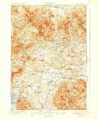 1931 Mt. Chocorua1931 Print · USGSCarroll County’s timber and mountain landscape is captured here in the late Prohibition era. Researchers can trace the path of the Beebe River RR, locate old schoolhouses like Fellows Sch, and find family sites near Wonalancet or Center Sandwich.7 unique versions available
 - 1932 Map of Franconia
 1932 Franconia1932 Print · USGSThe White Mountains in the early 1930s reveal a landscape caught between industrial timbering and the rise of mountain tourism. Researchers can trace the path of the Logging RR or locate family landmarks like the Russell Farm and Fairview.5 unique versions available
 - 1932 Map of Brattleboro
 1932 Brattleboro1932 Print · USGSThe Connecticut River valley comes into sharp focus during the 1930s, showing a landscape of river-side rail and high ridge-lines. Genealogists and historians can trace the Boston and Maine line past West Chesterfield, the Monument Sch, and the notable Childs Monument.
 - 1932 Map of Warwick
 1932 Warwick1932 Print · USGSIn the early 1930s, the tri-state border region of Massachusetts, New Hampshire, and Vermont was a vital corridor of rail and river transit. Genealogists and researchers can trace the old rail lines of the Central Vermont Ry, locate the East Northfield Sta, or find family landmarks like Curtis Corners and Wheeler Fall.
 - 1932 Map of Second Lake
 1932 Second Lake1932 Print · USGSThe northern New Hampshire wilderness and Maine borderlands are captured here in the early 1930s, showing a landscape of logging camps and high peaks. Genealogists and historians can trace old sites like Idlewild, the Deer Mtn Fire Tower, and remote outposts such as Camp No 36.4 unique versions available
 - 1932 Map of Newburyport
 1932 Newburyport1932 Print · USGSThe New Hampshire seacoast and southern Rockingham County are shown here in the early thirties, just as coastal recreation and inland farming reached a mature balance. Genealogists can locate family-named landmarks like Nason Corner, Dearborn Academy, and various district schools.4 unique versions available
 - 1932 Map of Winchendon
 1932 Winchendon1932 Print · USGSThe borderlands of New Hampshire and Massachusetts come into focus during the early thirties, showing a rural landscape dominated by glacial lakes and high ridges. Researchers can trace the Boston and Maine line through State Line or locate family sites at Rand Cem and Sch No 1.
Showing maps 1-25 of 66
Top cities of New Hampshire
- Manchester historical maps
- Nashua historical maps
- Concord historical maps
- Derry historical maps
- Dover historical maps
- Rochester historical maps
See more
Top counties of New Hampshire
- Hillsborough County historical maps
- Rockingham County historical maps
- Merrimack County historical maps
- Strafford County historical maps
- Grafton County historical maps
- Cheshire County historical maps
See more
Frequently asked questions
- What are the different types of historical maps available for New Hampshire?
- What is the oldest map of New Hampshire?
- Where can I purchase historical maps of New Hampshire for my home or office?
- Where can I download high-res historical maps of New Hampshire?
- Are there historical topographic maps available for New Hampshire?
- Is there historical aerial imagery available for New Hampshire?
- Where are historical maps of New Hampshire sourced from?