1980s Maps of New Hampshire
Explore 154 historic maps of New Hampshire from the 1980s. These maps offer a rare glimpse into what life looked like during the 1980s — showing old roads, neighborhoods, homes, and landmarks that have changed or disappeared over time.
Whether you're researching your family's past, planning a metal detecting trip, or studying how New Hampshire's landscape evolved across the 1980s, these high-resolution maps are a powerful tool for exploring the history of this region.
- Focus on a specific era: All maps on this page are from the 1980s, giving you a focused view of this time period.
- See what’s changed: Compare century-old streets, trails, and buildings to today's modern landscape using overlays and satellite layers.
- Research with precision: Use these maps for genealogy, historical research, land use analysis, or educational projects.
- View, download, or print: Maps are fully viewable online in high resolution, and can be downloaded or printed for your own records.
Start exploring New Hampshire's history through authentic maps from the 1980s. This is your window into the past.
New Hampshire maps
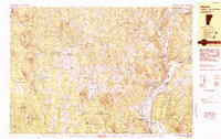
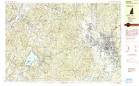
(154)- 1980 Map of Plymouth, 1981 Print
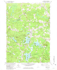
 1980 Plymouth1981 Print · USGSGrafton County's river valleys were well-established by the early 1980s, balancing local industry with institutional growth. Genealogists and historians can trace the foundations of Plymouth, locate the Holderness Sch, and find family plots at Blair Cem or the Townhall Campton Ch.2 unique versions available
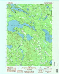
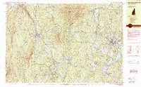
 - 1980 Map of Squam Mountains, 1981 Print
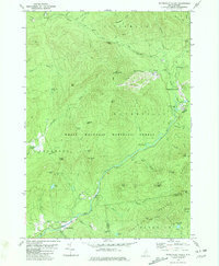
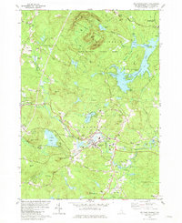
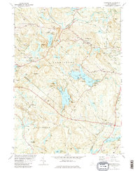
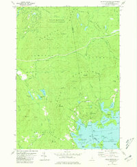 1980 Squam Mountains1981 Print · USGSThe Squam Lake shoreline and high peaks of the Sandwich Range define this central New Hampshire landscape in the early eighties. Genealogists and hikers can trace historical routes like the Sandwich Notch Road, the Old RR Grade, and localized landmarks including the Covered Bridge.2 unique versions available
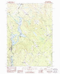
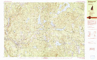
 - 1980 Map of Waterville Valley, 1981 Print
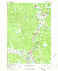
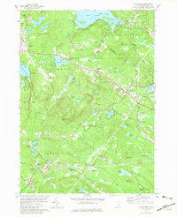
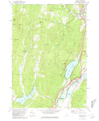
 1980 Waterville Valley1981 Print · USGSWaterville Valley and the surrounding peaks of the White Mountains are captured here in the early 1980s as the recreation economy matured. Researchers can locate the Mad River Cem, trace the old Sandwich Notch Road, and identify historic bridges like Sixmile Bridge.3 unique versions available
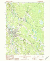
 - 1980 Map of Woodstock, 1981 Print
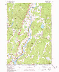
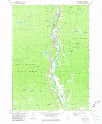 1980 Woodstock1981 Print · USGSGrafton County's river valley communities are documented here in the early eighties, showing the alignment of modern roads alongside traditional mountain settlements. You can locate family-history landmarks like Pine Grove Cem and Thornton Ch or trace the drainage of Mirror Lake into the Pemigewasset River.2 unique versions available
 - 1981 Map of Kingston
 1981 Kingston1981 Print · USGSSouthern New Hampshire's pond country is captured here in the early eighties, showing the historic village centers of Kingston and Brentwood. Genealogists can trace family sites at Ye Old Cem or Brentwood Cem and locate landmarks like the Ye Old Meeting House.2 unique versions available
 - 1981 Map of Mt. Pawtuckaway
 1981 Mt. Pawtuckaway1981 Print · USGSRockingham County in the early eighties shows a landscape defined by the Pawtuckaway Mountains and the busy Lamprey River valley. Genealogists and hikers can trace the Boston and Maine Railroad corridor or locate family landmarks like Bartlett Cem and Gove Cem.3 unique versions available
 - 1981 Map of Northwood
 1981 Northwood1981 Print · USGSSoutheastern New Hampshire’s lake country is captured here in the early eighties, showcasing the historic village clusters of Northwood and Deerfield. Genealogists and historians can trace family landmarks like Bartlett Cem, find the old White Sch, or locate the radio tower on Saddleback Mountain.3 unique versions available
 - 1981 Map of Lyme
 1981 Lyme1981 Print · USGSThe Upper Valley of the Connecticut River comes alive in the early eighties, showcasing the rural character of Vermont and New Hampshire. Genealogists and local historians can trace family ties through Lyme Cem, Highland Cem, and the historic Thetford Academy.3 unique versions available
 - 1981 Map of Epping
 1981 Epping1981 Print · USGSIn the early 1980s, the Rockingham County countryside remained a patchwork of small villages, historic river systems, and rail corridors. Researchers can trace ancestral plots and early civic life through Nottingham Square, the Ladd Cem, and the old Boston and Maine Railroad lines.
 - 1981 Map of Barrington
 1981 Barrington1981 Print · USGSSoutheastern New Hampshire’s lake country is captured here in the early eighties, showing a landscape of wooded hills and interconnected waterways. Genealogists and local historians can trace family plots at Pine Grove Cem, find the Canaan Chapel, or locate old landmarks like Mount Misery.2 unique versions available
 - 1981 Map of Fairlee
 1981 Fairlee1981 Print · USGSThe Connecticut River valley in the early eighties shows a landscape of lakeside leisure and transit corridors. Researchers can trace the Boston and Maine rail line, locate St Martins Chapel, and find local landmarks like the Drive-in Theater and Bear Ridge Raceway.3 unique versions available
 - 1981 Map of Sandown
 1981 Sandown1981 Print · USGSSoutheastern New Hampshire’s wooded hills and pond-side communities are captured here in the early 1980s. Genealogists and local historians can trace family roots through several landmarks, including Lakeview Cem, Wells Cem, and the community surrounding Angle Pond.3 unique versions available
 - 1982 Map of Pliny Range, 1983 Print
 1982 Pliny Range1983 Print · USGSCoos County, New Hampshire, is captured in the early 1980s as a high-altitude landscape of small mountain villages and expansive forest. Genealogists and hikers can trace old family sites near Jefferson Highland or locate the Forest Vale Cem and St Johns Ch.
 - 1982 Map of Lancaster, 1983 Print
 1982 Lancaster1983 Print · USGSThe Connecticut River valley comes alive in the early eighties as a network of rail lines and riverside towns. Genealogists and historians can trace family-named hills and find local landmarks like St Matthews Ch, the Covered Bridge, and Riverside Cem.2 unique versions available
 - 1982 Map of Bethlehem, 1983 Print
 1982 Bethlehem1983 Print · USGSUpper Grafton and Coos County are shown in the early eighties as the mountain rail corridors still shaped local life. Genealogists and hikers can trace old family burial sites like Burns Cem, follow the Boston and Maine Railroad, or locate the Twin Mountain Fish Hatchery.
 - 1982 Map of Mt. Washington, 1983 Print
 1982 Mt. Washington1983 Print · USGSThe Presidential Range and its iconic summit are captured here in the early eighties, showing the region as a mature hub for mountain tourism and transit. Trace the historic paths of the Mount Washington Cog Railway, explore the high-altitude Lakes of the Clouds, and locate the Lady of the Mountain Ch at Bretton Woods.2 unique versions available
 - 1983 Map of West Newfield
 1983 West Newfield1983 Print · USGSYork County and Carroll County meet at the state line during the early eighties, where upland townships like Parsonsfield and Newfield bridge the Maine and New Hampshire border. Genealogists can locate family names at Mee Corners or trace properties near Maplewood and Rock Haven Lake.2 unique versions available
 - 1983 Map of Barnet
 1983 Barnet1983 Print · USGSThe Vermont and New Hampshire borderlands come alive in the early eighties, centered on the river-and-rail corridor of the Connecticut River. Researchers can trace the Canadian Pacific tracks through Barnet and locate small hamlets like Ewells Mills and Mosquitoville.
 - 1983 Map of Great East Lake, 1984 Print
 1983 Great East Lake1984 Print · USGSThe Maine and New Hampshire border region is captured here in the early 1980s, showcasing a landscape of interconnected glacial lakes and rural settlements. Researchers can trace local heritage through landmarks like Milton Mills, the Maple Grove Church, and McCutcheon Corners.2 unique versions available
 - 1983 Map of Milton, 1984 Print
 1983 Milton1984 Print · USGSThe interstate border along the Salmon Falls River comes to life in the early 1980s, showing the tight connection between riverside industry and rural crossroads. Local researchers can trace the Boston and Maine rail line, find the Nute High Sch, and locate old cemeteries like Forest Grove Cem.2 unique versions available
 - 1983 Map of Rochester, 1984 Print
 1983 Rochester1984 Print · USGSRochester and the Maine-New Hampshire borderlands are captured here in the early eighties as the region balanced its industrial roots with suburban growth. Researchers can trace family sites like Forest Glade Cem or locate old transit points such as N Rochester (Hayes Sta) and Pickering.2 unique versions available
 - 1984 Map of Keene
 1984 Keene1984 Print · USGSCheshire County is captured in the mid-eighties as a hub of education and transit, centered on the growing city of Keene. Genealogists and historians can trace the Boston and Maine rail corridor, the grounds of St Josephs Cem, and landmarks like Goose Pond.2 unique versions available
 - 1984 Map of Monadnock Mountain
 1984 Monadnock Mountain1984 Print · USGSCheshire County in the 1980s remains a landscape of prominent peaks and rail-connected valley towns. Genealogists and hikers can trace the geography of Troy, Fitzwilliam, and Jaffrey Center alongside the trails of Monadnock State Park.2 unique versions available
 - 1984 Map of Lowell
 1984 Lowell1984 Print · USGSThe Merrimack Valley industrial corridor is captured here in the mid-eighties, showing the interconnected growth of Lowell, Nashua, and Lawrence. Genealogists and historians can trace the paths of the Boston and Maine railroad or locate institutional landmarks like Merrimack College and the Fort Devens Military Reservation.
 - 1984 Map of Marlborough
 1984 Marlborough1984 Print · USGSCheshire County at the start of the eighties reveals a classic New England mix of mill villages and mountain ridges. Genealogists and local historians can trace legacy sites like Pine Grove Cemetery, St Francis Church, and the distinctive Dublin Spire.2 unique versions available
Showing maps 1-25 of 154
Top cities of New Hampshire
- Manchester historical maps
- Nashua historical maps
- Concord historical maps
- Derry historical maps
- Dover historical maps
- Rochester historical maps
See more
Top counties of New Hampshire
- Hillsborough County historical maps
- Rockingham County historical maps
- Merrimack County historical maps
- Strafford County historical maps
- Grafton County historical maps
- Cheshire County historical maps
See more
Frequently asked questions
- What are the different types of historical maps available for New Hampshire?
- What is the oldest map of New Hampshire?
- Where can I purchase historical maps of New Hampshire for my home or office?
- Where can I download high-res historical maps of New Hampshire?
- Are there historical topographic maps available for New Hampshire?
- Is there historical aerial imagery available for New Hampshire?
- Where are historical maps of New Hampshire sourced from?