1960s Maps of Cheshire County, New Hampshire
Explore 6 historic maps of Cheshire County from the 1960s. These maps offer a rare glimpse into what life looked like during the 1960s — showing old roads, neighborhoods, homes, and landmarks that have changed or disappeared over time.
Whether you're researching your family's past, planning a metal detecting trip, or studying how Cheshire County's landscape evolved across the 1960s, these high-resolution maps are a powerful tool for exploring the history of this region.
- Focus on a specific era: All maps on this page are from the 1960s, giving you a focused view of this time period.
- See what’s changed: Compare century-old streets, trails, and buildings to today's modern landscape using overlays and satellite layers.
- Research with precision: Use these maps for genealogy, historical research, land use analysis, or educational projects.
- View, download, or print: Maps are fully viewable online in high resolution, and can be downloaded or printed for your own records.
Start exploring Cheshire County's history through authentic maps from the 1960s. This is your window into the past.
Cheshire County, NH maps
(6)- 1961 Map of Boston
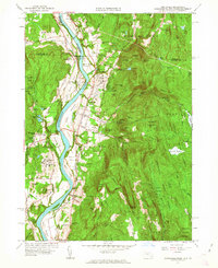
 1961 Boston1961 Print · USGSThe Massachusetts coastline and its industrial interior are detailed here in the mid-twentieth century, from the Monadnock highlands to Cape Cod. Researchers can trace the rail routes of the Boston and Maine or locate landmarks like Fort Devens and the Wachusett Reservoir.2 unique versions available
 - 1961 Map of Mt Grace, 1963 Print
 1961 Mt Grace1963 Print · USGSUpper Franklin County and the New Hampshire borderlands are captured here in the early 1960s as a region of forestry and small rural hamlets. Genealogists can locate family sites at South Cem or Newton Cem, while hikers can trace the terrain around Mt Grace and Tully Mtn.
 - 1961 Map of Northfield, 1963 Print
 1961 Northfield1963 Print · USGSThe Connecticut River valley at the tri-state border was a hub of academic and rail life in the early sixties. Genealogists can trace family plots at West Northfield Cem and Coller Cem or locate the sprawling grounds of the Northfield School for Boys.2 unique versions available
 - 1962 Map of Albany
 1962 Albany1962 Print · USGSThe Hudson and Connecticut River valleys meet the Green Mountains and Berkshires in this mid-century overview of the Northeast. Genealogists and historians can trace the industrial hearts of Albany and Springfield or locate features like Quabbin Reservoir and Westover Air Force Base.
 - 1964 Map of Glens Falls
 1964 Glens Falls1964 Print · USGSThe tri-state borderlands of New York, Vermont, and New Hampshire appear here in the mid-1960s. Researchers can trace the rail routes of the Rutland RR and find historic sites like Ticonderoga and Saratoga National Historical Park.
 - 1965 Map of Ashburnham, 1968 Print
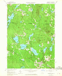 1965 Ashburnham1968 Print · USGSThe Worcester County highlands during the mid-sixties show a landscape of glacial lakes and quiet hill towns. Genealogists can locate family sites near St Dennis Cem or trace the early industrial footprint of Factory Village and Cushing Academy.5 unique versions available
End of results
Showing maps 1-6 of 6
Top cities of Cheshire County
- Keene historical maps
- Swanzey historical maps
- Rindge historical maps
- Winchester historical maps
- Walpole historical maps
- Chesterfield historical maps
See more
Frequently asked questions
- What are the different types of historical maps available for Cheshire County?
- What is the oldest map of Cheshire County?
- Where can I purchase historical maps of Cheshire County for my home or office?
- Where can I download high-res historical maps of Cheshire County?
- Are there historical topographic maps available for Cheshire County?
- Is there historical aerial imagery available for Cheshire County?
- Where are historical maps of Cheshire County sourced from?