1970s Maps of Cheshire County, New Hampshire
Explore 9 historic maps of Cheshire County from the 1970s. These maps offer a rare glimpse into what life looked like during the 1970s — showing old roads, neighborhoods, homes, and landmarks that have changed or disappeared over time.
Whether you're researching your family's past, planning a metal detecting trip, or studying how Cheshire County's landscape evolved across the 1970s, these high-resolution maps are a powerful tool for exploring the history of this region.
- Focus on a specific era: All maps on this page are from the 1970s, giving you a focused view of this time period.
- See what’s changed: Compare century-old streets, trails, and buildings to today's modern landscape using overlays and satellite layers.
- Research with precision: Use these maps for genealogy, historical research, land use analysis, or educational projects.
- View, download, or print: Maps are fully viewable online in high resolution, and can be downloaded or printed for your own records.
Start exploring Cheshire County's history through authentic maps from the 1970s. This is your window into the past.
Cheshire County, NH maps
(9)- 1971 Map of Winchendon, 1973 Print
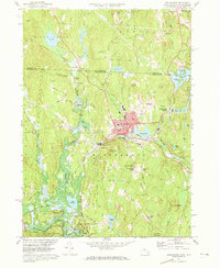 1971 Winchendon1973 Print · USGSWinchendon and the northern Massachusetts borderlands are captured here in the early 1970s as a landscape of river-driven industry and forest. Trace the rail-and-river history of Waterville, the legacy of the Boston and Maine Railroad, and the Birch Hill Dam.5 unique versions available
 - 1971 Map of Royalston, 1973 Print
 1971 Royalston1973 Print · USGSThe Worcester County highlands are captured here in the early 1970s, showing the distinct settlements of Royalston and South Royalston before modern development. You can trace family history through the Center Cem and Riverside Cem or follow the historic Boston and Maine rail line along the Millers River.5 unique versions available
 - 1975 Map of Northfield, 1981 Print
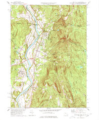
 1975 Northfield1981 Print · USGSThe Connecticut River valley during the mid-seventies is captured in this detailed aerial view of the Massachusetts and New Hampshire borderlands. Researchers can trace the exact footprint of riverfront settlements like Northfield and rural junctions such as Curtis Corner or Gill Station.
 - 1975 Map of Winchendon, 1981 Print
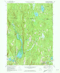
 1975 Winchendon1981 Print · USGSNorth-central Massachusetts and the New Hampshire border are seen here in the mid-1970s. Trace the mill town layouts of Winchendon and Waterville along the Millers River or locate property near Lake Monomonac.
 - 1975 Map of Ashburnham, 1981 Print
 1975 Ashburnham1981 Print · USGSNorthern Worcester County and the New Hampshire borderlands are visible in this mid-seventies aerial study. Local historians can trace the early residential footprints of Lane Village and Wellville or examine the shoreline of Lake Monomonac.
 - 1975 Map of Royalston, 1981 Print
 1975 Royalston1981 Print · USGSRoyalston and the northern Worcester County highlands are seen here in the mid-seventies through detailed aerial orthophotography. Researchers can trace the village layouts of West Royalston and Tully or the natural shorelines of Laurel Lake.
 - 1975 Map of Mt Grace, 1981 Print
 1975 Mt Grace1981 Print · USGSWarwick and the surrounding Franklin County highlands are captured in this mid-seventies aerial study of the Massachusetts-New Hampshire border. Genealogists and historians can trace the exact 1975 footprint of Warwick, Mayo Corners, and Moores Pond.
 - 1977 Map of Mt Grace
 1977 Mt Grace1977 Print · USGSThe hill country of Franklin County comes into focus in the mid-seventies, showing the intersection of forest conservation and village life. Researchers can locate family plots at Gale-Gates Cem, trace old routes like Quaker Lane, and see the early layout of Warwick and North Orange.3 unique versions available
 - 1977 Map of Northfield, 1978 Print
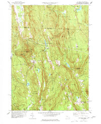
 1977 Northfield1978 Print · USGSThe Pioneer Valley at the junction of three states shows a landscape of river-plain farming and mountain forests in the mid-1970s. Researchers can locate family heritage sites from Mt Hermon to the Tyler Cem, or trace the rail lines through East Northfield.3 unique versions available
End of results
Showing maps 1-9 of 9
Top cities of Cheshire County
- Keene historical maps
- Swanzey historical maps
- Rindge historical maps
- Winchester historical maps
- Walpole historical maps
- Chesterfield historical maps
See more
Frequently asked questions
- What are the different types of historical maps available for Cheshire County?
- What is the oldest map of Cheshire County?
- Where can I purchase historical maps of Cheshire County for my home or office?
- Where can I download high-res historical maps of Cheshire County?
- Are there historical topographic maps available for Cheshire County?
- Is there historical aerial imagery available for Cheshire County?
- Where are historical maps of Cheshire County sourced from?