Old Maps of Cheshire County, New Hampshire for Academic Research
Study the evolution of Cheshire County with 229 high-resolution historic maps. Whether you're teaching, researching, or modeling changes in land use, these maps provide essential visual documentation of urban, environmental, and geographic change.
- Analyze long-term change: Track patterns in development, transportation, and natural features.
- Ideal for environmental or urban studies: Support academic projects with primary historical map data.
- Use in the classroom or lab: Educators and researchers rely on these maps to bring historical context to life.
These maps are a powerful tool for teaching, research, and visualizing how Cheshire County has changed over the decades.
Cheshire County, NH maps
(229)- 1887 Map of Warwick
 1887 Warwick1887 Print · USGSUpper Massachusetts and the New Hampshire border at the close of the nineteenth century reveal a landscape of river-powered industry and rail-connected villages. Researchers can trace the path of the Fitchburg R.R. through Millers Falls or locate early river crossings like Munns Ferry.
 - 1887 Map of Winchendon
 1887 Winchendon1887 Print · USGSNorth-central Massachusetts and the New Hampshire borderlands are captured here during a peak era of rail expansion and water-powered industry. Researchers can trace historic mill sites and depot locations such as Powers Mills, Pequoig Station, and the busy rail junction at Baldwinville.
 - 1887 Map of Fitchburg
 1887 Fitchburg1887 Print · USGSThe hills of Worcester County were a beehive of rail and industry when this survey was conducted. Trace the original routes of the Fitchburg Railroad and find long-established local centers like Wachusett Village, Converse Ville, and Rollstone Hill.
 - 1889 Map of Fitchburg
 1889 Fitchburg1889 Print · USGSNorth-central Massachusetts and southern New Hampshire are captured here in the late Victorian era as industry and rail expanded. Genealogists can trace family homesteads near Whitmanville or locate specific rail depots like Ashburnham Junction and Westminster Station.
 - 1889 Map of Warwick
 1889 Warwick1889 Print · USGSFranklin County in the late 1880s was defined by its busy rail junctions and river valleys. Genealogists and historians can trace the development of Orange and Northfield, or locate vanished rail stops like Gill Station and Wendell Depot along the Fitchburg Railroad.
 - 1890 Map of Winchendon
 1890 Winchendon1890 Print · USGSThe Worcester County borderlands at the end of the 19th century reveal a complex landscape of mill villages and hilltop commons. Researchers can trace the early industrial footprint at Powers Mills, find the rail junction at Pequoig Station, and locate the ancestral centers of Royalston Center or Templeton Center.
 - 1891 Map of Brattleboro
 1891 Brattleboro1891 Print · USGSSouthern Vermont’s industrial and rail corridors are captured here in the late nineteenth century as the region transitioned into a hub for trade. Genealogists and local historians can trace the early rail stops at Putney Station, Dummerston Station, and the rural layout of Guilford Center.
 - 1893 Map of Brattleboro
 1893 Brattleboro1893 Print · USGSWindham County at the close of the nineteenth century reveals a landscape defined by its river-valley railroads and hill-country settlements. Genealogists and historians can trace defunct rail stops like Williamsville Station and Dummerston Station or locate family landmarks near Ginseng Hill and Hinesburg.7 unique versions available
 - 1893 Map of Fitchburg
 1893 Fitchburg1893 Print · USGSNorth-central Massachusetts at the close of the nineteenth century was a complex network of industrial valley towns and highland rail junctions. You can trace the path of the Cheshire Railroad as it winds past Lake Monomonac or explore the early street layouts of Fitchburg and Leominster.7 unique versions available
 - 1894 Map of Winchendon
 1894 Winchendon1894 Print · USGSNorth-central Massachusetts and the New Hampshire border are captured here during a peak era of rail-driven industry. Genealogists and historians can trace the development of mill villages and family landmarks like Powers Mills, Baldwinville, and the Cheshire Railroad.6 unique versions available
 - 1894 Map of Warwick
 1894 Warwick1894 Print · USGSNorthern Massachusetts and New Hampshire borderlands are captured here in the late nineteenth century, showing a landscape shaped by the Millers River. Researchers can trace the path of the Central Vermont Railroad and find early settlements like Wendell Depot and Northfield.6 unique versions available
 - 1898 Map of Monadnock
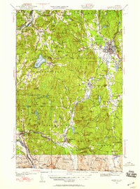
 1898 Monadnock1898 Print · USGSThe peaks and valleys of Southwest New Hampshire are shown here during the late nineteenth-century railroad era. Genealogists and historians can trace the rail-dependent growth of towns like East Jaffrey and locate sites such as Mountain House or the Marlboro Depot.8 unique versions available
 - 1898 Map of Keene
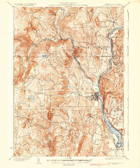
 1898 Keene1898 Print · USGSCheshire County at the turn of the century reveals a landscape defined by the convergence of major rail lines and river industry. Genealogists and historians can trace the early footings of Keene or find vanished details in Westmoreland, Ashuelot, and at the East Putney Sta.7 unique versions available
 - 1900 Map of Peterboro
 1900 Peterboro1900 Print · USGSHillsborough County villages and mountain ranges come into sharp focus during the late Victorian era as rail lines expanded through the valley. Researchers can trace the Boston and Maine RR corridors and locate family landmarks from Peterboro to New Ipswich and Lithia Spring.9 unique versions available
 - 1927 Map of Bellows Falls
 1927 Bellows Falls1927 Print · USGSThe borderlands of the Connecticut River valley are captured in the late 1920s, showing the vital rail links between Vermont and New Hampshire. Genealogists and local historians can trace rural schoolhouse districts like Mica Mine Sch, the grounds of the Kern-Hattin Home, and the layout of Westmoreland Depot.4 unique versions available
 - 1930 Map of Lovewell Mountain
 1930 Lovewell Mountain1930 Print · USGSThe Cheshire and Sullivan County borderlands come alive in this late 1920s survey of the New Hampshire highlands. Researchers can locate long-standing crossroads like East Lempster, find vanished rural education at Fifield Sch, or trace the old Loverens Mill site.4 unique versions available
 - 1930 Map of Bellows Falls
 1930 Bellows Falls1930 Print · USGSThe Connecticut River valley thrives between Vermont and New Hampshire in the late twenties, anchored by the rail hub at Bellows Falls. Researchers can trace old district schools like Derry Hill Sch and find family-named landmarks such as Dodge Tavern.7 unique versions available
 - 1931 Map of Fitchburg
 1931 Fitchburg1931 Print · USGSThe Massachusetts and New Hampshire border region was a network of mill villages and mountain ridges in the early thirties. Genealogists and historians can locate rural landmarks like School No 8, the High Bridge, and the Boston and Maine rail line.
 - 1932 Map of Brattleboro
 1932 Brattleboro1932 Print · USGSThe Connecticut River valley comes into sharp focus during the 1930s, showing a landscape of river-side rail and high ridge-lines. Genealogists and historians can trace the Boston and Maine line past West Chesterfield, the Monument Sch, and the notable Childs Monument.
 - 1932 Map of Warwick
 1932 Warwick1932 Print · USGSIn the early 1930s, the tri-state border region of Massachusetts, New Hampshire, and Vermont was a vital corridor of rail and river transit. Genealogists and researchers can trace the old rail lines of the Central Vermont Ry, locate the East Northfield Sta, or find family landmarks like Curtis Corners and Wheeler Fall.
 - 1932 Map of Winchendon
 1932 Winchendon1932 Print · USGSThe borderlands of New Hampshire and Massachusetts come into focus during the early thirties, showing a rural landscape dominated by glacial lakes and high ridges. Researchers can trace the Boston and Maine line through State Line or locate family sites at Rand Cem and Sch No 1.
 - 1932 Map of Keene, 1954 Print
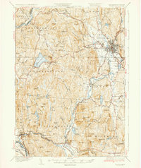
 1932 Keene1954 Print · USGSCheshire County in the early 1930s is a landscape of river-powered mill towns and developing mountain retreats. Local historians can trace the Boston and Maine RR through Keene or find vanished rural landmarks like Meetinghouse Hill and the County Farm.3 unique versions available
 - 1935 Map of Brattleboro
 1935 Brattleboro1935 Print · USGSThe Connecticut River valley in the mid-1930s reveals a landscape of industrial river towns and upland farming hamlets. Genealogists can trace family sites near Guilford Center or follow the rail stops at Dummerston Station and Putney Station.5 unique versions available
 - 1935 Map of Warwick
 1935 Warwick1935 Print · USGSUpper Massachusetts and the Tri-State borderlands thrive during the mid-thirties as rail corridors and river valleys connect mountain villages. Researchers can trace the Central Vermont Ry through Northfield or locate family landmarks like Barrows Cem and Barber Sch.2 unique versions available
 - 1935 Map of Keene
 1935 Keene1935 Print · USGSCheshire County in the mid-1930s reveals a network of mill towns and rail junctions centered on the industrial hub of Keene. Genealogists and researchers can trace local landmarks like Meetinghouse Hill, the County Farm, and the Richmond Trout Rearing Station.5 unique versions available
Showing maps 1-25 of 229
Top cities of Cheshire County
- Keene historical maps
- Swanzey historical maps
- Rindge historical maps
- Winchester historical maps
- Walpole historical maps
- Chesterfield historical maps
See more
Frequently asked questions
- What are the different types of historical maps available for Cheshire County?
- What is the oldest map of Cheshire County?
- Where can I purchase historical maps of Cheshire County for my home or office?
- Where can I download high-res historical maps of Cheshire County?
- Are there historical topographic maps available for Cheshire County?
- Is there historical aerial imagery available for Cheshire County?
- Where are historical maps of Cheshire County sourced from?