2020s Maps of Gloucester County, New Jersey
Explore 13 historic maps of Gloucester County from the 2020s. These maps offer a rare glimpse into what life looked like during the 2020s — showing old roads, neighborhoods, homes, and landmarks that have changed or disappeared over time.
Whether you're researching your family's past, planning a metal detecting trip, or studying how Gloucester County's landscape evolved across the 2020s, these high-resolution maps are a powerful tool for exploring the history of this region.
- Focus on a specific era: All maps on this page are from the 2020s, giving you a focused view of this time period.
- See what’s changed: Compare century-old streets, trails, and buildings to today's modern landscape using overlays and satellite layers.
- Research with precision: Use these maps for genealogy, historical research, land use analysis, or educational projects.
- View, download, or print: Maps are fully viewable online in high resolution, and can be downloaded or printed for your own records.
Start exploring Gloucester County's history through authentic maps from the 2020s. This is your window into the past.
Gloucester County, NJ maps
(13)- 2023 Map of Philadelphia, 2023 Print
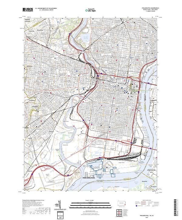 2023 Philadelphia2023 Print · USGSModern Philadelphia reveals its deep history along the Schuylkill River and Delaware River. Genealogists and historians can trace the city's past through Mount Moriah Cem, Mikveh Israel Cem, and the Edgar Allan Poe National Historic Site.
 - 2023 Map of Marcus Hook, 2023 Print
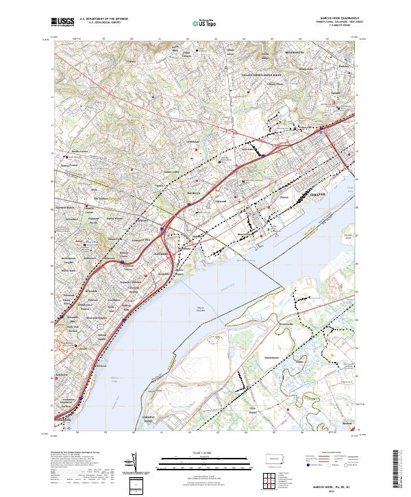 2023 Marcus Hook2023 Print · USGSThe industrial riverfront of Marcus Hook and the surrounding tri-state border region are shown here in modern detail. Researchers can locate numerous historic burial grounds including Old Saint Martins Episcopal Cem and Haven Memorial Cem among the neighborhoods of Garnet Valley and Linwood.
 - 2023 Map of Newfield, 2023 Print
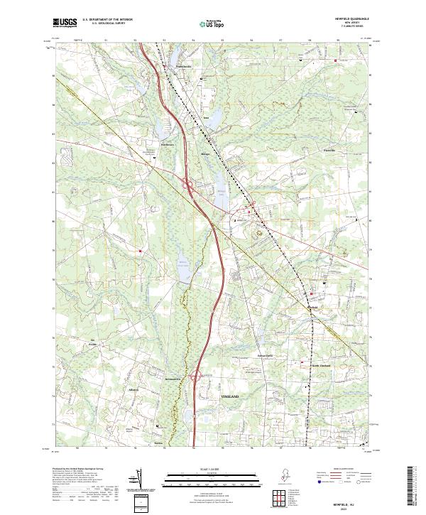 2023 Newfield2023 Print · USGSSouthern New Jersey's coastal plain comes into focus in this contemporary survey where the crossroads of three counties meet. Genealogists and historians can trace family roots through sites like Porchtown Zion Methodist Church,Cem, Rose Hill Cem, and the small aviation history found at Kroelinger Airport.
 - 2023 Map of Williamstown, 2023 Print
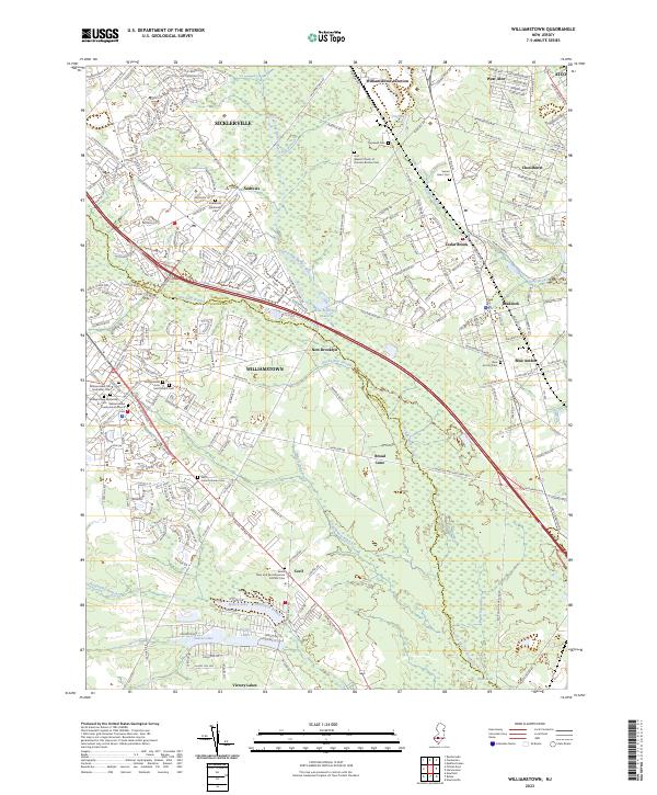 2023 Williamstown2023 Print · USGSThe borderlands of Gloucester and Camden Counties are shown here during their modern development. Genealogists can locate several historic burial grounds including Saint Johns Lutheran Cem and the Blue Anchor Cem near Braddock.
 - 2023 Map of Buena, 2023 Print
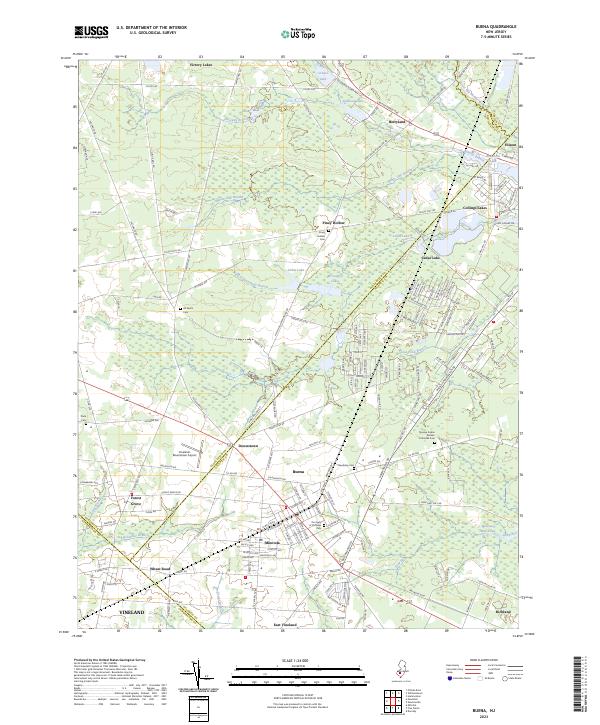 2023 Buena2023 Print · USGSThe South Jersey Pinelands communities of Buena and Folsom are shown here as they appear in the early 2020s. Genealogists and local researchers can trace family landmarks and neighborhood boundaries across Minotola, the Novaya Kuban Russian Orthodox Cem, and the Vineland-Downstown Airport.
 - 2023 Map of Woodstown, 2023 Print
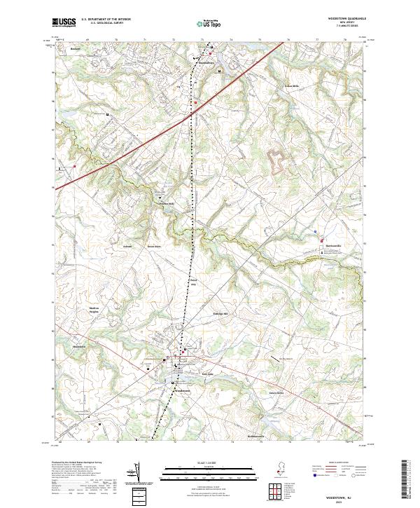 2023 Woodstown2023 Print · USGSSouth Jersey's agricultural and industrial roots are on display here as the contemporary landscape meets historic county borders. Researchers can locate numerous family burial sites and early mills, including the Friends Burying Ground, Porches Mill, and Lawnside Cem.
 - 2023 Map of Pitman East, 2023 Print
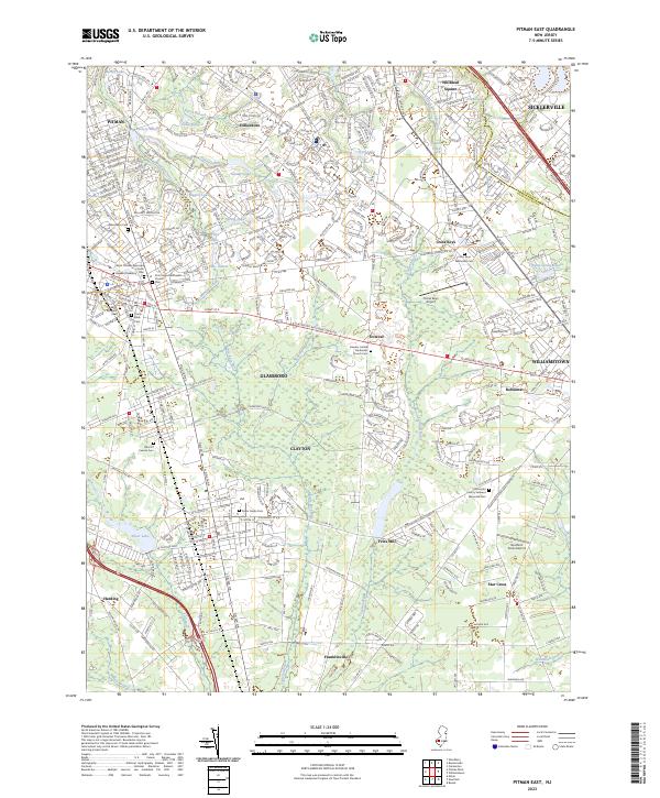 2023 Pitman East2023 Print · USGSGloucester County communities like Glassboro and Clayton are shown here as they appeared in the early 2020s. Researchers can locate several burial grounds including Land Of Canaan Cem and academic landmarks like Rowan University.
 - 2023 Map of Elmer, 2023 Print
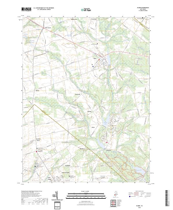 2023 Elmer2023 Print · USGSSouthern New Jersey farm country comes into focus in this contemporary survey of the Elmer and Deerfield areas. Local historians can trace family plots at the Deerfield Presbyterian Cemetery or explore the outskirts of Seabrook Farms and Pole Tavern.
 - 2023 Map of Woodbury, 2023 Print
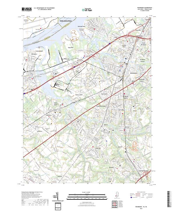 2023 Woodbury2023 Print · USGSGloucester County's transition from riverfront industry to suburban borough is captured here in the early twenty-first century. Genealogists can trace a high concentration of burial grounds, including Old Stephens Cem, Jesse Chew Cem, and the Mickleton Meeting House Graveyard.
 - 2023 Map of Runnemede, 2023 Print
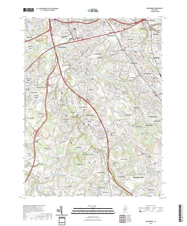 2023 Runnemede2023 Print · USGSSouth Jersey's residential and transit networks come into focus in this recent survey of the Camden and Gloucester county border. Researchers can trace numerous local burial sites and landmarks like the Deptford Strangers Burial Ground and Mount Pisgah A M E Church Cem.
 - 2023 Map of Bridgeport, 2023 Print
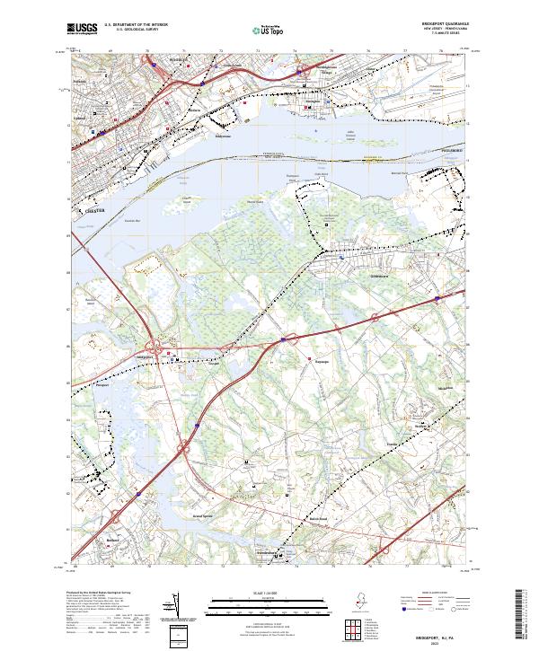 2023 Bridgeport2023 Print · USGSThe Delaware River corridor comes to life in this recent survey, showcasing the contrast between the industrial hubs of Pennsylvania and the rural marshlands of New Jersey. Researchers can trace historic burial grounds like Saint Pauls Burying Ground and Solomons Graveyard or explore the remnants of the Old Canal near Bridgeport.
 - 2023 Map of Penns Grove, 2023 Print
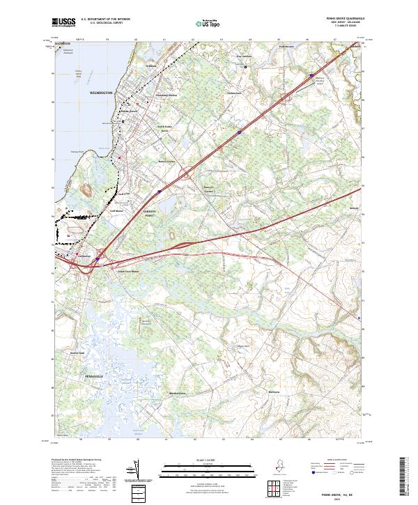 2023 Penns Grove2023 Print · USGSSalem County’s riverfront comes into focus during this modern era, showing the industrial and residential development along the Delaware River. Researchers can trace family sites at Riverview Cem, explore the crossroads of Danceys Corner, or locate the Oldmans Township Airport.
 - 2023 Map of Pitman West, 2023 Print
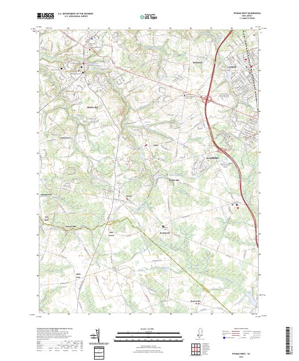 2023 Pitman West2023 Print · USGSGloucester County at the start of the 2020s shows a complex mix of university-led growth and deep-rooted rural history. Researchers can trace historic churchyards like Richwood United Methodist Church Cem or find old industrial sites like Wrights Mill.
End of results
Showing maps 1-13 of 13
Top cities of Gloucester County
- Washington Township historical maps
- Monroe Township historical maps
- Deptford Township historical maps
- West Deptford Township historical maps
- Glassboro historical maps
- Mantua Township historical maps
See more
Frequently asked questions
- What are the different types of historical maps available for Gloucester County?
- What is the oldest map of Gloucester County?
- Where can I purchase historical maps of Gloucester County for my home or office?
- Where can I download high-res historical maps of Gloucester County?
- Are there historical topographic maps available for Gloucester County?
- Is there historical aerial imagery available for Gloucester County?
- Where are historical maps of Gloucester County sourced from?