Old Maps of Albuquerque, New Mexico for Genealogy
Trace your family roots with 112 historic maps of Albuquerque. These high-res maps reveal old neighborhoods, homesites, landmarks, and streets — helping you uncover where your ancestors lived and how the area evolved over time.
- Explore historic neighborhoods: Identify where your relatives may have lived in the 1800s or 1900s.
- Compare maps over time: Trace the changes in streets, buildings, and landmarks for multi-generational research.
- Perfect for genealogy & ancestry research: Used by family historians and researchers to map out lineage and migration.
These maps are an incredible resource for exploring your personal connection to Albuquerque's past.
Albuquerque, NM maps
(112)- 1888 Map of Bernalillo, 1951 Print
 1888 Bernalillo1951 Print · USGSThe Middle Rio Grande valley appears here in the late nineteenth century, just as the railroad began to reshape the high desert. Genealogists and historians can trace the early footprints of Albuquerque, Bernalillo, and traditional communities like Atrisco and Santa Ana.
 - 1889 Map of Albuquerque
 1889 Albuquerque1889 Print · USGSAlbuquerque and the Rio Grande Valley appear here during the expansion of the territorial railroad system. Local historians can trace the early rail corridor of the Atchison Topeka and Santa Fe Railroad and find early river settlements like Bernalillo, Alameda, and Artisco.
 - 1892 Map of San Pedro
 1892 San Pedro1892 Print · USGSNew Mexico's high desert and mountain mining districts come alive in the late nineteenth century as the rail lines reached the interior. Genealogists and historians can trace old wagon routes and rail stops near Dolores, the mining activity at Golden, and early adobe settlements like Algodones and San Pedro.5 unique versions available
 - 1893 Map of Albuquerque
 1893 Albuquerque1893 Print · USGSThe Rio Grande valley in the late nineteenth century is a study in river-fronting settlements and the emerging rail economy. Genealogists can trace the early footprints of Albuquerque, Bernalillo, and the traditional community at Artisco.5 unique versions available
 - 1934 Map of Alameda
 1934 Alameda1934 Print · USGSThe Rio Grande valley in the mid-1930s reveals a landscape of deep-rooted land grants and modernizing infrastructure. Genealogists and historians can trace the irrigation ditches around Alameda and find landmarks like the Nazareth Sanatorium and KOB Radio Transmitter.
 - 1934 Map of West Albuquerque
 1934 West Albuquerque1934 Print · USGSThe Rio Grande Valley near Albuquerque was a complex landscape of irrigation and industry during the mid-thirties. Genealogists and historians can trace family-named schools and early city infrastructure, from the US Indian School to the Old Town Bridge and Hubble Lake.
 - 1934 Map of Griegos
 1934 Griegos1934 Print · USGSThe Rio Grande valley north of Albuquerque is shown here in the mid-thirties as a landscape of historic land grants and complex irrigation. Genealogists and historians can trace the early rail-and-road network near Hahn Station and the Alameda Bridge.
 - 1934 Map of East Albuquerque
 1934 East Albuquerque1934 Print · USGSAlbuquerque's eastern reaches are captured in the mid-1930s just as federal and institutional growth began defining the city. Local historians can trace the early University of New Mexico campus and the original Albuquerque Landing Field.
 - 1938 Map of Albuquerque
 1938 Albuquerque1938 Print · USGSAlbuquerque and the Rio Grande Valley are shown in the late 1930s, when irrigation ditches still defined the rural landscape between the river and the mountains. Researchers can trace ancestral lands through the Town of Atrisco Grant or locate landmarks like the U S Indian School and Old Albuquerque.
 - 1952 Map of Hubbell Spring, 1953 Print
 1952 Hubbell Spring1953 Print · USGSThe Isleta Pueblo region in the early fifties shows a rugged landscape of ranching and early aviation infrastructure. Researchers can trace the boundaries of Mc Cormick Ranch and locate remote landmarks like Hubble Spring and the Ojo de la Cabra spring.4 unique versions available
 - 1952 Map of Isleta, 1954 Print
 1952 Isleta1954 Print · USGSThe Rio Grande valley south of Albuquerque was a complex network of irrigation and transit in the early fifties. Local historians can trace the foundations of Pajarito and Isleta Pueblo alongside landmarks like St Andres Ch and the Isleta Diversion Dam.3 unique versions available
 - 1954 Map of Sandia Crest, 1955 Print
 1954 Sandia Crest1955 Print · USGSThe high peaks and deep canyons of Bernalillo County come into sharp focus in the mid-1950s as recreation and infrastructure began to expand. Genealogists and hikers can trace old routes like the La Luz Trail or locate remote landmarks like Ellis Ranch and Cañoncito Cemetery.2 unique versions available
 - 1954 Map of Alameda, 1955 Print
 1954 Alameda1955 Print · USGSThe Rio Grande valley and the Sandia foothills meet in this mid-century survey of the historic land grants north of Albuquerque. Researchers can trace early irrigation canals, the path of El Camino Real, and landmarks like Sandia View Academy and San Ysidro Ch.
 - 1954 Map of Volcano Ranch, 1955 Print
 1954 Volcano Ranch1955 Print · USGSNew Mexico's high desert west of the Rio Grande is captured here in the mid-fifties, showing a landscape still defined by historic land grants. Genealogists and historians can trace old ranching outposts like Volcano Ranch and Black Ranch near the prominent peaks of The Volcanoes.4 unique versions available
 - 1954 Map of Albuquerque East, 1955 Print
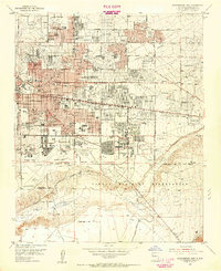 1954 Albuquerque East1955 Print · USGSAlbuquerque’s post-war eastern expansion is documented here as neighborhoods rise toward the foothills and military installations. Trace mid-century landmarks like the Del Norte Airport, the University of New Mexico, and the Cactus Drive-in Theater.
 - 1954 Map of Tijeras, 1955 Print
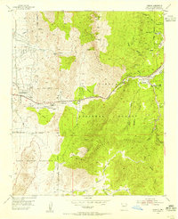 1954 Tijeras1955 Print · USGSEast of Albuquerque in the mid-fifties, the mountain villages along the Cañon De Carnue Grant were key outposts on the road through the canyon. Genealogists and hikers can trace old routes like the Apachitos Trail or locate landmarks like the Santo Nino Cemetery and York Mine.2 unique versions available
 - 1954 Map of Los Griegos, 1955 Print
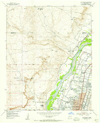 1954 Los Griegos1955 Print · USGSNorth of Albuquerque in the mid-fifties, the Rio Grande valley is a patchwork of historic land grants and expanding neighborhoods. Trace family sites near Los Griegos or follow old irrigation routes like the Albuquerque Main Canal and Corrales Lateral.
 - 1954 Map of La Mesita Negra SE, 1955 Print
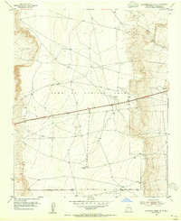 1954 La Mesita Negra SE1955 Print · USGSThe high mesas of Bernalillo County are captured in the mid-1950s, showing the intersection of Spanish land grants and the legendary Route 66. Researchers can trace the boundaries of the Town of Atrisco Grant and locate early infrastructure like the CAA Beacon.4 unique versions available
 - 1954 Map of La Mesita Negra, 1955 Print
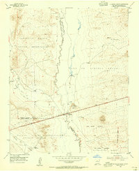 1954 La Mesita Negra1955 Print · USGSIn the mid-1950s, this area of Bernalillo County was defined by the intersection of tribal lands and the historic path of Mother Road travelers. You can trace the path of U.S. Route 66 past the Rio Puerco Trading Post and into the Town of Atrisco Grant.4 unique versions available
 - 1954 Map of Benavidez Ranch, 1955 Print
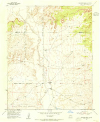 1954 Benavidez Ranch1955 Print · USGSThe Rio Puerco Valley in the mid-1950s was a landscape defined by expansive land grants and remote ranching outposts. Genealogists and researchers can trace the footprint of family holdings like Benavidez Ranch and Rio Puerco Ranch or locate the State Game and Fish Commission Bird Shelter.2 unique versions available
 - 1954 Map of Albuquerque West, 1955 Print
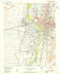 1954 Albuquerque West1955 Print · USGSAlbuquerque and its surrounding valley settlements are captured in the mid-1950s as urban growth begins to transform the Rio Grande landscape. Researchers can trace the heritage of Old Town, identify historic parish sites like San Felipe Ch, and locate family names near the US Indian School.
 - 1954 Map of Socorro, 1972 Print
 1954 Socorro1972 Print · USGSMid-century New Mexico comes into focus as the Rio Grande valley and the surrounding high desert undergo post-war growth. Genealogists and historians can trace old mountain settlements like Tajique and Punta de Agua or locate remote sites like the Torrance Mine.2 unique versions available
 - 1958 Map of Socorro
 1958 Socorro1958 Print · USGSNew Mexico's high desert during the late fifties reveals a landscape of massive land grants and remote mining outposts. Researchers can trace the path of the Atchison Topeka and Santa Fe railroad as it connects Socorro and Belen to industrial sites like the Manganese Mill.
 - 1958 Map of Albuquerque
 1958 Albuquerque1958 Print · USGSAlbuquerque and the surrounding high desert are captured here during a period of massive federal expansion and postwar growth. Researchers can trace the development of Kirtland Air Force Base, find ancestral homes in Pueblo de Santa Ana, or locate industrial sites like the Jackpile Mine.
 - 1960 Map of Los Griegos
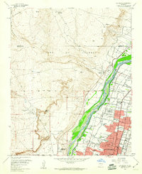 1960 Los Griegos1960 Print · USGSThe Rio Grande valley north of Albuquerque is captured here during a period of suburban growth into traditional grant lands. Researchers can trace the extensive irrigation network and find sites like St Joseph College, Los Poblanos Ranch, and the A T & S F RR.3 unique versions available
Showing maps 1-25 of 112
Top cities near Albuquerque
- Rio Rancho historical maps
- South Valley historical maps
- Bernalillo historical maps
- Corrales historical maps
- Los Ranchos de Albuquerque historical maps
- Paradise Hills historical maps
See more
Top neighborhoods of Albuquerque
- Four Hills (HOA) historical maps
- Antelope Run historical maps
- Matheson Park historical maps
- Juan Tabo Hills historical maps
- Monte Largo Hills historical maps
- Cielito Lindo historical maps
See more
Frequently asked questions
- What are the different types of historical maps available for Albuquerque?
- What is the oldest map of Albuquerque?
- Where can I purchase historical maps of Albuquerque for my home or office?
- Where can I download high-res historical maps of Albuquerque?
- Are there historical topographic maps available for Albuquerque?
- Is there historical aerial imagery available for Albuquerque?
- Where are historical maps of Albuquerque sourced from?