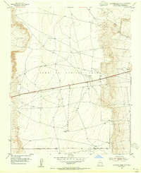
1954 Map of La Mesita Negra SE
USGS Topo · Published 1955About this map
The Town of Atrisco Grant and Pajarito Grant dominate this mid-century landscape west of the Rio Grande valley, where historical land tenure patterns meet the emerging infrastructure of the 1950s. The survey captures a critical corridor of western travel, anchored by the iconic alignment of Route 66, which cuts through the high desert terrain. The map documents early telecommunications and aviation markers necessary for navigating this open space, including a CAA Beacon, a TV Tower, and a Radio Relay Tower.
Find a feature on this map
11 named features on this map. Tap any name to fly to it.
Don’t see what you’re looking for? This feature index may not catch every label — zoom into the map to look around manually.
Map Details
Editions of this 1954 La Mesita Negra SE Map
4 editions found
Other maps of this area

1888 · Bernalillo
USGS Topo · 1:125,000

1889 · Albuquerque
USGS Topo · 1:125,000

1893 · Albuquerque
USGS Topo · 1:125,000

1934 · West Albuquerque
USGS Topo · 1:24,000

1934 · Griegos
USGS Topo · 1:24,000

1938 · Albuquerque
USGS Topo · 1:62,500

1952 · Wind Mesa
USGS Topo · 1:24,000

1952 · Isleta
USGS Topo · 1:24,000

1952 · Dalies NW
USGS Topo · 1:24,000

1954 · Volcano Ranch
USGS Topo · 1:24,000