1900s (20th Century) Maps of De Baca County, New Mexico
Explore 66 historic maps of De Baca County from the 1900s (20th Century). These maps offer a rare glimpse into what life looked like during the 1900s — showing old roads, neighborhoods, homes, and landmarks that have changed or disappeared over time.
Whether you're researching your family's past, planning a metal detecting trip, or studying how De Baca County's landscape evolved across the 1900s, these high-resolution maps are a powerful tool for exploring the history of this region.
- Focus on a specific era: All maps on this page are from the 1900s, giving you a focused view of this time period.
- See what’s changed: Compare century-old streets, trails, and buildings to today's modern landscape using overlays and satellite layers.
- Research with precision: Use these maps for genealogy, historical research, land use analysis, or educational projects.
- View, download, or print: Maps are fully viewable online in high resolution, and can be downloaded or printed for your own records.
Start exploring De Baca County's history through authentic maps from the 1900s. This is your window into the past.
De Baca County, NM maps
(66)- 1954 Map of Fort Sumner, 1964 Print
 1954 Fort Sumner1964 Print · USGSEast-central New Mexico's ranching and rail heartland is captured here in the mid-1950s, centered on the strategic junctions of the high plains. Researchers can trace the development of early highway networks and rail towns like Vaughn, Fort Sumner, and the copper operations at Guadalupe Mine.3 unique versions available
 - 1954 Map of Clovis, 1966 Print
 1954 Clovis1966 Print · USGSThe High Plains of the Texas-New Mexico borderland come alive in this mid-century survey as the region's agricultural and rail networks reached their peak. Trace family roots and local history through features like Cannon AFB, the massive Sand Hills, and busy rail towns such as Friona and Littlefield.4 unique versions available
 - 1955 Map of Roswell, 1974 Print
 1955 Roswell1974 Print · USGSSoutheastern New Mexico is shown in transition during the mid-fifties, from the Pecos Valley ranching hubs to the high timber of the Sacramento Mountains. Researchers can trace the Atchison Topeka and Santa Fe RR through Roswell and Hagerman or locate the old barracks at Ft Stanton.3 unique versions available
 - 1958 Map of Fort Sumner
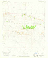
 1958 Fort Sumner1958 Print · USGSEast-central New Mexico in the mid-fifties is captured here as a sprawling landscape of high mesas and cattle ranching. Researchers can trace the convergence of the Southern Pacific railroad at Vaughn and locate family landmarks like Borica School or Marquez Ranch.
 - 1958 Map of Clovis
 1958 Clovis1958 Print · USGSThe High Plains of the New Mexico-Texas borderlands are captured here in the late fifties, during a period of significant military and agricultural expansion. Genealogists and historians can trace the rail-side growth of Clovis, the operations at Clovis Air Force Base, and the rural layout of communities like Muleshoe and Hereford.
 - 1958 Map of Roswell
 1958 Roswell1958 Print · USGSThe High Plains and mountain peaks of New Mexico are captured here during the mid-fifties, showing the region before the closure of Walker Air Force Base. Researchers can trace the ranching and rail landscape from Lincoln to the Pecos River valley through Hagerman and Lake Arthur.
 - 1962 Map of Roswell
 1962 Roswell1962 Print · USGSSoutheastern New Mexico in the early sixties shows a landscape defined by high mountain peaks and a growing military presence at Roswell. Genealogists and historians can trace the roads connecting Fort Stanton, Capitan, and the Mescalero Apache Indian Reservation.
 - 1964 Map of Canada Colorado, 1966 Print
 1964 Canada Colorado1966 Print · USGSGuadalupe County ranching life is preserved here in the mid-1960s, showing a landscape defined by cattle outposts and seasonal arroyos. Researchers can locate family landmarks like Alamo Ranch, trace the Guadalupe and De Baca County line, or find the Alamo Cem.
 - 1965 Map of Fort Sumner West, 1968 Print
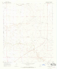
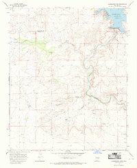
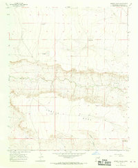
 1965 Fort Sumner West1968 Print · USGSDe Baca County ranching and rail infrastructure are on full display in the mid-sixties as the Atchison Topeka and Santa Fe cuts across the plains. Genealogists and local historians can locate specific family outposts like Steele Ranch, Vaughn Ranch, and Jensen Well.2 unique versions available
 - 1965 Map of Windmill Draw, 1969 Print
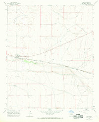
 1965 Windmill Draw1969 Print · USGSDe Baca County ranchlands and river systems are documented here in the mid-1960s, showing the critical infrastructure of the Pecos River valley. Genealogists and historians can trace family holdings like York Ranch and Brassel Ranch alongside the Fort Sumner Diversion Dam.2 unique versions available
 - 1966 Map of West Camp, 1968 Print
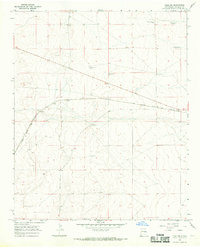
 1966 West Camp1968 Print · USGSDe Baca County ranching country is captured here in the mid-1960s, showing a landscape shaped by livestock and water management. Researchers can trace land use through Weston Ranch, West Camp, and the Lower End Windmill.2 unique versions available
 - 1966 Map of El Morro Mesa, 1968 Print
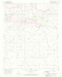
 1966 El Morro Mesa1968 Print · USGSDe Baca County ranching country is documented here in the mid-1960s, showing a remote landscape defined by high mesas and seasonal creek beds. Researchers can locate family holdings like Overton Ranch or trace early habitation sites near Ruins and Yeso Creek.2 unique versions available
 - 1966 Map of Alamo Ranch, 1968 Print
 1966 Alamo Ranch1968 Print · USGSDe Baca County ranching country is captured here in the mid-1960s, showing a landscape defined by water and rail. Trace the historic Atchison Topeka and Santa Fe line and find remote landmarks like Alamo Ranch and Pennington Well.
 - 1966 Map of Gibbons Ranch, 1968 Print
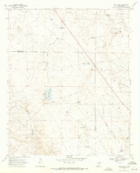
 1966 Gibbons Ranch1968 Print · USGSThe Pecos River valley and the emerging Alamogordo Reservoir define the landscape of eastern New Mexico in the mid-1960s. Researchers can trace ranching history at Gibbons Ranch and Los Ojitos, or locate early habitation sites marked by ruins.2 unique versions available
 - 1966 Map of Ricardo, 1968 Print
 1966 Ricardo1968 Print · USGSDe Baca County ranching and rail life are recorded here in the mid-sixties, centered on the Atchison Topeka and Santa Fe line. Researchers can locate family landmarks like the McMeans Ranch or burial sites at Morris Cem and Ricardo Cem.2 unique versions available
 - 1966 Map of Alamogordo Dam, 1969 Print
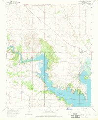
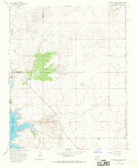
 1966 Alamogordo Dam1969 Print · USGSDe Baca and Guadalupe counties are captured in the mid-1960s as the Pecos River corridor supported both recreation and ranching. Researchers can trace historic ranch footprints at Koontz Ranch, find remote burial sites like Guadalupe Cem, and locate numerous windmills across the plains.2 unique versions available
 - 1966 Map of Borica SW, 1969 Print
 1966 Borica SW1969 Print · USGSThe ranchlands of east-central New Mexico appear here in the mid-sixties, showing a landscape shaped by the search for water. Genealogists and local historians can trace family landholdings like Good Ranch or locate remote landmarks such as High Lonesome Windmill and the local Landing Area.
 - 1966 Map of Cooper Ranch, 1969 Print
 1966 Cooper Ranch1969 Print · USGSThe high plains of De Baca and Guadalupe counties are documented here in the mid-1960s, a time of quiet cattle ranching and scattered outposts. Researchers can trace land use through features like the Cooper Ranch, the Upper Wagon Windmill, and a remote Cem near the creek.2 unique versions available
 - 1966 Map of Colorado Canyon, 1969 Print
 1966 Colorado Canyon1969 Print · USGSDe Baca and Guadalupe counties appear here in the mid-1960s, a period of ranching and water management on the high plains. Researchers can locate family landmarks like McRee Ranch and Head Ranch or trace the early shoreline of Alamogordo Reservoir.2 unique versions available
 - 1966 Map of Horney Ranch, 1969 Print
 1966 Horney Ranch1969 Print · USGSDe Baca County ranching lands are captured in the mid-sixties, showcasing a remote landscape defined by isolated homesteads and vital water sources. Researchers can locate family landmarks like Horney Ranch, find the small Cem, or trace Yeso Creek.
 - 1966 Map of Yeso, 1969 Print
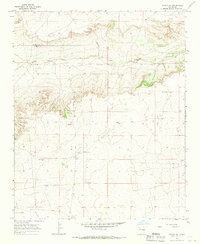
 1966 Yeso1969 Print · USGSThe high plains of De Baca County are captured in the late 1960s, centered on the railroad siding of Yeso. Genealogists and researchers can trace the alignment of the Atchison Topeka and Santa Fe and locate family landmarks like Hisel Ranch and Evanola.
 - 1966 Map of Yeso NW, 1969 Print
 1966 Yeso NW1969 Print · USGSHigh plains ranching and rail infrastructure dominate this De Baca County landscape during the mid-1960s. Genealogists and researchers can trace family-named landmarks like Smith Ranch and McCabe Ranch or locate the historic Atchison Topeka and Santa Fe rail line near Largo.
 - 1967 Map of Deering Place, 1971 Print
 1967 Deering Place1971 Print · USGSThe Pecos River valley in Chaves County is captured here during the late sixties, showing a landscape of remote ranching outposts and seasonal draws. Genealogists and historians can locate the Benedict Ranch and Deering Place, or trace the winding course of Huggins Draw and Willow Creek.2 unique versions available
 - 1967 Map of Wire Lake, 1971 Print
 1967 Wire Lake1971 Print · USGSThe ranch lands of the Chaves and De Baca county line are captured here in the late sixties, showing a landscape defined by water and isolation. Researchers can trace historic property hubs like Halfway House Ranch and the waters of Wire Lake and Burro Spring.2 unique versions available
 - 1967 Map of Round Mountain, 1971 Print
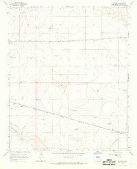
 1967 Round Mountain1971 Print · USGSChaves County ranching lands are captured in the late sixties, showing a landscape defined by vital water sources and remote outposts. Researchers can trace the path of the Military Road and locate historical landmarks like Yoder Ranch, Cowboy Well, and the Boswell Windmill.
Showing maps 1-25 of 66
Top cities of De Baca County
Frequently asked questions
- What are the different types of historical maps available for De Baca County?
- What is the oldest map of De Baca County?
- Where can I purchase historical maps of De Baca County for my home or office?
- Where can I download high-res historical maps of De Baca County?
- Are there historical topographic maps available for De Baca County?
- Is there historical aerial imagery available for De Baca County?
- Where are historical maps of De Baca County sourced from?