1970s Maps of De Baca County, New Mexico
Explore 9 historic maps of De Baca County from the 1970s. These maps offer a rare glimpse into what life looked like during the 1970s — showing old roads, neighborhoods, homes, and landmarks that have changed or disappeared over time.
Whether you're researching your family's past, planning a metal detecting trip, or studying how De Baca County's landscape evolved across the 1970s, these high-resolution maps are a powerful tool for exploring the history of this region.
- Focus on a specific era: All maps on this page are from the 1970s, giving you a focused view of this time period.
- See what’s changed: Compare century-old streets, trails, and buildings to today's modern landscape using overlays and satellite layers.
- Research with precision: Use these maps for genealogy, historical research, land use analysis, or educational projects.
- View, download, or print: Maps are fully viewable online in high resolution, and can be downloaded or printed for your own records.
Start exploring De Baca County's history through authentic maps from the 1970s. This is your window into the past.
De Baca County, NM maps
(9)- 1973 Map of Tolar, 1975 Print
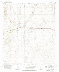 1973 Tolar1975 Print · USGSIn the early 1970s, the plains of Roosevelt County remained a vital transit corridor defined by the Atchison Topeka and Santa Fe railroad. Genealogists and historians can locate the Tolar Cem, the settlement of Tolar, and remote water markers like Stinking Spring.2 unique versions available
 - 1973 Map of Gammil Well, 1975 Print
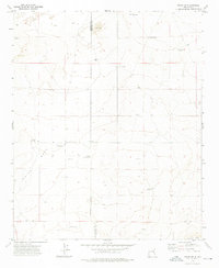
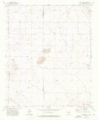 1973 Gammil Well1975 Print · USGSHigh plains ranching life in the 1970s is captured here along the border of De Baca and Roosevelt Counties. Researchers can trace the importance of isolated water sources like Gammil Well, Jones Windmill, and Benathy Well across this remote landscape.2 unique versions available
 - 1973 Map of Peach Canyon, 1975 Print
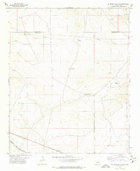
 1973 Peach Canyon1975 Print · USGSEastern New Mexico ranching country is documented here in the early 1970s at the intersection of Quay, De Baca, and Roosevelt counties. Researchers can locate remote landmarks like Peach Canyon Spring, a solitary Grave, and the winding path of Sand Creek.
 - 1973 Map of Rippee Ranch, 1976 Print
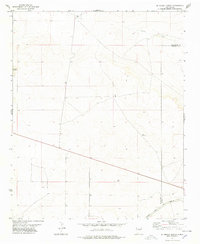
 1973 Rippee Ranch1976 Print · USGSThe high plains of Chaves and De Baca Counties are captured here in the early seventies, showing a landscape shaped by ranching and water scarcity. Genealogists and local historians can locate specific family-named landmarks like Liston Cem, Rippee Ranch, and the West Jett Windmill.
 - 1973 Map of Tolar SW, 1976 Print
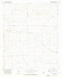
 1973 Tolar SW1976 Print · USGSThe high plains of De Baca County come into focus during the early 1970s, revealing a landscape defined by ranching and vital groundwater sources. Genealogists and historians can trace local landmarks like Blanco Cem and family-named sites such as Noblitt Windmill and White Well.2 unique versions available
 - 1978 Map of El Morro Ranch SE
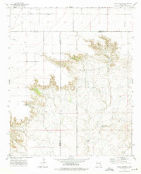
 1978 El Morro Ranch SE1978 Print · USGSThe high plains along the De Baca and Guadalupe county line are captured here in the late seventies. Family researchers and historians can trace the Atchison Topeka and Santa Fe railroad past Cardenas and locate remote ranch landmarks like Big Tank Windmill and Spring Windmill.
 - 1978 Map of El Morro Ranch
 1978 El Morro Ranch1978 Print · USGSEastern New Mexico ranchlands are captured here in the late seventies as industrial exploration and rail transit defined the landscape. Genealogists and historians can trace the Atchison Topeka and Santa Fe line near El Morro Ranch and Sotano Blanco.
 - 1979 Map of Fort Sumner
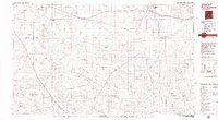 1979 Fort Sumner1979 Print · USGSThe Pecos River valley in the late seventies reveals a landscape shaped by irrigation and the rail lines of the Atchison Topeka and Santa Fe. Genealogists and historians can trace small communities like Taiban and Yeso alongside landmarks like The Caprock.
 - 1979 Map of Salt Creek
 1979 Salt Creek1979 Print · USGSChaves County's high plains and river valleys are captured here in the late seventies as the region balanced ranching life with historic aerospace milestones. Trace the Atchison Topeka and Santa Fe Railroad past Elkins or locate the Dr Robert Goddard Original Rocket Tower Site.
End of results
Showing maps 1-9 of 9
Top cities of De Baca County
Frequently asked questions
- What are the different types of historical maps available for De Baca County?
- What is the oldest map of De Baca County?
- Where can I purchase historical maps of De Baca County for my home or office?
- Where can I download high-res historical maps of De Baca County?
- Are there historical topographic maps available for De Baca County?
- Is there historical aerial imagery available for De Baca County?
- Where are historical maps of De Baca County sourced from?